Jacob Riis Park-Fort Tilden-Breezy Point Tip
Park · Queens
On the Rockaway Peninsula, Jacob Riis Park, Fort Tilden and Breezy Point Tip all belong to Gateway National Recreation Area, created in 1972 and run by the National Park Service.
- 1.89 square miles
- 23 street corners
- 2 bus routes
The city bought the Riis Park site in 1912 and later named it for the journalist and activist Jacob Riis; its bathhouse dates from 1932. Fort Tilden, a onetime military site facing the entrance to New York Harbor, keeps dunes, maritime forest, coastal defense batteries and a Nike missile launch site, while Breezy Point Tip offers ocean beach, marshland and breeding grounds for birds such as the piping plover and least tern.
Sources: Jacob Riis Park - Gateway National Recreation Area (National Park Service); Jacob Riis Park (The Cultural Landscape Foundation); Fort Tilden - Gateway National Recreation Area (National Park Service); Breezy Point, Queens (Wikipedia).
Jacob Riis Park-Fort Tilden-Breezy Point Tip borders one area, and Beach Channel Drive and Heinzelman Road hold more of its corners than any other street, five each of 23.
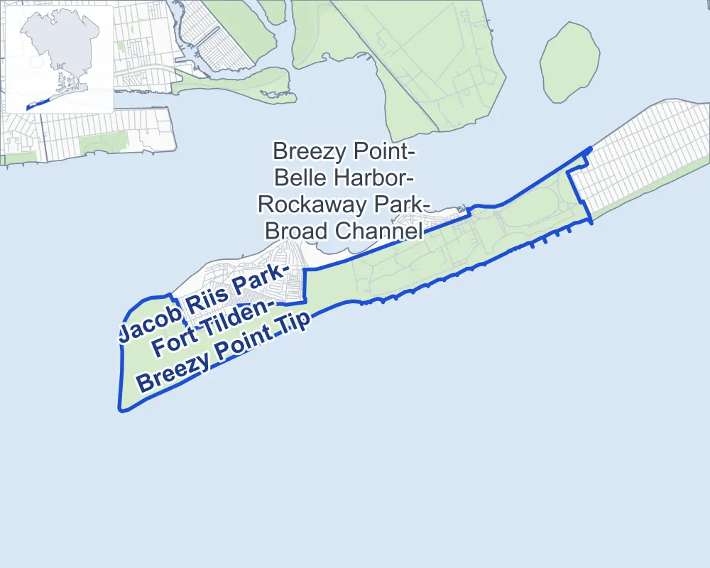
- Jacob Riis Park-Fort Tilden-Breezy Point Tip
- A neighboring area
- Park
- Another station
Neighborhood areas and streets: NYC Department of City Planning. Parks: NYC Parks. Stations: MTA.
Neighboring areas
Getting around
Buses on two routes stop in or at the edge of Jacob Riis Park-Fort Tilden-Breezy Point Tip.
- 1 local bus route
- 1 express bus route
Local bus route
- Q35
Express bus route
- QM16
Safety record
Between 2021 and 2025, its corners averaged fewer police-reported crashes than the average Queens corner.
- 7 police-reported crashes at its corners
- 0.3 a corner, on average
- 5.2 the average Queens corner
- 17 corners with a clean record
Camera tickets
In 2025 the Department of Finance recorded no red-light, school-zone speed or bus-lane camera ticket at its corners.
Parks
- Parkland
- 0.6 acre of Rockaway Beach, as NYC Parks maps it within Jacob Riis Park-Fort Tilden-Breezy Point Tip
Streets and trees
- Trees
- 113 in NYC Parks' records, most often Chinese juniper, Kentucky coffeetree and lagerstroemia
- Street with the most corners
- Beach Channel Drive, with five of the area's 23
- Height above sea level
- From 7 feet at Range Road & Center Road to 32 feet at Beach Channel Drive & Marine Parkway Bridge
Street corners
- Barret Road & Steele Road
- Beach 169th Street & Barret Road
- Beach 169th Street & Davis Road
- Beach Channel Drive & Beach 169th Street
- Beach Channel Drive & Marine Parkway Bridge (north-east)
- Beach Channel Drive & Marine Parkway Bridge (south-west)
- Beach Channel Drive & Rockaway Beach Boulevard (north-east)
- Beach Channel Drive & Rockaway Beach Boulevard (south-west)
- Heinzelman Road & Barret Road (east)
- Heinzelman Road & Barret Road (west)
- Heinzelman Road & Steele Road
- Hero Road & Davis Road
- Marine Parkway-Gil Hodges Memorial Bridge & Marine Parkway Bridge
- Murray Road & Beach 169th Street
- Murray Road & Heinzelman Road (north-east)
- Murray Road & Heinzelman Road (south-west)
- Murray Road & Hero Road
- Range Road & Beach 193rd Street
- Range Road & Center Road
- Range Road & East Road
- Range Road & West Road
- Rockaway Beach Boulevard & Jacob Riis Boardwalk
- Shore Road & Hero Road
How the figures above are measured: Methodology.