Highbridge
Neighborhood · Bronx
Highbridge sits on hilly ground above the Harlem River, between the river and Jerome Avenue from the Macombs Dam Bridge to the Cross Bronx Expressway.
- 0.47 square miles
- 32,456 residents, 2020 Census
- 118 street corners
- 6 bus routes
It takes its name from the High Bridge, which began carrying Croton Aqueduct water across the river in 1848 and is the city's oldest standing bridge; in the mid- to late 1800s wealthy families built large homes overlooking the river, and a village grew up around a local railroad station. The bridge is open again to walkers and cyclists, and the neighborhood's Art Deco apartment houses include the Park Plaza Apartments on Jerome Avenue, listed on the National Register of Historic Places.
Sources: Highbridge, Bronx (Wikipedia); Raoul Wallenberg Playground (NYC Parks); The Bronx (The Bronx County Historical Society); High Bridge (New York City) (Wikipedia).
Highbridge borders four areas, and Major Deegan Expressway holds more of its corners than any other street, 17 of 118.
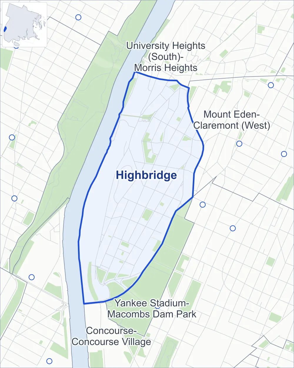
- Highbridge
- A neighboring area
- Park
- Another station
Neighborhood areas and streets: NYC Department of City Planning. Parks: NYC Parks. Stations: MTA.
Neighboring areas
Getting around
Buses on six routes stop in or at the edge of Highbridge.
- 6 local bus routes
Local bus routes
- Bx6
- Bx11
- Bx13
- Bx18A
- Bx18B
- Bx35
Safety record
Between 2021 and 2025, its corners averaged more police-reported crashes than the average Bronx corner.
- 1,402 police-reported crashes at its corners
- 11.9 a corner, on average
- 8.0 the average Bronx corner
- 27 corners with a clean record
Signal or safety changes on City record, at 28 of its corners
- Leading pedestrian intervals
- 19
- Accessible pedestrian signals
- 15
- Enhanced crossings
- 4
- Safety Improvement Projects
- 2
- Turn calming
- 1
- Barnes Dance all-way crossings
- 1
Camera tickets
In 2025 its corners had more school-zone speed camera tickets than red-light or bus-lane tickets.
- 0 red-light camera tickets
- 2,357 school-zone speed camera tickets at three corners
- 0 bus-lane camera tickets
- Most speed tickets
- Jerome Avenue & East 164th Street, 1,681
People and homes
The 2020 Census counted 32,456 residents in Highbridge, about 69,100 per square mile.
- 11,969 homes, 2020 Census
- 2,093 homes added since April 2010, net, by City Planning's count
Half of its 618 residential lots hold buildings from 1927 or earlier, and 64% of them date from before 1940, by the City's tax lot records.
NYCHA development
NYCHA's Highbridge Gardens development lies wholly or partly within Highbridge.
Parks and landmarks
- Parkland
- 20.8 acres of NYC Parks property
- The largest pieces
- Macombs Dam Park (9.8 acres), Merriam Playground (2.9 acres) and Bridge Park (2.2 acres)
- Designated landmarks
- The American Female Guardian Society, Public School 91, the Highbridge Community Church and the Noonan Plaza Apartments, among others
Streets and trees
- Trees
- 2,000 in NYC Parks' records, most often pin oak, thornless honeylocust and Callery pear
- Street with the most corners
- Major Deegan Expressway, with 17 of the area's 118
- Height above sea level
- From 15 feet at Jerome Avenue & West 166th Street to 147 feet at West 170th Street & Merriam Avenue
- Honorary street names
- 2 at its corners, enacted by local law
Schools and libraries
The City lists nine schools and one library in Highbridge.
- Public schools
- 5
- Charter and private schools
- 4
- Library
- High Bridge Library
Bike share and public art
By the station list of October 3, 2026, ten bike-share stations stand in Highbridge. The City's public art inventory lists two works in the area: Macombs Dam Park Fountain (1908) and Highbridge World War I Memorial (1923).
- 10 bike-share stations
- 2 works of public art
Public safety
How complaints are countedIn 2025 the NYPD recorded 521 major felonies at places in Highbridge.
Recorded by the NYPD at places in Highbridge
- 553 major felonies in 2024
- 1,864 other felonies, misdemeanors and violations in 2025
In 2025, on the streets along the edge of Highbridge, the NYPD recorded another 75 major felonies. Counting the streets along its edge, in 2025 the NYPD recorded 18.4 major felonies for every thousand residents the 2020 Census counted in Highbridge.
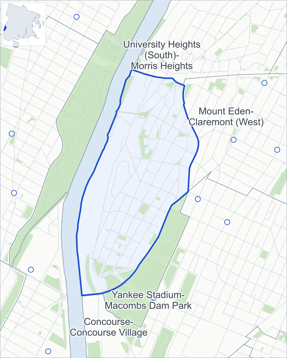
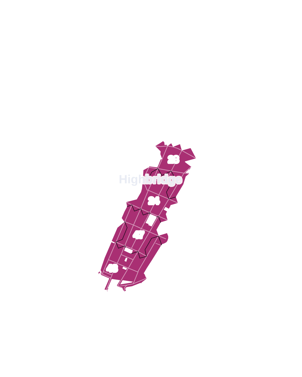
- 5 to 9
- 10 to 19
- 20 to 49
- 50 to 99
- 100 or more
- Not shaded: fewer than 5, held back under the rules in How complaints are counted, parks and public-housing grounds, and land in no patch
- Police precinct
- 44th
From January to June 2026 the NYPD recorded 267 major felonies at places in Highbridge, against 274 in the same months of 2025.
Sources: the NYPD's Complaint Data Historic, updated April 28, 2026, and Complaint Data Current (Year To Date), updated July 27, 2026, on NYC Open Data. Figures to June 30, 2026.
Street corners
- Alexander Hamilton Bridge & Cross Bronx Expressway (east)
- Alexander Hamilton Bridge & Cross Bronx Expressway (west)
- Alexander Hamilton Bridge & Major Deegan
- Alexander Hamilton Bridge & Major Deegan Expressway (Exit 7N)
- Alexander Hamilton Bridge & Major Deegan Expressway (Exit 7S)
- Alexander Hamilton Bridge & Sedgwick Avenue
- Anderson Avenue & Pedestrian Path
- Anderson Avenue & West 162nd Street
- Anderson Avenue & West 164th Street
- Anderson Avenue & West 165th Street
- Anderson Avenue & West 166th Street
- Anderson Avenue & West 167th Street
- Cross Bronx Expressway & Alexander Hamilton Bridge
- Cross Bronx Expressway & High Bridge
- Cross Bronx Expressway & Washington Bridge Pedestrian Path
- Depot Place & Cross Bronx Expressway
- Depot Place & Exterior Street
- Depot Place & Major Deegan Expressway
- Depot Place & Sedgwick Avenue
- Edward L Grant Highway & West 170th Street
- High Bridge & Highbridge Park Path
- Highbridge Park Path & Highbridge Park Stairway
- Jerome Avenue & Anderson Avenue
- Jerome Avenue & Connector Road Macombs Dam Bridge Manhattan
- Jerome Avenue & East 161st Street
- Jerome Avenue & East 161st Street at Woodycrest Avenue
- Jerome Avenue & East 164th Street
- Jerome Avenue & East 165th Street
- Jerome Avenue & Ogden Avenue
- Jerome Avenue & Pedestrian Path
- Jerome Avenue & Sedgwick Avenue
- Jerome Avenue & Shakespeare Avenue
- Jerome Avenue & West 166th Street
- Macombs Dam Bridge & East 161st Street
- Macombs Dam Bridge & Macombs Dam Bridge Pedestrian Path
- Macombs Dam Bridge & Major Deegan Expressway
- Macombs Dam Bridge & Major Deegan Expressway Service Road
- Major Deegan Expressway & Alexander Hamilton Bridge
- Major Deegan Expressway & Cross Bronx Expressway
- Major Deegan Expressway & Depot Place
- Major Deegan Expressway & High Bridge
- Major Deegan Expressway & Macombs Dam Bridge Pedestrian Path (east)
- Major Deegan Expressway & Macombs Dam Bridge Pedestrian Path (Exit 5)
- Major Deegan Expressway & Macombs Dam Bridge Pedestrian Path (west)
- Major Deegan Expressway & Washington Bridge Pedestrian Path
- Major Deegan Expressway & West 161st Street Pedestrian Overpass
- Merriam Avenue & West 171st Street
- Nelson Avenue & Edward L Grant Highway
- Nelson Avenue & West 164th Street
- Nelson Avenue & West 165th Street
- Nelson Avenue & West 166th Street
- Nelson Avenue & West 167th Street
- Nelson Avenue & West 168th Street
- Nelson Avenue & West 169th Street
- Nelson Avenue & West 170th Street
- Ogden Avenue & Merriam Avenue
- Ogden Avenue & West 161st Street
- Ogden Avenue & West 162nd Street
- Ogden Avenue & West 163rd Street
- Ogden Avenue & West 164th Street
- Ogden Avenue & West 165th Street
- Ogden Avenue & West 166th Street
- Ogden Avenue & West 167th Street
- Ogden Avenue & West 168th Street
- Ogden Avenue & West 169th Street
- Ogden Avenue & West 170th Street
- Ogden Avenue & West 171st Street
- Plimpton Avenue & Edward L Grant Highway
- Plimpton Avenue & West 169th Street
- Plimpton Avenue & West 170th Street
- Sedgwick Avenue & Cross Bronx Expressway
- Sedgwick Avenue & High Bridge
- Sedgwick Avenue & Highbridge Park Stairway
- Sedgwick Avenue & Major Deegan
- Sedgwick Avenue & Major Deegan Expressway (north)
- Sedgwick Avenue & Major Deegan Expressway (south)
- Sedgwick Avenue & Major Deegan Expressway Service Road
- Sedgwick Avenue & University Avenue
- Sedgwick Avenue & West 165th Street
- Sedgwick Avenue & West 167th Street
- Shakespeare Avenue & Anderson Avenue
- Shakespeare Avenue & Edward L Grant Highway
- Shakespeare Avenue & Pedestrian Path
- Shakespeare Avenue & West 167th Street
- Shakespeare Avenue & West 168th Street
- Shakespeare Avenue & West 169th Street
- Shakespeare Avenue & West 170th Street
- Shakespeare Avenue & Woodycrest Avenue
- Summit Avenue & West 161st Street
- Summit Avenue & West 162nd Street
- Summit Avenue & West 164th Street
- Summit Avenue & West 165th Street
- Summit Avenue & West 166th Street
- Undercliff Avenue & Major Deegan Expressway
- Undercliff Avenue & West 171st Street
- University Avenue & Boscobel Place
- University Avenue & Highbridge Park Path
- University Avenue & Highbridge Park Stairway
- University Avenue & Merriam Avenue
- University Avenue & Ogden Avenue
- University Avenue & West 165th Street
- University Avenue & West 166th Street
- University Avenue & West 167th Street
- University Avenue & West 168th Street
- University Avenue & West 169th Street
- University Avenue & West 170th Street
- University Avenue & West 171st Street
- West 161st Street & Pedestrian Path
- West 168th Street & West 167th Street
- West 169th Street & Merriam Avenue
- West 170th Street & Merriam Avenue
- Woodycrest Avenue & West 162nd Street
- Woodycrest Avenue & West 163rd Street
- Woodycrest Avenue & West 164th Street
- Woodycrest Avenue & West 165th Street
- Woodycrest Avenue & West 166th Street
- Woodycrest Avenue & West 167th Street
- Woodycrest Avenue & West 168th Street
How the figures above are measured: Methodology.