Shirley Chisholm State Park
Park · Brooklyn
Shirley Chisholm State Park covers 407 acres between the Belt Parkway and Jamaica Bay in southeastern Brooklyn.
- 0.66 square miles
- 15 street corners
The City's Sanitation Department began filling the Pennsylvania Avenue landfill in 1956 and the Fountain Avenue landfill in the early 1960s; once both were capped and replanted, the park opened atop them in 2019 as the largest state park in New York City. Visitors find 10 miles of biking and hiking trails, waterfront piers and views reaching the Empire State Building. Its namesake, Brooklyn-born Shirley Chisholm, represented this area as the first Black woman in Congress and later became the first Black woman to seek a major party's presidential nomination.
Sources: Shirley Chisholm State Park (New York State Parks); Shirley Chisholm State Park (Wikipedia).
Shirley Chisholm State Park borders two areas, and Chisholm Park Fountain Ring Drive holds more of its corners than any other street, five of 15.
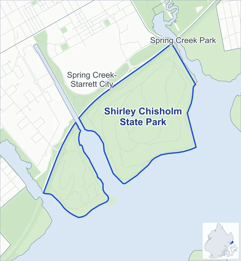
- Shirley Chisholm State Park
- A neighboring area
- Park
Neighborhood areas and streets: NYC Department of City Planning. Parks: NYC Parks. Stations: MTA.
Neighboring areas
- Spring Creek Park northeast
- Spring Creek-Starrett City northwest
Safety record
Between 2021 and 2025, police reported zero crashes at all 15 of its corners.
Camera tickets
In 2025 the Department of Finance recorded no red-light, school-zone speed or bus-lane camera ticket at its corners.
Streets and trees
- Street with the most corners
- Chisholm Park Fountain Ring Drive, with five of the area's 15
- Height above sea level
- From 18 feet at Chisholm Park Fountain Ring Drive & Chisholm Park Gull Trail to 116 feet at Chisholm Park Gull Trail & Chisholm Park Falcon Trail
Street corners
- Chisholm Park Fountain Ring Drive & Chisholm Park Falcon Trail
- Chisholm Park Fountain Ring Drive & Chisholm Park Fountain Bike Conn
- Chisholm Park Fountain Ring Drive & Chisholm Park Great Blue Heron Lo
- Chisholm Park Fountain Ring Drive & Chisholm Park Gull Trail (north-east)
- Chisholm Park Fountain Ring Drive & Chisholm Park Gull Trail (south-west)
- Chisholm Park Great Blue Heron Lo & Chisholm Park Falcon Trail
- Chisholm Park Gull Trail & Chisholm Park Falcon Trail (north-west)
- Chisholm Park Gull Trail & Chisholm Park Falcon Trail (south-east)
- Chisholm Park Penn Ring Drive & Chisholm Park Peregrine Trail
- Chisholm Park Penn Ring Drive & Chisholm Park Red Tail Trail
- Chisholm Park Peregrine Trail & Chisholm Park Oystercatcher Trail
- Chisholm Park Red Tail Trail & Chisholm Park Peregrine Trail
- Erskine Street & Belt Parkway
- Fountain Avenue & Chisholm Park Great Blue Heron Lo
- Pennsylvania Avenue & Belt Parkway
How the figures above are measured: Methodology.