Fort Totten
Queens
Fort Totten occupies the point once called Willets Point, at the head of Little Neck Bay where the East River broadens into Long Island Sound.
- 0.25 square miles
- 40 street corners
- 2 bus routes
The federal government bought the Willets family's land in 1857 and began a fort in 1862; renamed in 1898 for Joseph Gilbert Totten, the foremost American fort designer of the early 19th century, it remained an active Army post until 1974. Its castle-like Gothic Revival officers' club, finished in 1887 for the Army's engineering school, is a city landmark and home of the Bayside Historical Society. The grounds now include a public park and training sites for the city's fire and police departments.
Sources: Fort Totten (Queens) (Wikipedia); About BHS (Bayside Historical Society); Willets Point (Wikipedia).
Fort Totten borders one area, and Sergeant Beers Loop holds more of its corners than any other street, nine of 40.
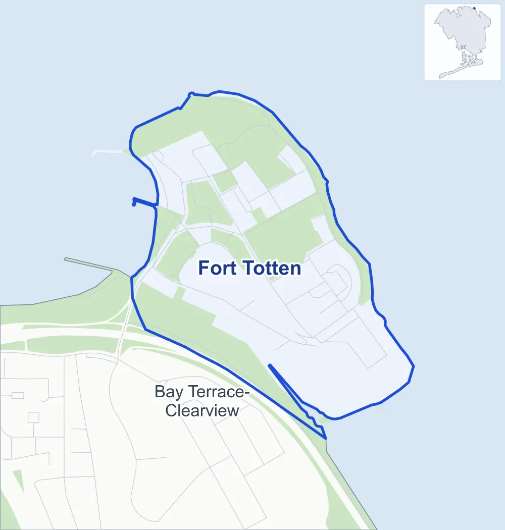
- Fort Totten
- A neighboring area
- Park
Neighborhood areas and streets: NYC Department of City Planning. Parks: NYC Parks. Stations: MTA.
Neighboring areas
- Bay Terrace-Clearview south
Getting around
Buses on two routes stop in or at the edge of Fort Totten.
- 2 local bus routes
Local bus routes
- Q13
- Q16
Safety record
Between 2021 and 2025, its corners averaged fewer police-reported crashes than the average Queens corner.
- 4 police-reported crashes at its corners
- 0.1 a corner, on average
- 5.2 the average Queens corner
- 36 corners with a clean record
Camera tickets
In 2025 the Department of Finance recorded no red-light, school-zone speed or bus-lane camera ticket at its corners.
Parks and landmarks
- Parkland
- 61.1 acres of Fort Totten Park, as NYC Parks maps it within Fort Totten
- Historic district
- Fort Totten Historic District, wholly or partly within Fort Totten
Streets and trees
- Trees
- 462 in NYC Parks' records, most often eastern white pine, maple and Norway maple
- Street with the most corners
- Sergeant Beers Loop, with nine of the area's 40
- Height above sea level
- From 12 feet at Little Bay Road & Willets Street to 59 feet at Murray Avenue & North Loop
Street corners
- Abbott Road & Chapel Road
- Bayside Street & Abbott Road
- Bayside Street & Willets Street
- Duane Road & Boundary Road
- Duane Road & Totten Avenue
- Duane Road & Underhill Road
- General Berry Road & Murray Avenue
- General Berry Road & Sergeant Beers Lane (north-east)
- General Berry Road & Sergeant Beers Lane (south-west)
- Little Bay Road & Willets Street
- Murray Avenue & Jarman Road
- Murray Avenue & North Loop
- Murray Avenue & Sergeant Beers Loop
- Murray Avenue & Westaway Road
- North Loop & Ordnance Road
- Red Cross Lane & East Loop
- Sergeant Beers Loop & East Loop
- Sergeant Beers Loop & Red Cross Lane (north-west)
- Sergeant Beers Loop & Red Cross Lane (south-east)
- Sergeant Beers Loop & Sergeant Beers Avenue
- Sergeant Beers Loop & Story Avenue
- Sergeant Beers Loop & Theater Road
- Sergeant Beers Loop & Westaway Road
- Shore Road & General Berry Road
- Shore Road & Ordnance Road
- Shore Road & Story Avenue
- Shore Road & Walter Reed Road
- Shore Road & Weaver Avenue
- Sylvester Lane & Jarman Road
- Sylvester Lane & North Loop
- Totten Avenue & Bayside Street
- Totten Avenue & Chapel Road
- Totten Avenue & Murray Avenue
- Totten Avenue & Officers Drive
- Totten Avenue & Willets Street
- Underhill Road & Officers Drive
- Underhill Road & Willets Street
- Walter Reed Road & Sylvester Lane
- Walter Reed Road & Whistler Avenue
- Weaver Avenue & Whistler Avenue
How the figures above are measured: Methodology.