Bay Terrace-Clearview
Neighborhood · Queens
Bay Terrace-Clearview has the East River along its northern shore and Little Neck Bay to the east.
- 1.41 square miles
- 23,287 residents, 2020 Census
- 177 street corners
- 9 bus routes
Bay Terrace, originally part of Bayside, was still a place of farms and large estates in the 1950s, when the Meyer family sold its 225-acre farm, which gave way to cooperative and garden apartments and a shopping center. Clearview Park Golf Course was founded in 1925 as the Clearview Golf and Yacht Club, whose name reflects its views over the East River and Long Island Sound, and the City bought it in 1931. The Queens approach to the Throgs Neck Bridge, opened in 1961, runs through the area.
Sources: Bay Terrace, Queens (Wikipedia); Bay Terrace Playground History (NYC Parks); Clearview Park Golf Course History (NYC Parks); Throgs Neck Bridge (MTA Bridges and Tunnels).
Bay Terrace-Clearview borders five areas, and Cross Island Parkway holds more of its corners than any other street, 22 of 177.
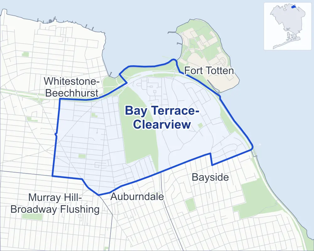
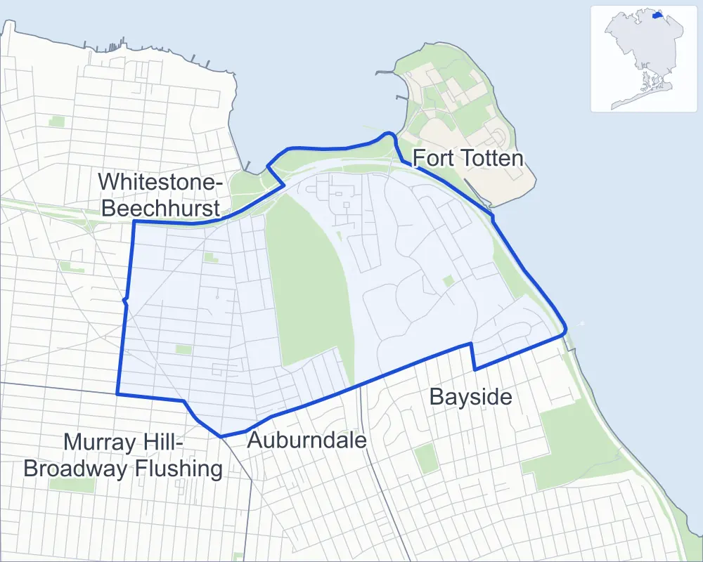
- Bay Terrace-Clearview
- A neighboring area
- Park
Neighborhood areas and streets: NYC Department of City Planning. Parks: NYC Parks. Stations: MTA.
Neighboring areas
- Fort Totten northeast
- Bayside southeast
- Auburndale south
- Murray Hill-Broadway Flushing southwest
- Whitestone-Beechhurst west
Getting around
Buses on nine routes stop in or at the edge of Bay Terrace-Clearview.
- 6 local bus routes
- 3 express bus routes
Local bus routes
- Q13
- Q16
- Q28
- Q31
- Q61
- Q76
Express bus routes
- QM2
- QM20
- QM32
Safety record
Between 2021 and 2025, its corners averaged fewer police-reported crashes than the average Queens corner.
- 365 police-reported crashes at its corners
- 2.1 a corner, on average
- 5.2 the average Queens corner
- 73 corners with a clean record
Signal or safety changes on City record, at eight of its corners
- Leading pedestrian intervals
- 5
- Accessible pedestrian signals
- 3
- Turn calming
- 1
- Barnes Dance all-way crossings
- 1
- Enhanced crossings
- 1
- Safety Improvement Projects
- 1
Camera tickets
In 2025 its corners had more school-zone speed camera tickets than red-light or bus-lane tickets.
- 0 red-light camera tickets
- 11,578 school-zone speed camera tickets at ten corners
- 0 bus-lane camera tickets
- Most speed tickets
- Willets Point Boulevard & 17th Avenue, 2,817
People and homes
The 2020 Census counted 23,287 residents in Bay Terrace-Clearview, about 16,500 per square mile.
- 11,248 homes, 2020 Census
- 97 homes added since April 2010, net, by City Planning's count
Half of its 2,546 residential lots hold buildings from 1955 or earlier, and 3% of them date from before 1940, by the City's tax lot records.
Parks
- Parkland
- 30.6 acres of NYC Parks property
- The largest pieces
- Little Bay Park (21.2 acres), Clearview Park (5.6 acres) and Playground Twenty One (1.4 acres)
Streets and trees
- Trees
- 3,204 in NYC Parks' records, most often London planetree, pin oak and thornless honeylocust
- Street with the most corners
- Cross Island Parkway, with 22 of the area's 177
- Height above sea level
- From 9 feet at Cross Island Parkway & 208th Place to 116 feet at 201st Street & 24th Road
- Honorary street names
- 3 at its corners, enacted by local law
Schools and libraries
The City lists five schools and two libraries in Bay Terrace-Clearview.
- Public schools
- 5
- Libraries
- Auburndale Library and Bay Terrace Library
Public safety
How complaints are countedIn 2025 the NYPD recorded 159 major felonies at places in Bay Terrace-Clearview.
Recorded by the NYPD at places in Bay Terrace-Clearview
- 166 major felonies in 2024
- 269 other felonies, misdemeanors and violations in 2025
In 2025, on the streets along the edge of Bay Terrace-Clearview, the NYPD recorded another 23 major felonies. Counting the streets along its edge, in 2025 the NYPD recorded 7.8 major felonies for every thousand residents the 2020 Census counted in Bay Terrace-Clearview.
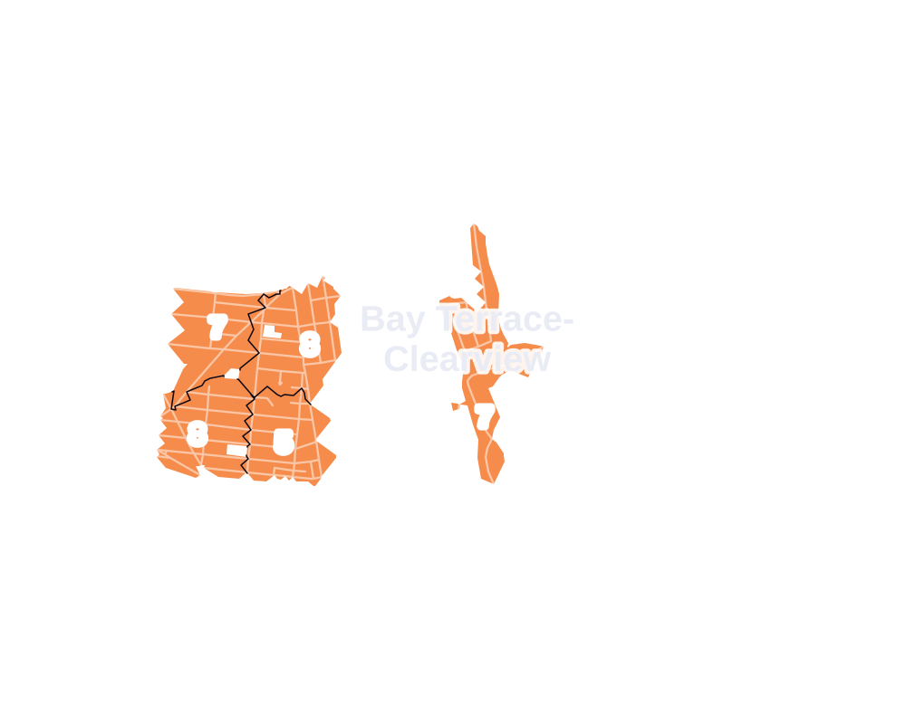
- 5 to 9
- 10 to 19
- 20 to 49
- 50 to 99
- 100 or more
- Not shaded: fewer than 5, held back under the rules in How complaints are counted, parks and public-housing grounds, and land in no patch
- Police precincts
- 109th (most of the area), 111th
From January to June 2026 the NYPD recorded 70 major felonies at places in Bay Terrace-Clearview, against 78 in the same months of 2025.
Sources: the NYPD's Complaint Data Historic, updated April 28, 2026, and Complaint Data Current (Year To Date), updated July 27, 2026, on NYC Open Data. Figures to June 30, 2026.
Street corners
- 14th Avenue & 209th Street
- 14th Avenue & Waters Edge Drive
- 15th Drive & 208th Place
- 15th Road & 208th Place
- 15th Road & Waters Edge Drive
- 19th Avenue & Willets Point Boulevard
- 20th Avenue & 163rd Street
- 20th Avenue & Willets Point Boulevard
- 21st Avenue & 163rd Street
- 22nd Avenue & Clintonville Street
- 23rd Avenue & 163rd Street
- 23rd Avenue & 166th Street
- 23rd Avenue & 169th Street
- 23rd Avenue & 201st Street
- 23rd Avenue & 202nd Street
- 23rd Avenue & 204th Street
- 23rd Avenue & 205th Street
- 23rd Avenue & 206th Street
- 23rd Avenue & 207th Street
- 23rd Avenue & 211th Street
- 23rd Avenue & 212th Street
- 23rd Avenue & 213th Place
- 23rd Avenue & 215th Street
- 23rd Avenue & Bell Boulevard
- 23rd Avenue & Corporal Kennedy Street
- 23rd Road & Waters Edge Drive
- 24th Avenue & 163rd Street
- 24th Avenue & 216th Street
- 24th Avenue & Waters Edge Drive
- 26th Avenue & 27th Avenue
- 26th Avenue & 204th Street
- 26th Avenue & 207th Street
- 26th Avenue & 210th Place
- 26th Avenue & 211th Street
- 26th Avenue & Corporal Kennedy Street
- 27th Avenue & 216th Street
- 27th Avenue & Little Neck Boulevard
- 28th Avenue & 215th Place
- 28th Avenue & Little Neck Boulevard
- 160th Street & 17th Road
- 160th Street & 23rd Avenue
- 160th Street & 24th Avenue
- 163rd Street & 15th Drive
- 163rd Street & 16th Avenue
- 163rd Street & 16th Road
- 163rd Street & 17th Avenue
- 163rd Street & 19th Avenue
- 163rd Street & 20th Road
- 163rd Street & 21st Road
- 163rd Street & 24th Road
- 163rd Street & Clintonville Street
- 166th Street & 16th Avenue
- 166th Street & 16th Road
- 166th Street & 17th Avenue
- 166th Street & 17th Road
- 166th Street & 19th Avenue
- 166th Street & 20th Avenue
- 166th Street & 20th Road
- 166th Street & 21st Avenue
- 166th Street & 21st Road
- 166th Street & 22nd Avenue
- 166th Street & 24th Avenue
- 166th Street & 24th Road
- 166th Street & Willets Point Boulevard
- 166th Street & Willets Point Boulevard at 15th Drive
- 169th Street & 17th Road
- 169th Street & 18th Avenue
- 169th Street & 19th Avenue
- 169th Street & 20th Avenue
- 169th Street & 20th Road
- 169th Street & 21st Avenue
- 169th Street & 21st Road
- 169th Street & 22nd Avenue
- 169th Street & 24th Avenue
- 169th Street & 24th Road
- 169th Street & 25th Avenue
- 200th Street & 15th Road
- 200th Street & 16th Avenue
- 200th Street & 17th Avenue
- 201st Street & 15th Avenue
- 201st Street & 15th Road
- 201st Street & 16th Avenue
- 201st Street & 17th Avenue
- 201st Street & 19th Avenue
- 201st Street & 22nd Avenue
- 201st Street & 24th Avenue
- 201st Street & 24th Road
- 202nd Street & 15th Road
- 202nd Street & 16th Avenue
- 202nd Street & 17th Avenue
- 202nd Street & 19th Avenue
- 202nd Street & 21st Avenue
- 202nd Street & 22nd Avenue
- 202nd Street & 24th Avenue
- 202nd Street & 24th Road
- 202nd Street & 26th Avenue
- 207th Street & 23rd Road
- 208th Place & Estates Drive
- 208th Place & Robert Road
- 209th Street & 15th Avenue
- 209th Street & 15th Road
- 211th Street & 18th Avenue
- 212th Street & 15th Avenue
- 212th Street & 16th Avenue
- 212th Street & 18th Avenue
- 212th Street & 26th Avenue
- 212th Street & Bay Lane (north-west)
- 212th Street & Bay Lane (south-east)
- 212th Street & Bell Boulevard
- 215th Street & 15th Avenue
- 215th Street & 15th Road
- 215th Street & 16th Avenue
- 215th Street & 17th Avenue
- 215th Street & 18th Avenue
- 215th Street & 24th Avenue
- 215th Street & 26th Avenue
- 215th Street & 27th Avenue
- 216th Street & 15th Road
- 216th Street & 17th Avenue
- Bell Boulevard & 14th Avenue
- Bell Boulevard & 15th Avenue
- Bell Boulevard & 16th Avenue
- Bell Boulevard & 18th Avenue
- Bell Boulevard & 24th Avenue
- Bell Boulevard & 26th Avenue
- Bell Boulevard & 27th Avenue
- Clearview Expressway & Cross Island Parkway
- Clintonville Street & 21st Road
- Cross Island Parkway & 28th Avenue Pedestrian Overpass
- Cross Island Parkway & 163rd Street
- Cross Island Parkway & 166th Street
- Cross Island Parkway & 200th Street
- Cross Island Parkway & 201st Street
- Cross Island Parkway & 208th Place
- Cross Island Parkway & 209th Street
- Cross Island Parkway & Bayside Marina Access Road (north-west)
- Cross Island Parkway & Bayside Marina Access Road (south-east)
- Cross Island Parkway & Bell Boulevard
- Cross Island Parkway & Bell Boulevard at Totten Avenue
- Cross Island Parkway & Clearview Expressway
- Cross Island Parkway & Clearview Expressway (Cross Island Parkway)
- Cross Island Parkway & Clearview Expressway (Exit 7)
- Cross Island Parkway & Estates Lane
- Cross Island Parkway & Throgs Neck Bridge at Totten Avenue
- Cross Island Parkway & Throgs Neck Bridge at Totten Avenue (Exit 32)
- Cross Island Parkway & Totten Avenue
- Cross Island Parkway & Utopia Parkway
- Cross Island Parkway & Willets Point Boulevard
- Diane Place & Robert Road
- Estates Drive & Michael Place
- Estates Lane & Darren Drive
- Estates Lane & Emily Road
- Estates Lane & Estates Drive
- Estates Lane & Lori Drive
- Estates Lane & Melissa Court
- Francis Lewis Boulevard & 21st Road
- Francis Lewis Boulevard & 23rd Avenue
- Francis Lewis Boulevard & 24th Road
- Francis Lewis Boulevard & 160th Street
- Francis Lewis Boulevard & 169th Street
- Francis Lewis Boulevard & Willets Point Boulevard
- Jordan Drive & Bonnie Lane
- Jordan Drive & Jordan Court
- Lori Drive & Robin Lane
- Michael Court & Michael Place
- Robin Lane & Brian Crescent
- Robin Lane & Emily Road
- Throgs Neck Bridge & Clearview Expressway
- Utopia Parkway & 16th Avenue
- Utopia Parkway & 17th Avenue
- Utopia Parkway & 19th Avenue
- Utopia Parkway & 21st Avenue
- Utopia Parkway & 22nd Avenue
- Utopia Parkway & 24th Avenue
- Willets Point Boulevard & 16th Avenue
- Willets Point Boulevard & 16th Road
- Willets Point Boulevard & 17th Avenue
How the figures above are measured: Methodology.