Inwood Hill Park
Park · Manhattan
Inwood Hill Park spreads over Manhattan's northern tip, from Dyckman Street north to Spuyten Duyvil Creek along the Hudson River, and holds the island's largest remaining old-growth forest and one of its last natural salt marshes.
- 0.36 square miles
- 1 street corner
- 4 bus routes
Lenape people lived here through the 17th century, artifacts have been found in the park's rock shelters, and a boulder and plaque placed in 1954 mark the former site of a tulip tree where, by legend, Peter Minuit bought Manhattan in 1626. The city began buying the land in the 1910s, and WPA workers built or paved many of its roads in the 1930s.
Sources: Inwood Hill Park (The Cultural Landscape Foundation); Inwood Hill Park (Wikipedia); Inwood, Manhattan (Wikipedia).
Inwood Hill Park borders two areas.
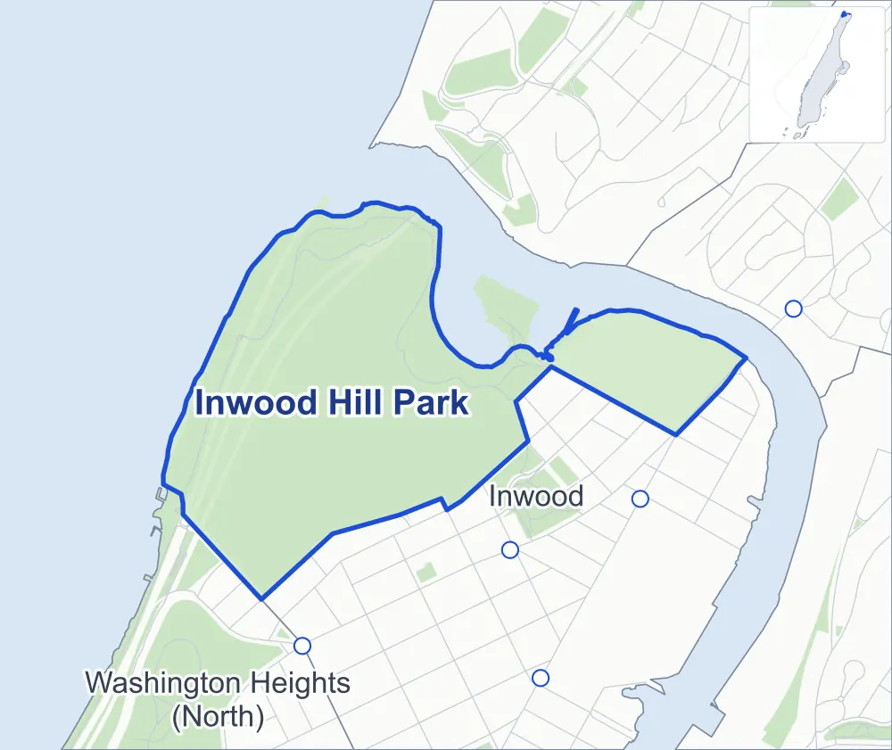
- Inwood Hill Park
- A neighboring area
- Park
- Another station
Neighborhood areas and streets: NYC Department of City Planning. Parks: NYC Parks. Stations: MTA.
Neighboring areas
- Inwood southeast
- Washington Heights (North) southwest
Getting around
Buses on four routes stop in or at the edge of Inwood Hill Park.
- 3 local bus routes
- 1 express bus route
Local bus routes
- Bx7
- Bx20
- M100
Express bus route
- BxM1
Safety record
Between 2021 and 2025, police reported zero crashes at its one corner.
Camera tickets
In 2025 the Department of Finance recorded no red-light, school-zone speed or bus-lane camera ticket at its corners.
Parks
- Parkland
- 168.7 acres of Inwood Hill Park, as NYC Parks maps it within the area's boundary
Streets and trees
- Trees
- 858 in NYC Parks' records, most often London planetree, pin oak and mulberry
Bike share
By the station list of October 3, 2026, four bike-share stations stand in Inwood Hill Park.
- 4 bike-share stations
The corner
How the figures above are measured: Methodology.