Washington Heights (North)
Neighborhood · Manhattan
Washington Heights (North) takes up the northern part of Washington Heights, from about 177th Street west of Broadway and 180th Street east of it up to Dyckman Street.
- 0.89 square miles
- 71,842 residents, 2020 Census
- 166 street corners
- 6 subway stations
- 13 bus routes
Bennett Park occupies Manhattan's highest point of land, 265.05 feet above sea level, where paving traces part of Fort Washington, built in 1776 and seized by British and Hessian troops that November. The George Washington Bridge, built from 1927 to 1931, crosses the Hudson from here, and Fort Tryon Park, given to the City in 1931 and landscaped by Frederick Law Olmsted Jr., is home to the Cloisters, which opened in 1938 to display medieval art.
Sources: Washington Heights, Manhattan (Wikipedia); Bennett Park (NYC Parks); Fort Tryon Park (NYC Parks); George Washington Bridge (Encyclopaedia Britannica).
Washington Heights (North) borders four areas, and Broadway holds more of its corners than any other street, 23 of 166.
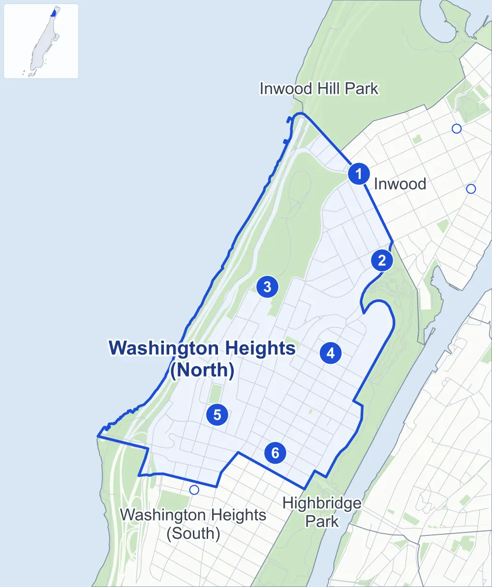
- Washington Heights (North)
- A neighboring area
- Park
- A station in the list
- Another station
Neighborhood areas and streets: NYC Department of City Planning. Parks: NYC Parks. Stations: MTA.
Neighboring areas
- Inwood Hill Park north
- Inwood northeast
- Highbridge Park east
- Washington Heights (South) southwest
Subway stations
- Dyckman St lines A
- Dyckman St lines 1 accessible
- 190 St lines A
- 191 St lines 1
- 181 St lines A accessible
- 181 St lines 1
Getting around
Six subway stations and buses on 13 routes stop in or at the edge of Washington Heights (North).
- 6 subway stations
- 2 of them listed by the MTA as fully accessible
- 12 local bus routes
- 1 express bus route
Local bus routes
- Bx3
- Bx7
- Bx11
- Bx13
- Bx35
- Bx36
- M3
- M4
- M5
- M98
- M100
- M101
Express bus route
- BxM1
Safety record
Between 2021 and 2025, its corners averaged fewer police-reported crashes than the average Manhattan corner.
- 2,193 police-reported crashes at its corners
- 13.2 a corner, on average
- 13.4 the average Manhattan corner
- 13 corners with a clean record
Signal or safety changes on City record, at 61 of its corners
- Leading pedestrian intervals
- 44
- Accessible pedestrian signals
- 21
- Barnes Dance all-way crossings
- 8
- Turn calming
- 6
- Enhanced crossings
- 1
- Safety Improvement Projects
- 1
Camera tickets
In 2025 its corners had more bus-lane camera tickets than school-zone speed or red-light tickets.
- 2,101 red-light camera tickets at one corner
- 5,371 school-zone speed camera tickets at five corners
- 24,362 bus-lane camera tickets at two corners
- Most red-light tickets
- Broadway & Sherman Avenue, 2,101
- Most speed tickets
- Broadway & West 196th Street, 2,941
- Most bus-lane tickets
- Wadsworth Avenue & West 181st Street, 15,808
People and homes
The 2020 Census counted 71,842 residents in Washington Heights (North), about 80,700 per square mile.
- 30,550 homes, 2020 Census
- 718 homes added since April 2010, net, by City Planning's count
Half of its 713 residential lots hold buildings from 1920 or earlier, and 87% of them date from before 1940, by the City's tax lot records.
Parks and landmarks
- Parkland
- 124.6 acres of NYC Parks property
- The largest pieces
- Fort Tryon Park (67.2 acres), Fort Washington Park (49.2 acres) and Bennett Rest (4.1 acres)
- Designated landmark
- The Cloisters (Metropolitan Museum of Art)
Streets and trees
- Trees
- 4,300 in NYC Parks' records, most often thornless honeylocust, pin oak and northern red oak
- Street with the most corners
- Broadway, with 23 of the area's 166
- Height above sea level
- From 9 feet at Dyckman Street & Henry Hudson Parkway to 257 feet at Pinehurst Avenue & West 185th Street
- Honorary street names
- 18 at its corners, enacted by local law
Schools
The City lists 26 schools in Washington Heights (North).
- Public schools
- 16
- Charter and private schools
- 10
Bike share and public art
By the station list of October 3, 2026, 22 bike-share stations stand in Washington Heights (North). The City's public art inventory lists three works in the area: Fort Tryon Memorial (1904), Gertie A. Gorman Memorial (1929) and Columnade (1973).
- 22 bike-share stations
- 3 works of public art
Public safety
How complaints are countedIn 2025 the NYPD recorded 729 major felonies at places in Washington Heights (North).
Recorded by the NYPD at places in Washington Heights (North)
- 769 major felonies in 2024
- 2,888 other felonies, misdemeanors and violations in 2025
In 2025, on the streets along the edge of Washington Heights (North), the NYPD recorded another 212 major felonies. Counting the streets along its edge, in 2025 the NYPD recorded 13.1 major felonies for every thousand residents the 2020 Census counted in Washington Heights (North).
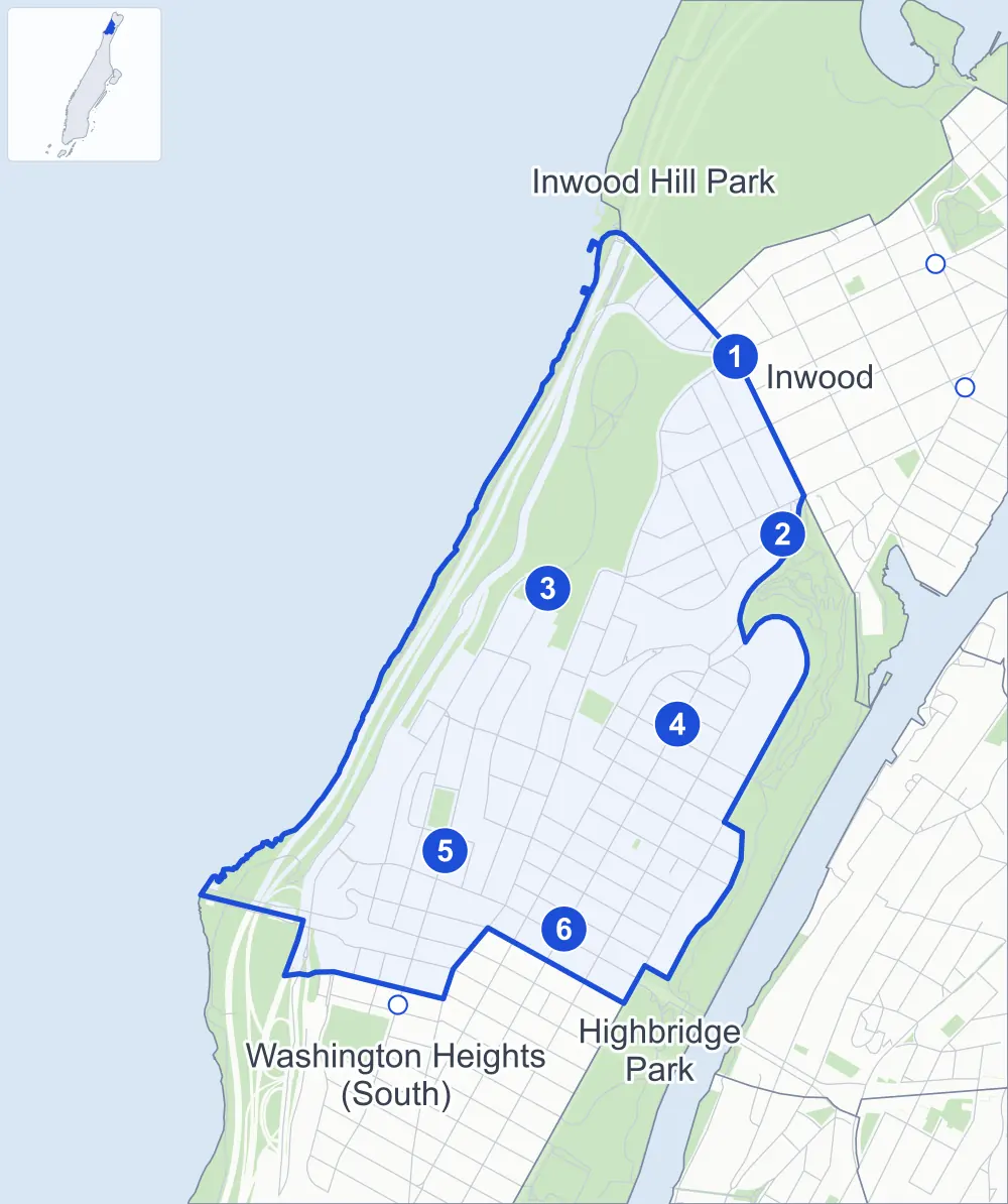
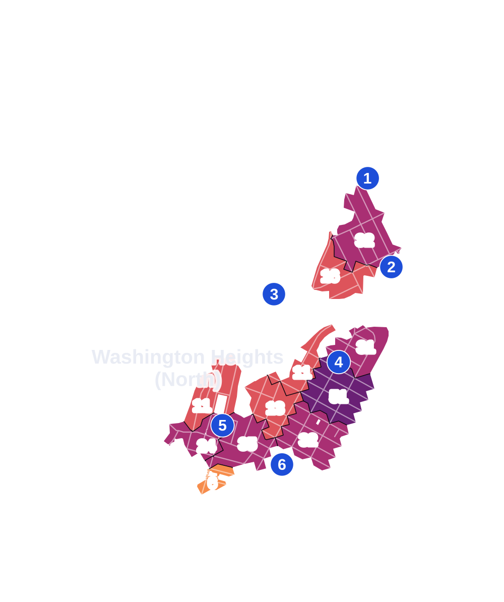
- 5 to 9
- 10 to 19
- 20 to 49
- 50 to 99
- 100 or more
- Not shaded: fewer than 5, held back under the rules in How complaints are counted, parks and public-housing grounds, and land in no patch
- Police precincts
- 34th (most of the area), 33rd
From January to June 2026 the NYPD recorded 383 major felonies at places in Washington Heights (North), against 364 in the same months of 2025.
Sources: the NYPD's Complaint Data Historic, updated April 28, 2026, and Complaint Data Current (Year To Date), updated July 27, 2026, on NYC Open Data. Figures to June 30, 2026.
Street corners
- Amsterdam Avenue & Cross Bronx Expressway
- Amsterdam Avenue & Laurel Hill Terrace
- Amsterdam Avenue & West 180th Street
- Amsterdam Avenue & West 182nd Street
- Amsterdam Avenue & West 183rd Street
- Amsterdam Avenue & West 184th Street
- Amsterdam Avenue & West 185th Street
- Amsterdam Avenue & West 186th Street
- Amsterdam Avenue & West 187th Street
- Amsterdam Avenue & West 189th Street
- Amsterdam Avenue & West 190th Street
- Arden Street & Dongan Place
- Audubon Avenue & Fort George Avenue
- Audubon Avenue & West 180th Street
- Audubon Avenue & West 181st Street
- Audubon Avenue & West 182nd Street
- Audubon Avenue & West 183rd Street
- Audubon Avenue & West 184th Street
- Audubon Avenue & West 185th Street
- Audubon Avenue & West 186th Street
- Audubon Avenue & West 187th Street
- Audubon Avenue & West 188th Street
- Audubon Avenue & West 189th Street
- Audubon Avenue & West 190th Street
- Audubon Avenue & West 191st Street
- Audubon Avenue & West 192nd Street
- Audubon Avenue & West 193rd Street
- Bennett Avenue & West 181st Street
- Bennett Avenue & West 184th Street
- Bennett Avenue & West 186th Street
- Bennett Avenue & West 187th Street
- Bennett Avenue & West 189th Street
- Bennett Avenue & West 190th Street
- Bennett Avenue & West 192nd Street
- Broadway & Arden Street
- Broadway & Bennett Avenue
- Broadway & Dongan Place
- Broadway & Fairview Avenue
- Broadway & Hillside Avenue
- Broadway & Riverside Drive
- Broadway & Sherman Avenue
- Broadway & Thayer Street
- Broadway & West 177th Street
- Broadway & West 179th Street
- Broadway & West 180th Street
- Broadway & West 181st Street
- Broadway & West 182nd Street
- Broadway & West 183rd Street
- Broadway & West 184th Street
- Broadway & West 185th Street
- Broadway & West 186th Street
- Broadway & West 187th Street
- Broadway & West 189th Street
- Broadway & West 190th Street
- Broadway & West 192nd Street
- Broadway & West 193rd Street
- Broadway & West 196th Street
- Cabrini Boulevard & West 177th Street
- Cabrini Boulevard & West 180th Street
- Cabrini Boulevard & West 181st Street
- Cabrini Boulevard & West 186th Street
- Cabrini Boulevard & West 187th Street
- Cabrini Boulevard & West 190th Street
- Cross Bronx Expressway & Cabrini Boulevard
- Cross Bronx Expressway & Fort Washington Avenue
- Cross Bronx Expressway & George Washington Bridge Bus Terminal Ramp
- Cross Bronx Expressway & George Washington Bridge Entrance Lower Level
- Cross Bronx Expressway & George Washington Bridge Pedestrian Path
- Cross Bronx Expressway & Haven Avenue
- Cross Bronx Expressway & Henry Hudson Parkway at George Washington Bridge Pedestrian Path
- Cross Bronx Expressway & Riverside Drive
- Dyckman Street & Henry Hudson Parkway
- Dyckman Street & Henshaw Street
- Dyckman Street & Payson Avenue
- Dyckman Street & Post Avenue
- Dyckman Street & Seaman Avenue
- Dyckman Street & Sherman Avenue
- Dyckman Street & Staff Street
- Ellwood Street & Bogardus Place
- Ellwood Street & West 196th Street
- Fairview Avenue & Broadway Terrace
- Fairview Avenue & Wadsworth Terrace
- Fort Tryon Place & Henry Hudson Parkway
- Fort Washington Avenue & Cabrini Boulevard
- Fort Washington Avenue & West 177th Street
- Fort Washington Avenue & West 178th Street
- Fort Washington Avenue & West 179th Street
- Fort Washington Avenue & West 180th Street
- Fort Washington Avenue & West 181st Street
- Fort Washington Avenue & West 183rd Street
- Fort Washington Avenue & West 185th Street
- Fort Washington Avenue & West 187th Street
- Fort Washington Avenue & West 190th Street
- George Washington Bridge Entrance Lower Level & Cross Bronx Expressway
- Haven Avenue & West 181st Street
- Henry Hudson Parkway & Cross Bronx Expressway
- Henry Hudson Parkway & Cross Bronx Expressway at I 95
- Henry Hudson Parkway & George Washington Bridge
- Hillside Avenue & Bogardus Place
- Hillside Avenue & Ellwood Street
- Hillside Avenue & Sickles Street
- Margaret Corbin Drive & Margaret Corbin Plaza
- Nagle Avenue & Arden Street
- Nagle Avenue & Ellwood Street
- Nagle Avenue & Fort George Hill
- Nagle Avenue & Sickles Street
- Nagle Avenue & Thayer Street
- Pinehurst Avenue & Hudson View Gardens
- Pinehurst Avenue & West 178th Street
- Pinehurst Avenue & West 179th Street
- Pinehurst Avenue & West 180th Street
- Pinehurst Avenue & West 185th Street
- Riverside Drive & Henry Hudson Parkway at Henshaw Street
- Riverside Drive & Henry Hudson Parkway at Staff Street
- Riverside Drive & Henry Hudson Parkway at West 181st Street Pedestrian Overpass
- Riverside Drive & Payson Avenue
- Riverside Drive & Plaza Lafayette
- Riverside Drive & Seaman Avenue
- Sherman Avenue & Arden Street
- Sherman Avenue & Ellwood Street
- Sherman Avenue & Sickles Street
- Sherman Avenue & Thayer Street
- St Nicholas Avenue & Fort George Avenue
- St Nicholas Avenue & Fort George Hill
- St Nicholas Avenue & Wadsworth Avenue
- St Nicholas Avenue & West 180th Street
- St Nicholas Avenue & West 181st Street
- St Nicholas Avenue & West 182nd Street
- St Nicholas Avenue & West 183rd Street
- St Nicholas Avenue & West 184th Street
- St Nicholas Avenue & West 185th Street
- St Nicholas Avenue & West 186th Street
- St Nicholas Avenue & West 187th Street
- St Nicholas Avenue & West 188th Street
- St Nicholas Avenue & West 189th Street
- St Nicholas Avenue & West 190th Street
- St Nicholas Avenue & West 191st Street
- St Nicholas Avenue & West 192nd Street
- Wadsworth Avenue & West 180th Street
- Wadsworth Avenue & West 181st Street
- Wadsworth Avenue & West 182nd Street
- Wadsworth Avenue & West 183rd Street
- Wadsworth Avenue & West 184th Street
- Wadsworth Avenue & West 185th Street
- Wadsworth Avenue & West 186th Street
- Wadsworth Avenue & West 187th Street
- Wadsworth Avenue & West 188th Street
- Wadsworth Avenue & West 189th Street
- Wadsworth Avenue & West 190th Street
- Wadsworth Avenue & West 191st Street
- Wadsworth Avenue & West 192nd Street
- Washington Bridge & Amsterdam Avenue
- West 181st Street & Magaw Place
- West 181st Street & Pinehurst Avenue
- West 182nd Street & Laurel Hill Terrace
- West 183rd Street & Pinehurst Avenue
- West 184th Street & Overlook Terrace
- West 186th Street & Chittenden Avenue
- West 186th Street & Laurel Hill Terrace
- West 186th Street & Overlook Terrace
- West 186th Street & Washington Terrace
- West 187th Street & Laurel Hill Terrace
- West 187th Street & Overlook Terrace
- West 187th Street & Pinehurst Avenue
- West 189th Street & Wadsworth Terrace
- West 190th Street & Wadsworth Terrace
How the figures above are measured: Methodology.