Highbridge Park
Park · Manhattan
Highbridge Park stretches along the Harlem River from West 155th Street to Dyckman Street, following Edgecombe and Amsterdam Avenues.
- 0.28 square miles
- 11 street corners
- 1 subway station
- 11 bus routes
It is named for the High Bridge, which began carrying Croton Aqueduct water across the river in 1848, is the city's oldest standing bridge and reopened to walkers and cyclists in 2015. The parkland was assembled piece by piece between 1867 and the 1960s, and the park is known for its water tower, completed in 1872, a pool and recreation center open since 1936, and the city's first mountain biking course.
Sources: Raoul Wallenberg Playground (NYC Parks); Highbridge Park (NYC Parks); High Bridge (New York City) (Wikipedia).
Highbridge Park borders four areas, and Harlem River Driveway holds more of its corners than any other street, seven of 11.
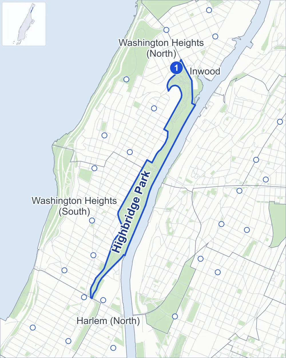
- Highbridge Park
- A neighboring area
- Park
- A station in the list
- Another station
Neighborhood areas and streets: NYC Department of City Planning. Parks: NYC Parks. Stations: MTA.
Neighboring areas
- Washington Heights (North) north
- Inwood northeast
- Washington Heights (South) southwest
- Harlem (North) southwest
Subway stations
- Dyckman St lines 1 accessible
Getting around
One subway station and buses on 11 routes stop in or at the edge of Highbridge Park.
- 1 subway station
- 1 listed by the MTA as fully accessible
- 11 local bus routes
Local bus routes
- Bx3
- Bx6
- Bx11
- Bx13
- Bx35
- Bx36
- M2
- M3
- M98
- M100
- M101
Safety record
Between 2021 and 2025, its corners averaged fewer police-reported crashes than the average Manhattan corner.
- 83 police-reported crashes at its corners
- 7.5 a corner, on average
- 13.4 the average Manhattan corner
- 3 corners with a clean record
Camera tickets
In 2025 its corners had more bus-lane camera tickets than red-light or school-zone speed tickets.
- 0 red-light camera tickets
- 0 school-zone speed camera tickets
- 23,185 bus-lane camera tickets at one corner
- Most bus-lane tickets
- Harlem River Driveway & Washington Bridge, 23,185
Parks and landmarks
- Parkland
- 124.2 acres of Highbridge Park, as NYC Parks maps it within the area's boundary
- Designated landmarks
- The High Bridge Water Tower, the Highbridge Play Center Promenade and the Highbridge Play Center Bathhouse
Streets and trees
- Trees
- 1,490 in NYC Parks' records, most often London planetree, cherry and pin oak
- Street with the most corners
- Harlem River Driveway, with seven of the area's 11
Bike share
By the station list of October 3, 2026, six bike-share stations stand in Highbridge Park.
- 6 bike-share stations
Street corners
- Alexander Hamilton Bridge & Cross Bronx Expressway
- Cross Bronx Expressway & Harlem River Drive
- Harlem River Driveway & Alexander Hamilton Bridge
- Harlem River Driveway & Harlem River Drive (Exit 23)
- Harlem River Driveway & Harlem River Drive (Exit 24)
- Harlem River Driveway & High Bridge
- Harlem River Driveway & Washington Bridge
- Harlem River Driveway & Washington Bridge Bike Path
- Harlem River Driveway & Washington Bridge Pedestrian Path
- Washington Bridge & Cross Bronx Expressway (University Avenue)
- Washington Bridge & Cross Bronx Expressway (Washington Bridge)
How the figures above are measured: Methodology.