Fort Wadsworth
Staten Island
Fort Wadsworth covers 226 acres on Staten Island's northeastern shore, on the Narrows of New York Harbor, and the Verrazzano-Narrows Bridge crosses its grounds.
- 0.35 square miles
- 48 street corners
- 6 bus routes
British forces fortified the site in 1779, and its forts include the granite Battery Weed, completed in 1862, and Fort Tompkins, completed in 1876. The post was named in 1865 for James Wadsworth, a general killed at the Battle of the Wilderness, and it served the Army and then the Navy before becoming part of the National Park Service's Gateway National Recreation Area in the mid-1990s. Today it has a harbor overlook, walking and biking trails and a visitor center.
Sources: Fort Wadsworth - Gateway National Recreation Area (National Park Service); Detailed History of Fort Wadsworth - Gateway National Recreation Area (National Park Service); Fort Wadsworth (The Cultural Landscape Foundation); Fort Wadsworth (Wikipedia).
Fort Wadsworth borders two areas, and New York Avenue holds more of its corners than any other street, nine of 48.
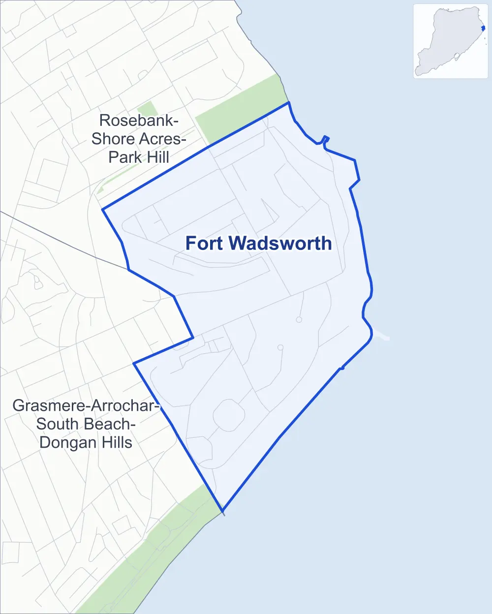
- Fort Wadsworth
- A neighboring area
- Park
Neighborhood areas and streets: NYC Department of City Planning. Parks: NYC Parks. Stations: MTA.
Neighboring areas
- Grasmere-Arrochar-South Beach-Dongan Hills southwest
- Rosebank-Shore Acres-Park Hill northwest
Getting around
Buses on six routes stop in or at the edge of Fort Wadsworth.
- 3 local bus routes
- 3 express bus routes
Local bus routes
- S51
- S53
- S81
Express bus routes
- SIM5
- SIM6
- SIM9
Safety record
Between 2021 and 2025, its corners averaged fewer police-reported crashes than the average Staten Island corner.
- 17 police-reported crashes at its corners
- 0.4 a corner, on average
- 2.2 the average Staten Island corner
- 47 corners with a clean record
Camera tickets
In 2025 the Department of Finance recorded no red-light, school-zone speed or bus-lane camera ticket at its corners.
Landmarks
- Designated landmarks
- The Fort Tompkins and the Battery Weed
Streets and trees
- Trees
- 2 in NYC Parks' records, most often Japanese flowering cherry and magnolia
- Street with the most corners
- New York Avenue, with nine of the area's 48
- Height above sea level
- From 9 feet at Weed Road & Dock Road to 197 feet at Verrazzano-Narrows Bridge & Weed Road
Street corners
- Ayers Road & USS North Carolina Road
- Ayers Road & USS Tennessee Road
- Battery Road & USS New Mexico Court
- Clifton Road & South Road
- Coast Guard Drive & Maloney Drive
- Coast Guard Drive & Marshall Road
- Drum Road & Maloney Drive
- Hudson Road & Battery Road
- Hudson Road & Battery Road at Weed Road
- Hudson Road & Mont Sec Avenue
- Hudson Road & Range Road
- Hudson Road & Tompkins Street
- Hudson Road & USS Tennessee Road
- King Road & Path Road
- Loop Road & Battery Road
- Loop Road & USS Tennessee Road
- Major Avenue & Artillery Road
- Major Avenue & Verrazzano-Narrows Bridge
- Marshall Road & Artillery Road
- Marshall Road & Drum Road
- McClean Avenue & Duer Avenue
- Mont Sec Avenue & South Road
- New York Avenue & Artillery Road
- New York Avenue & Battery Road
- New York Avenue & Coast Guard Drive
- New York Avenue & Drum Road
- New York Avenue & Headquarters Road
- New York Avenue & Marshall Road
- New York Avenue & Mont Sec Avenue
- New York Avenue & North Road
- Richmond Avenue & Battery Road
- Richmond Avenue & Path Road
- Staten Island Expressway & Verrazzano-Narrows Bridge
- Staten Island Expressway & Verrazzano-Narrows Bridge at Verrazzano Bridge Bus Slip
- USS Connecticut Court & USS Arizona Lane
- USS Iowa Circle & USS Arizona Lane
- USS Iowa Circle & USS Missouri Lane
- USS North Carolina Road & USS Connecticut Court (north-west)
- USS North Carolina Road & USS Connecticut Court (south-east)
- USS Tennessee Road & King Road
- USS Tennessee Road & USS Florida Court
- USS Tennessee Road & USS Missouri Lane
- Verrazzano-Narrows Bridge & Hudson Road
- Verrazzano-Narrows Bridge & Major Avenue (north-west)
- Verrazzano-Narrows Bridge & Major Avenue (south-east)
- Verrazzano-Narrows Bridge & New York Avenue
- Verrazzano-Narrows Bridge & Weed Road
- Weed Road & Dock Road
How the figures above are measured: Methodology.