Dyker Beach Park
Park · Brooklyn
Dyker Beach Park is a city park at the southern end of Dyker Heights, across 14th Avenue from Bath Beach, on land that once included swamp.
- 0.36 square miles
- 2 street corners
- 6 bus routes
The City of Brooklyn bought its first parcel in 1895, and a 50-acre saltwater lagoon was planned for the site, a design revised in 1911; filling of the swampy section began in 1918, and more parcels were added between 1924 and 1934. Today NYC Parks runs it as a public park with an 18-hole municipal golf course, playgrounds and ballfields.
Sources: Dyker Beach Park History (NYC Parks); Dyker Heights, Brooklyn (Wikipedia); Bath Beach, Brooklyn (Wikipedia).
Dyker Beach Park borders four areas.
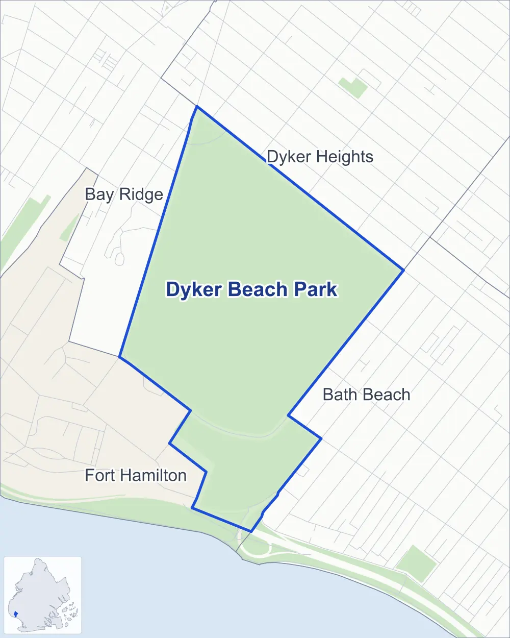
- Dyker Beach Park
- A neighboring area
- Park
Neighborhood areas and streets: NYC Department of City Planning. Parks: NYC Parks. Stations: MTA.
Neighboring areas
- Dyker Heights northeast
- Bath Beach southeast
- Fort Hamilton southwest
- Bay Ridge northwest
Getting around
Buses on six routes stop in or at the edge of Dyker Beach Park.
- 4 local bus routes
- 2 express bus routes
Local bus routes
- B1
- B8
- B64
- B70
Express bus routes
- X28
- X38
Safety record
Between 2021 and 2025, its corners averaged fewer police-reported crashes than the average Brooklyn corner.
- 1 police-reported crash at its corners
- 0.5 a corner, on average
- 10.5 the average Brooklyn corner
- 1 corner with a clean record
Camera tickets
In 2025 the Department of Finance recorded no red-light, school-zone speed or bus-lane camera ticket at its corners.
Parks
- Parkland
- 207.2 acres of Dyker Beach Park, as NYC Parks maps it within the area's boundary
Streets and trees
- Trees
- 764 in NYC Parks' records, most often pin oak, London planetree and thornless honeylocust
Street corners
How the figures above are measured: Methodology.