Upper East Side-Lenox Hill-Roosevelt Island
Neighborhood · Manhattan
Roosevelt Island, in the East River between Manhattan and Queens, joins the riverside blocks of Lenox Hill on the southern Upper East Side to form Upper East Side-Lenox Hill-Roosevelt Island.
- 0.77 square miles
- 85,527 residents, 2020 Census
- 115 street corners
- 2 subway stations
- 14 bus routes
The Lenox Hill name recalls Robert Lenox, a Scottish merchant who bought East Side farmland from 1818; his son James sold it as lots in the 1860s and 1870s. On York Avenue at 66th Street, the Rockefeller Institute opened its laboratories in 1906 and became Rockefeller University in 1965. Roosevelt Island, once Blackwell's and then Welfare Island, took its present name in 1973, gained its tramway in 1976, and keeps Blackwell House, a farmhouse built between 1796 and 1804.
Sources: Lenox Hill, Manhattan (Wikipedia); Roosevelt Island (Wikipedia); The Rockefeller University » Our History (The Rockefeller University).
Upper East Side-Lenox Hill-Roosevelt Island borders three areas, and 1st Avenue and 2nd Avenue hold more of its corners than any other street, 22 each of 115.
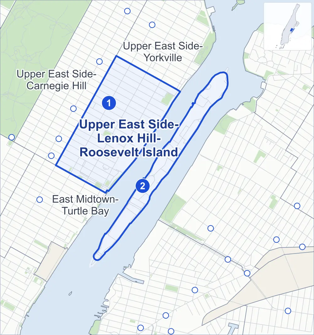
- Upper East Side-Lenox Hill-Roosevelt Island
- A neighboring area
- Park
- A station in the list
- Another station
Neighborhood areas and streets: NYC Department of City Planning. Parks: NYC Parks. Stations: MTA.
Neighboring areas
- Upper East Side-Yorkville north
- East Midtown-Turtle Bay southwest
- Upper East Side-Carnegie Hill northwest
Subway stations
- 72 St lines Q accessible
- Roosevelt Island lines M accessible
Getting around
Two subway stations and buses on 14 routes stop in or at the edge of Upper East Side-Lenox Hill-Roosevelt Island.
- 2 subway stations
- 2 of them listed by the MTA as fully accessible
- 13 local bus routes
- 1 express bus route
Local bus routes
- M15
- M15-SBS
- M31
- M66
- M72
- M79-SBS
- M98
- M101
- M102
- M103
- Q32
- Q60
- Q102
Express bus route
- BxM1
Safety record
Between 2021 and 2025, its corners averaged more police-reported crashes than the average Manhattan corner.
- 1,932 police-reported crashes at its corners
- 16.8 a corner, on average
- 13.4 the average Manhattan corner
- 25 corners with a clean record
Signal or safety changes on City record, at 65 of its corners
- Leading pedestrian intervals
- 57
- Turn calming
- 17
- Accessible pedestrian signals
- 16
- Barnes Dance all-way crossings
- 5
Camera tickets
In 2025 its corners had more bus-lane camera tickets than school-zone speed or red-light tickets.
- 0 red-light camera tickets
- 1,685 school-zone speed camera tickets at four corners
- 14,289 bus-lane camera tickets at six corners
- Most speed tickets
- 1st Avenue & East 75th Street, 776
- Most bus-lane tickets
- 1st Avenue & East 62nd Street, 6,486
People and homes
The 2020 Census counted 85,527 residents in Upper East Side-Lenox Hill-Roosevelt Island, about 111,100 per square mile.
- 52,289 homes, 2020 Census
- 2,013 homes added since April 2010, net, by City Planning's count
Half of its 1,149 residential lots hold buildings from 1910 or earlier, and 78% of them date from before 1940, by the City's tax lot records.
NYCHA development
NYCHA's Robbins Plaza development lies wholly or partly within Upper East Side-Lenox Hill-Roosevelt Island.
Parks and landmarks
- Parkland
- 11.8 acres of NYC Parks property
- The largest pieces
- John Jay Park (3.3 acres), East River Walk (2.6 acres) and Andrew Haswell Green Park (1.8 acres)
- Designated landmarks
- The Abigail Adams Smith Museum; the City and Suburban Homes Company, First Avenue Estate; the Bohemian National Hall (Narodni Budova); and the First Hungarian Reformed Church, among others
- Historic district
- Treadwell Farm Historic District, wholly or partly within Upper East Side-Lenox Hill-Roosevelt Island
Streets and trees
- Trees
- 2,739 in NYC Parks' records, most often thornless honeylocust, Callery pear and London planetree
- Street with the most corners
- 1st Avenue, with 22 of the area's 115
- Height above sea level
- From 5 feet at John Finley Walk & FDR Drive Greenway to 79 feet at 3rd Avenue & East 67th Street
- Honorary street names
- 6 at its corners, enacted by local law
Schools and libraries
The City lists 19 schools and four libraries in Upper East Side-Lenox Hill-Roosevelt Island.
- Public schools
- 12
- Charter and private schools
- 7
- Libraries
- 67th Street Library, Roosevelt Island Library, Webster Library and Yorkville Library
Bike share and public art
By the station list of October 3, 2026, 15 bike-share stations stand in Upper East Side-Lenox Hill-Roosevelt Island. The City's public art inventory lists three works in the area: Eaphae-Aekyad #2 (1979), Kryeti-Aekyad #2 (1979) and East River Roundabout (1995).
- 15 bike-share stations
- 3 works of public art
Public safety
How complaints are countedIn 2025 the NYPD recorded 610 major felonies at places in Upper East Side-Lenox Hill-Roosevelt Island.
Recorded by the NYPD at places in Upper East Side-Lenox Hill-Roosevelt Island
- 557 major felonies in 2024
- 1,443 other felonies, misdemeanors and violations in 2025
In 2025, on the streets along the edge of Upper East Side-Lenox Hill-Roosevelt Island, the NYPD recorded another 287 major felonies. Counting the streets along its edge, in 2025 the NYPD recorded 10.5 major felonies for every thousand residents the 2020 Census counted in Upper East Side-Lenox Hill-Roosevelt Island.
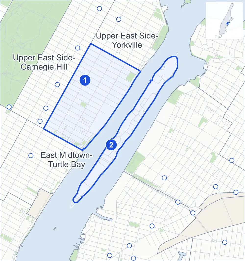
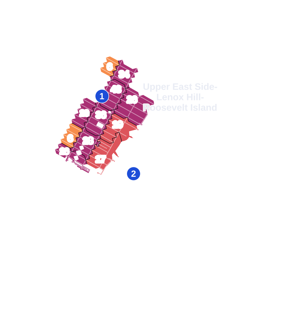
- 5 to 9
- 10 to 19
- 20 to 49
- 50 to 99
- 100 or more
- Not shaded: fewer than 5, held back under the rules in How complaints are counted, parks and public-housing grounds, and land in no patch
- Police precincts
- 19th (most of the area), 114th
From January to June 2026 the NYPD recorded 278 major felonies at places in Upper East Side-Lenox Hill-Roosevelt Island, against 304 in the same months of 2025.
Sources: the NYPD's Complaint Data Historic, updated April 28, 2026, and Complaint Data Current (Year To Date), updated July 27, 2026, on NYC Open Data. Figures to June 30, 2026.
Street corners
- 1st Avenue & East 59th Street
- 1st Avenue & East 60th Street
- 1st Avenue & East 61st Street
- 1st Avenue & East 62nd Street
- 1st Avenue & East 63rd Street
- 1st Avenue & East 64th Street
- 1st Avenue & East 65th Street
- 1st Avenue & East 66th Street
- 1st Avenue & East 67th Street
- 1st Avenue & East 68th Street
- 1st Avenue & East 69th Street
- 1st Avenue & East 70th Street
- 1st Avenue & East 71st Street
- 1st Avenue & East 72nd Street
- 1st Avenue & East 73rd Street
- 1st Avenue & East 74th Street
- 1st Avenue & East 75th Street
- 1st Avenue & East 76th Street
- 1st Avenue & East 77th Street
- 1st Avenue & East 78th Street
- 2nd Avenue & East 61st Street
- 2nd Avenue & East 62nd Street
- 2nd Avenue & East 63rd Street
- 2nd Avenue & East 64th Street
- 2nd Avenue & East 65th Street
- 2nd Avenue & East 66th Street
- 2nd Avenue & East 67th Street
- 2nd Avenue & East 68th Street
- 2nd Avenue & East 69th Street
- 2nd Avenue & East 70th Street
- 2nd Avenue & East 71st Street
- 2nd Avenue & East 72nd Street
- 2nd Avenue & East 73rd Street
- 2nd Avenue & East 74th Street
- 2nd Avenue & East 75th Street
- 2nd Avenue & East 76th Street
- 2nd Avenue & East 77th Street
- 2nd Avenue & East 78th Street
- 2nd Avenue & East 79th Street
- 3rd Avenue & East 62nd Street
- 3rd Avenue & East 63rd Street
- 3rd Avenue & East 65th Street
- 3rd Avenue & East 67th Street
- 3rd Avenue & East 70th Street
- 3rd Avenue & East 75th Street
- 3rd Avenue & East 76th Street
- East 59th Street & Ed Koch Queensboro Bridge Pedestrian Path
- East 63rd Street & East 63rd Street Pedestrian Overpass
- East 77th Street & Cherokee Place
- East 78th Street & Cherokee Place
- East 78th Street & East 78th Street Pedestrian Overpass
- East 79th Street & East End Avenue
- East Road & FDR Four Freedoms Park Path
- East Road & Loop Road
- FDR Drive & East 60th Street
- FDR Drive & East 61st Street
- FDR Drive & East 62nd Street
- FDR Drive & East 63rd Street
- FDR Drive & East 63rd Street Pedestrian Overpass
- FDR Drive & East 70th Street
- FDR Drive & East 71st Street
- FDR Drive & East 71st Street Pedestrian Overpass
- FDR Drive & East 72nd Street
- FDR Drive & East 73rd Street
- FDR Drive & East 78th Street
- FDR Drive & Ed Koch Queensboro Bridge Bike Path
- John Finley Walk & East 63rd Street Pedestrian Overpass
- John Finley Walk & East 71st Street Pedestrian Overpass
- John Finley Walk & East 78th Street Pedestrian Overpass
- John Finley Walk & FDR Drive Greenway
- Loop Road & East Main Street
- Loop Road & West Main Street
- Main Street & East Main Street
- Main Street & East Road (north-east)
- Main Street & East Road (south-west)
- Main Street & River Road (north-east)
- Main Street & River Road (south-west)
- Main Street & Roosevelt Island Bridge Ramp
- Queensboro Bridge & 1st Avenue
- Queensboro Bridge & 1st Avenue at Ed Koch Queensboro Bridge Bike Path
- Queensboro Bridge & 2nd Avenue
- Queensboro Bridge & 2nd Avenue at East 59th Street
- Queensboro Bridge & 2nd Avenue at East 60th Street
- Queensboro Bridge & East 60th Street
- Queensboro Bridge & East 61st Street
- Queensboro Bridge & East 62nd Street
- Queensboro Bridge & East 63rd Street
- Queensboro Bridge & East Main Street
- Queensboro Bridge & Ed Koch Queensboro Bridge Bike Path
- Queensboro Bridge & Queensboro Bridge Exit
- Queensboro Bridge & West Main Street
- Queensboro Bridge & York Avenue
- Queensboro Bridge Exit & East 60th Street
- Roosevelt Island Bridge & East Road
- West Road & West Main Street
- York Avenue & East 59th Street
- York Avenue & East 60th Street
- York Avenue & East 61st Street
- York Avenue & East 62nd Street
- York Avenue & East 63rd Street
- York Avenue & East 64th Street
- York Avenue & East 65th Street
- York Avenue & East 66th Street
- York Avenue & East 67th Street
- York Avenue & East 68th Street
- York Avenue & East 69th Street
- York Avenue & East 70th Street
- York Avenue & East 71st Street
- York Avenue & East 72nd Street
- York Avenue & East 73rd Street
- York Avenue & East 74th Street
- York Avenue & East 75th Street
- York Avenue & East 76th Street
- York Avenue & East 77th Street
- York Avenue & East 78th Street
How the figures above are measured: Methodology.