Astoria (Central)
Neighborhood · Queens
Astoria (Central) takes in the middle of Astoria in western Queens, reaching from Astoria Boulevard south to 36th Avenue with Steinway Street along its eastern edge.
- 0.76 square miles
- 52,220 residents, 2020 Census
- 124 street corners
- 4 subway stations
- 10 bus routes
The village of Astoria, named in 1839 for John Jacob Astor, became part of Long Island City in 1870 and of New York City in 1898, and the elevated Astoria subway line through the area opened in 1917. Filmmaking arrived in 1920-21 with a large studio on 35th Avenue that turned out more than 100 silent features, and one of its former buildings has housed the Museum of the Moving Image since 1988.
Sources: Astoria, Queens (Wikipedia); Museum of the Moving Image (Wikipedia); About (Museum of the Moving Image).
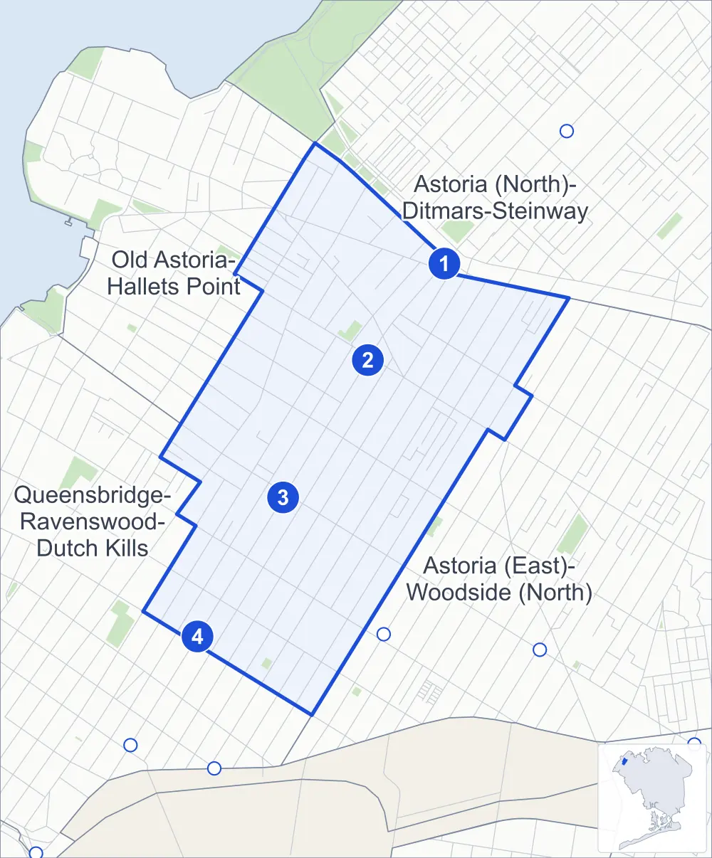
Astoria (Central) borders four areas, and Crescent Street holds more of its corners than any other street, 15 of 124.
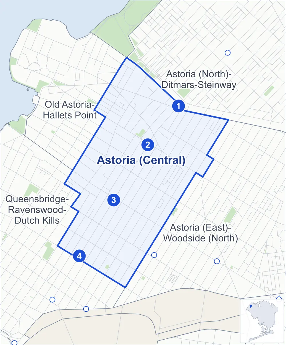
- Astoria (Central)
- A neighboring area
- Park
- A station in the list
- Another station
Neighborhood areas and streets: NYC Department of City Planning. Parks: NYC Parks. Stations: MTA.
Neighboring areas
- Astoria (North)-Ditmars-Steinway northeast
- Astoria (East)-Woodside (North) southeast
- Queensbridge-Ravenswood-Dutch Kills southwest
- Old Astoria-Hallets Point northwest
Subway stations
- Astoria Blvd lines N W accessible
- 30 Av lines N W
- Broadway lines N W
- 36 Av lines N W
Getting around
Four subway stations and buses on ten routes stop in or at the edge of Astoria (Central).
- 4 subway stations
- 1 of them listed by the MTA as fully accessible
- 10 local bus routes
Local bus routes
- B62
- M60-SBS
- Q18
- Q19
- Q66
- Q69
- Q100
- Q101
- Q102
- Q104
Safety record
Between 2021 and 2025, its corners averaged more police-reported crashes than the average Queens corner.
- 1,403 police-reported crashes at its corners
- 11.3 a corner, on average
- 5.2 the average Queens corner
- 4 corners with a clean record
Signal or safety changes on City record, at 29 of its corners
- Leading pedestrian intervals
- 21
- Accessible pedestrian signals
- 7
- Turn calming
- 5
Camera tickets
In 2025 its corners had more school-zone speed camera tickets than red-light or bus-lane tickets.
- 0 red-light camera tickets
- 7,140 school-zone speed camera tickets at six corners
- 0 bus-lane camera tickets
- Most speed tickets
- 24th Street & Hoyt Avenue South, 4,858
People and homes
The 2020 Census counted 52,220 residents in Astoria (Central), about 68,700 per square mile.
- 26,720 homes, 2020 Census
- 2,923 homes added since April 2010, net, by City Planning's count
Half of its 3,978 residential lots hold buildings from 1928 or earlier, and 66% of them date from before 1940, by the City's tax lot records.
Parks and landmarks
- Parkland
- 0.9 acre of Athens Square, as NYC Parks maps it within Astoria (Central)
- Designated landmark
- The Famous Players-Lasky Studio
Streets and trees
- Trees
- 2,705 in NYC Parks' records, most often thornless honeylocust, London planetree and pin oak
- Street with the most corners
- Crescent Street, with 15 of the area's 124
- Height above sea level
- From 11 feet at 23rd Street & 31st Road to 68 feet at 28th Avenue & 38th Street
- Honorary street names
- 3 at its corners, enacted by local law
Schools
The City lists 11 schools in Astoria (Central).
- Public schools
- 7
- Charter and private schools
- 4
Bike share and public art
By the station list of October 3, 2026, 18 bike-share stations stand in Astoria (Central). The City's public art inventory lists five works in the area, among them Socrates (1993), Doric Columns (1996) and Athena (1998).
- 18 bike-share stations
- 5 works of public art
Public safety
How complaints are countedIn 2025 the NYPD recorded 323 major felonies at places in Astoria (Central).
Recorded by the NYPD at places in Astoria (Central)
- 355 major felonies in 2024
- 994 other felonies, misdemeanors and violations in 2025
In 2025, on the streets along the edge of Astoria (Central), the NYPD recorded another 116 major felonies. Counting the streets along its edge, in 2025 the NYPD recorded 8.4 major felonies for every thousand residents the 2020 Census counted in Astoria (Central).
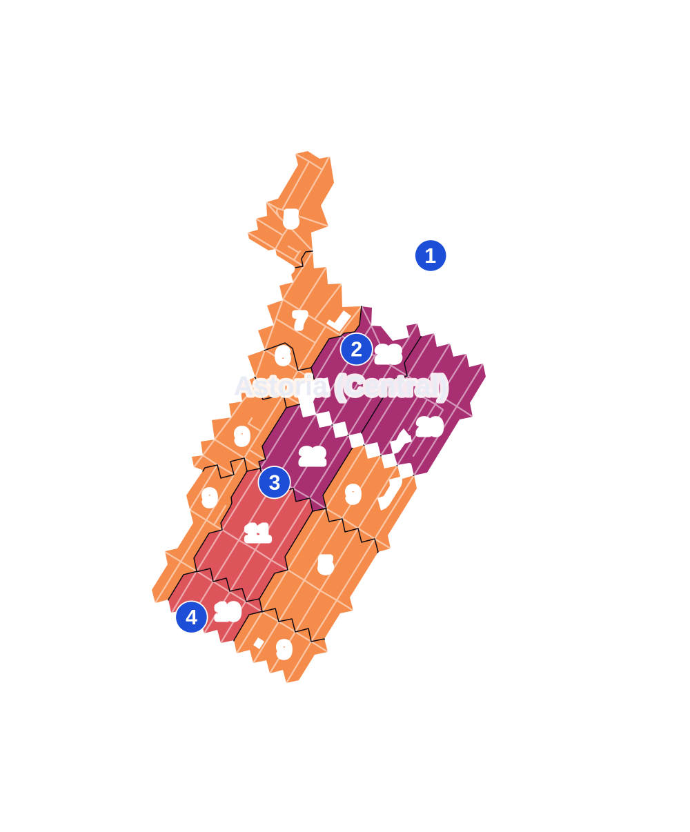
- 5 to 9
- 10 to 19
- 20 to 49
- 50 to 99
- 100 or more
- Not shaded: fewer than 5, held back under the rules in How complaints are counted, parks and public-housing grounds, and land in no patch
- Police precinct
- 114th
From January to June 2026 the NYPD recorded 144 major felonies at places in Astoria (Central), against 161 in the same months of 2025.
Sources: the NYPD's Complaint Data Historic, updated April 28, 2026, and Complaint Data Current (Year To Date), updated July 27, 2026, on NYC Open Data. Figures to June 30, 2026.
Street corners
- 21st Street & 26th Road
- 21st Street & 27th Avenue
- 21st Street & 27th Road
- 22nd Street & 25th Road
- 23rd Street & 25th Road
- 23rd Street & 27th Road
- 23rd Street & 30th Drive
- 23rd Street & 31st Road
- 23rd Street & Astoria Boulevard
- 23rd Street & Hoyt Avenue South
- 23rd Street & Newtown Avenue
- 24th Street & Hoyt Avenue South
- 27th Street & 25th Road
- 27th Street & Astoria Boulevard
- 27th Street & Hoyt Avenue South
- 27th Street & Newtown Avenue
- 28th Avenue & 23rd Street
- 28th Avenue & 31st Street
- 28th Avenue & 32nd Street
- 28th Avenue & 33rd Street
- 28th Avenue & 34th Street
- 28th Avenue & 35th Street
- 28th Avenue & 36th Street
- 28th Avenue & 37th Street
- 28th Avenue & 38th Street
- 28th Avenue & Crescent Street
- 28th Street & Newtown Avenue
- 29th Avenue & 23rd Street
- 29th Avenue & Crescent Street
- 29th Street & 30th Drive
- 29th Street & 30th Road
- 29th Street & 33rd Avenue
- 29th Street & Astoria Boulevard
- 29th Street & Hoyt Avenue South
- 29th Street & Newtown Avenue
- 30th Avenue & 27th Street
- 30th Avenue & 29th Street
- 30th Avenue & 30th Street
- 30th Avenue & 31st Street
- 30th Avenue & 32nd Street
- 30th Avenue & 33rd Street
- 30th Avenue & 34th Street
- 30th Avenue & 35th Street
- 30th Avenue & 36th Street
- 30th Avenue & 37th Street
- 30th Avenue & Crescent Street
- 30th Street & 30th Drive
- 30th Street & Newtown Avenue
- 31st Avenue & 29th Street
- 31st Avenue & 30th Street
- 31st Avenue & 31st Street
- 31st Avenue & 32nd Street
- 31st Avenue & 33rd Street
- 31st Avenue & 34th Street
- 31st Avenue & 35th Street
- 31st Avenue & 36th Street
- 31st Avenue & 37th Street
- 31st Avenue & Crescent Street
- 31st Street & 28th Road
- 31st Street & 30th Drive
- 31st Street & Astoria Boulevard
- 31st Street & Newtown Avenue
- 32nd Street & Newtown Avenue
- 33rd Avenue & 23rd Street
- 33rd Avenue & 28th Street
- 33rd Avenue & Crescent Street
- 33rd Street & 28th Road
- 34th Avenue & 28th Street
- 34th Avenue & 29th Street
- 34th Avenue & 30th Street
- 34th Avenue & 31st Street
- 34th Avenue & 32nd Street
- 34th Avenue & 33rd Street
- 34th Avenue & 34th Street
- 34th Avenue & 35th Street
- 34th Avenue & 36th Street
- 34th Avenue & 37th Street
- 34th Avenue & 38th Street
- 34th Avenue & Crescent Street
- 34th Street & 36th Avenue
- 34th Street & Astoria Boulevard South
- 35th Avenue & 29th Street
- 35th Avenue & 30th Street
- 35th Avenue & 31st Street
- 35th Avenue & 32nd Street
- 35th Avenue & 33rd Street
- 35th Avenue & 34th Street
- 35th Avenue & 35th Street
- 35th Avenue & 36th Street
- 35th Avenue & 37th Street
- 35th Avenue & 38th Street
- 35th Street & Astoria Boulevard South
- 36th Avenue & 28th Street
- 36th Avenue & 32nd Street
- 36th Avenue & 36th Street
- 36th Street & Astoria Boulevard South
- 37th Street & 36th Avenue
- 37th Street & Astoria Boulevard South
- Astoria Boulevard & 22nd Street
- Astoria Boulevard & 28th Street
- Astoria Boulevard & 30th Street
- Astoria Boulevard & 32nd Street
- Astoria Boulevard & Newtown Avenue
- Broadway & 23rd Street
- Broadway & 29th Street
- Broadway & 30th Street
- Broadway & 31st Street
- Broadway & 32nd Street
- Broadway & 33rd Street
- Broadway & 34th Street
- Broadway & 35th Street
- Broadway & 36th Street
- Broadway & 37th Street
- Broadway & Crescent Street
- Crescent Street & 30th Drive
- Crescent Street & 30th Road
- Crescent Street & 31st Drive
- Crescent Street & 31st Road
- Crescent Street & 33rd Road
- Crescent Street & Astoria Boulevard
- Crescent Street & Hoyt Avenue South
- Crescent Street & Newtown Avenue
- Hoyt Avenue South & 26th Street
- Hoyt Avenue South & Grand Central Parkway
How the figures above are measured: Methodology.