Queensbridge-Ravenswood-Dutch Kills
Neighborhood · Queens
Queensbridge-Ravenswood-Dutch Kills follows the East River shore of Long Island City north of the Queensboro Bridge and reaches inland through Dutch Kills around Queens Plaza.
- 0.99 square miles
- 32,954 residents, 2020 Census
- 159 street corners
- 6 subway stations
- 14 bus routes
Dutch Kills began as a hamlet named for a navigable branch of Newtown Creek, and Ravenswood, a strip along the river, saw mansions go up from 1848; both became part of Long Island City in 1870. The Queensbridge Houses, opened in 1939 and named for the bridge, are the largest public housing project in the United States, and Vernon Boulevard is home to the Noguchi Museum, which opened in 1985.
Sources: Long Island City (Wikipedia); Astoria, Queens (Wikipedia); Affordable New York: Queensbridge Houses (Museum of the City of New York); Timeline (The Noguchi Museum).
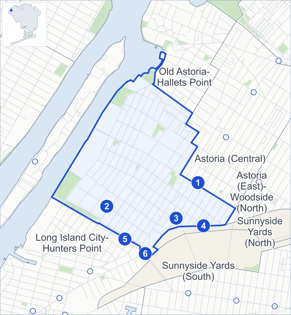
Queensbridge-Ravenswood-Dutch Kills borders six areas, and 37th Avenue holds more of its corners than any other street, 24 of 159.
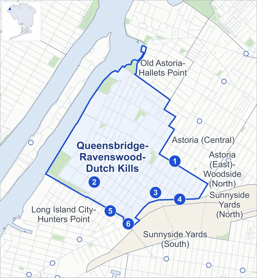
- Queensbridge-Ravenswood-Dutch Kills
- A neighboring area
- Park
- A station in the list
- Another station
Neighborhood areas and streets: NYC Department of City Planning. Parks: NYC Parks. Stations: MTA.
Neighboring areas
- Old Astoria-Hallets Point north
- Astoria (Central) east
- Sunnyside Yards (North) southeast
- Astoria (East)-Woodside (North) southeast
- Sunnyside Yards (South) south
- Long Island City-Hunters Point southwest
Subway stations
- 36 Av lines N W
- 21 St-Queensbridge lines M accessible
- 39 Av-Dutch Kills lines N W
- 36 St lines M R
- Queensboro Plaza lines 7 N W accessible
- Queens Plaza lines E F R accessible
Getting around
Six subway stations and buses on 14 routes stop in or at the edge of Queensbridge-Ravenswood-Dutch Kills.
- 6 subway stations
- 3 of them listed by the MTA as fully accessible
- 14 local bus routes
Local bus routes
- B62
- Q32
- Q60
- Q63
- Q66
- Q69
- Q96
- Q100
- Q101
- Q102
- Q103
- Q104
- Q108
- T320
Safety record
Between 2021 and 2025, its corners averaged more police-reported crashes than the average Queens corner.
- 1,385 police-reported crashes at its corners
- 8.7 a corner, on average
- 5.2 the average Queens corner
- 10 corners with a clean record
Signal or safety changes on City record, at 37 of its corners
- Accessible pedestrian signals
- 30
- Leading pedestrian intervals
- 22
- Safety Improvement Projects
- 6
- Turn calming
- 3
- Barnes Dance all-way crossings
- 2
Camera tickets
In 2025 its corners had more school-zone speed camera tickets than red-light or bus-lane tickets.
- 0 red-light camera tickets
- 6,426 school-zone speed camera tickets at seven corners
- 0 bus-lane camera tickets
- Most speed tickets
- 21st Street & 33rd Road, 2,575
People and homes
The 2020 Census counted 32,954 residents in Queensbridge-Ravenswood-Dutch Kills, about 33,300 per square mile.
- 14,903 homes, 2020 Census
- 6,854 homes added since April 2010, net, by City Planning's count
Half of its 1,194 residential lots hold buildings from 1930 or earlier, and 61% of them date from before 1940, by the City's tax lot records.
NYCHA developments
NYCHA's Queensbridge North, Queensbridge South and Ravenswood developments lie wholly or partly within Queensbridge-Ravenswood-Dutch Kills.
Parks and landmarks
- Parkland
- 40.6 acres of NYC Parks property
- The largest pieces
- Queensbridge Park (20.3 acres), Rainey Park (9.1 acres) and Socrates Sculpture Park (4.6 acres)
- Designated landmarks
- The Barkin, Levin & Company Office Pavilion; and the Bank of the Manhattan Company Building
Streets and trees
- Trees
- 3,347 in NYC Parks' records, most often London planetree, thornless honeylocust and pin oak
- Street with the most corners
- 37th Avenue, with 24 of the area's 159
- Height above sea level
- From 7 feet at Vernon Boulevard & 31st Drive to 47 feet at 36th Avenue & 30th Street
- Honorary street names
- 12 at its corners, enacted by local law
Schools and libraries
The City lists 15 schools and three libraries in Queensbridge-Ravenswood-Dutch Kills.
- Public schools
- 10
- Charter and private schools
- 5
- Libraries
- Long Island City Library, Queensbridge Library and Ravenswood Library
Bike share and public art
By the station list of October 3, 2026, 24 bike-share stations stand in Queensbridge-Ravenswood-Dutch Kills. The City's public art inventory lists one work in the area: Diagonal Sonata (2007).
- 24 bike-share stations
- 1 work of public art
Public safety
How complaints are countedIn 2025 the NYPD recorded 546 major felonies at places in Queensbridge-Ravenswood-Dutch Kills.
Recorded by the NYPD at places in Queensbridge-Ravenswood-Dutch Kills
- 593 major felonies in 2024
- 2,573 other felonies, misdemeanors and violations in 2025
In 2025, on the streets along the edge of Queensbridge-Ravenswood-Dutch Kills, the NYPD recorded another 80 major felonies. Counting the streets along its edge, in 2025 the NYPD recorded 19.0 major felonies for every thousand residents the 2020 Census counted in Queensbridge-Ravenswood-Dutch Kills.
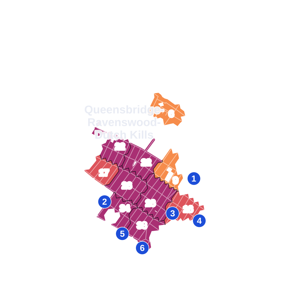
- 5 to 9
- 10 to 19
- 20 to 49
- 50 to 99
- 100 or more
- Not shaded: fewer than 5, held back under the rules in How complaints are counted, parks and public-housing grounds, and land in no patch
- Police precincts
- 114th (most of the area), 108th
From January to June 2026 the NYPD recorded 254 major felonies at places in Queensbridge-Ravenswood-Dutch Kills, against 271 in the same months of 2025.
Sources: the NYPD's Complaint Data Historic, updated April 28, 2026, and Complaint Data Current (Year To Date), updated July 27, 2026, on NYC Open Data. Figures to June 30, 2026.
Street corners
- 9th Street & 33rd Road
- 10th Street & 33rd Road
- 10th Street & 40th Avenue
- 10th Street & 41st Road
- 11th Street & 33rd Road
- 11th Street & 40th Avenue
- 12th Street & 33rd Road
- 12th Street & 40th Avenue
- 12th Street & 41st Road
- 14th Street & 33rd Road
- 21st Street & 14th Street
- 21st Street & 33rd Avenue
- 21st Street & 33rd Road
- 21st Street & 36th Avenue
- 21st Street & 40th Avenue
- 21st Street & Ed Koch Bridge Upper Roadway
- 21st Street & Queens Plaza North
- 22nd Street & Queens Plaza North
- 23rd Street & 33rd Road
- 23rd Street & 36th Avenue
- 23rd Street & 40th Avenue
- 23rd Street & Queens Plaza North
- 24th Street & 40th Avenue
- 24th Street & Queens Plaza North
- 27th Street & 40th Avenue
- 27th Street & Queens Plaza North
- 28th Street & 40th Avenue
- 28th Street & Queens Plaza North
- 29th Street & 36th Avenue
- 29th Street & 40th Avenue
- 29th Street & 40th Road
- 29th Street & Queens Plaza North
- 30th Street & 40th Avenue
- 31st Street & 36th Avenue
- 33rd Avenue & 11th Street
- 33rd Avenue & 12th Street
- 33rd Avenue & 14th Street
- 34th Avenue & 9th Street
- 34th Avenue & 10th Street
- 34th Avenue & 11th Street
- 34th Avenue & 12th Street
- 34th Avenue & 13th Street
- 34th Avenue & 14th Street
- 34th Avenue & 21st Street
- 34th Avenue & 24th Street
- 34th Avenue & Vernon Boulevard
- 35th Avenue & 9th Street
- 35th Avenue & 10th Street
- 35th Avenue & 11th Street
- 35th Avenue & 12th Street
- 35th Avenue & 21st Street
- 35th Avenue & 24th Street
- 35th Avenue & 28th Street
- 35th Avenue & Crescent Street
- 35th Avenue & Vernon Boulevard
- 35th Street & 36th Avenue
- 36th Avenue & 9th Street
- 36th Avenue & 10th Street
- 36th Avenue & 11th Street
- 36th Avenue & 12th Street
- 36th Avenue & 13th Street
- 36th Avenue & 14th Street
- 36th Avenue & 22nd Street
- 36th Avenue & 24th Street
- 36th Avenue & 30th Street
- 36th Avenue & 33rd Street
- 36th Avenue & Crescent Street
- 37th Avenue & 9th Street
- 37th Avenue & 10th Street
- 37th Avenue & 11th Street
- 37th Avenue & 12th Street
- 37th Avenue & 13th Street
- 37th Avenue & 14th Street
- 37th Avenue & 21st Street
- 37th Avenue & 22nd Street
- 37th Avenue & 23rd Street
- 37th Avenue & 24th Street
- 37th Avenue & 27th Street
- 37th Avenue & 28th Street
- 37th Avenue & 29th Street
- 37th Avenue & 30th Street
- 37th Avenue & 31st Street
- 37th Avenue & 32nd Street
- 37th Avenue & 33rd Street
- 37th Avenue & 34th Street
- 37th Avenue & 35th Street
- 37th Avenue & 36th Street
- 37th Avenue & 37th Street
- 37th Avenue & Crescent Street
- 37th Avenue & Old Ridge Road
- 37th Avenue & Vernon Boulevard
- 38th Avenue & 9th Street
- 38th Avenue & 10th Street
- 38th Avenue & 11th Street
- 38th Avenue & 12th Street
- 38th Avenue & 13th Street
- 38th Avenue & 21st Street
- 38th Avenue & 22nd Street
- 38th Avenue & 23rd Street
- 38th Avenue & 24th Street
- 38th Avenue & 27th Street
- 38th Avenue & 28th Street
- 38th Avenue & 29th Street
- 38th Avenue & 30th Street
- 38th Avenue & 31st Street
- 38th Avenue & 32nd Street
- 38th Avenue & 33rd Street
- 38th Avenue & 34th Street
- 38th Avenue & 35th Street
- 38th Avenue & Crescent Street
- 38th Avenue & Old Ridge Road
- 38th Avenue & Vernon Boulevard
- 39th Avenue & 21st Street
- 39th Avenue & 22nd Street
- 39th Avenue & 23rd Street
- 39th Avenue & 24th Street
- 39th Avenue & 27th Street
- 39th Avenue & 28th Street
- 39th Avenue & 29th Street
- 39th Avenue & 30th Street
- 39th Avenue & 31st Street
- 39th Avenue & 32nd Street
- 39th Avenue & Crescent Street
- 40th Avenue & 9th Street
- 40th Avenue & 13th Street
- 40th Avenue & 22nd Street
- 41st Avenue & 10th Street
- 41st Avenue & 12th Street
- 41st Avenue & 21st Street
- 41st Avenue & 22nd Street
- 41st Avenue & 23rd Street
- 41st Avenue & 24th Street
- 41st Avenue & 27th Street
- 41st Avenue & 28th Street
- 41st Avenue & 29th Street
- 41st Avenue & Crescent Street
- 41st Avenue & Queens Plaza North
- 41st Avenue & Vernon Boulevard
- Broadway & 12th Street
- Broadway & Vernon Boulevard
- Crescent Street & 40th Avenue
- Ed Koch Bridge Upper Roadway & Ed Koch Queensboro Bridge Bike Path
- Ed Koch Bridge Upper Roadway & Queensboro Bridge (north-west)
- Ed Koch Bridge Upper Roadway & Queensboro Bridge (south-east)
- Northern Boulevard & 34th Street
- Northern Boulevard & 35th Street
- Northern Boulevard & 38th Avenue
- Northern Boulevard & 41st Avenue
- Northern Boulevard & 41st Avenue at Queens Plaza East
- Queens Plaza & Queens Plaza East
- Queensboro Bridge & Crescent Street
- Queensboro Bridge & Vernon Boulevard
- Vernon Boulevard & 9th Street
- Vernon Boulevard & 10th Street
- Vernon Boulevard & 31st Drive
- Vernon Boulevard & 33rd Road
- Vernon Boulevard & 36th Avenue
- Vernon Boulevard & 40th Avenue
- Vernon Boulevard & Ed Koch Queensboro Bridge Bike Path
How the figures above are measured: Methodology.