Hollis
Neighborhood · Queens
Between Jamaica and Queens Village in southeast Queens, Hollis is a residential neighborhood whose first European settlers were Dutch homesteaders in the 1600s.
- 0.88 square miles
- 24,576 residents, 2020 Census
- 186 street corners
- 13 bus routes
During the Battle of Long Island in 1776, an American militia general was captured at a tavern on the Jamaica road here. In the 1880s developer Frederick W. Dunton began building houses on the farmland and named the area for Hollis, New Hampshire, where he had grown up. In more recent times Hollis has been celebrated as one of the birthplaces of hip-hop, the hometown of pioneering rap artists of the 1980s.
Sources: Run DMC and the Revolution: Historic Hollis, Queens (The Bowery Boys); Hollis, Queens (Wikipedia).
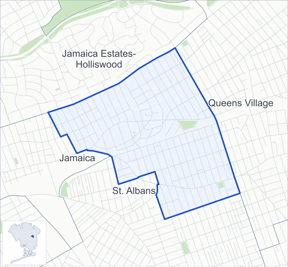
Hollis borders four areas, and Jamaica Avenue holds more of its corners than any other street, 19 of 186.
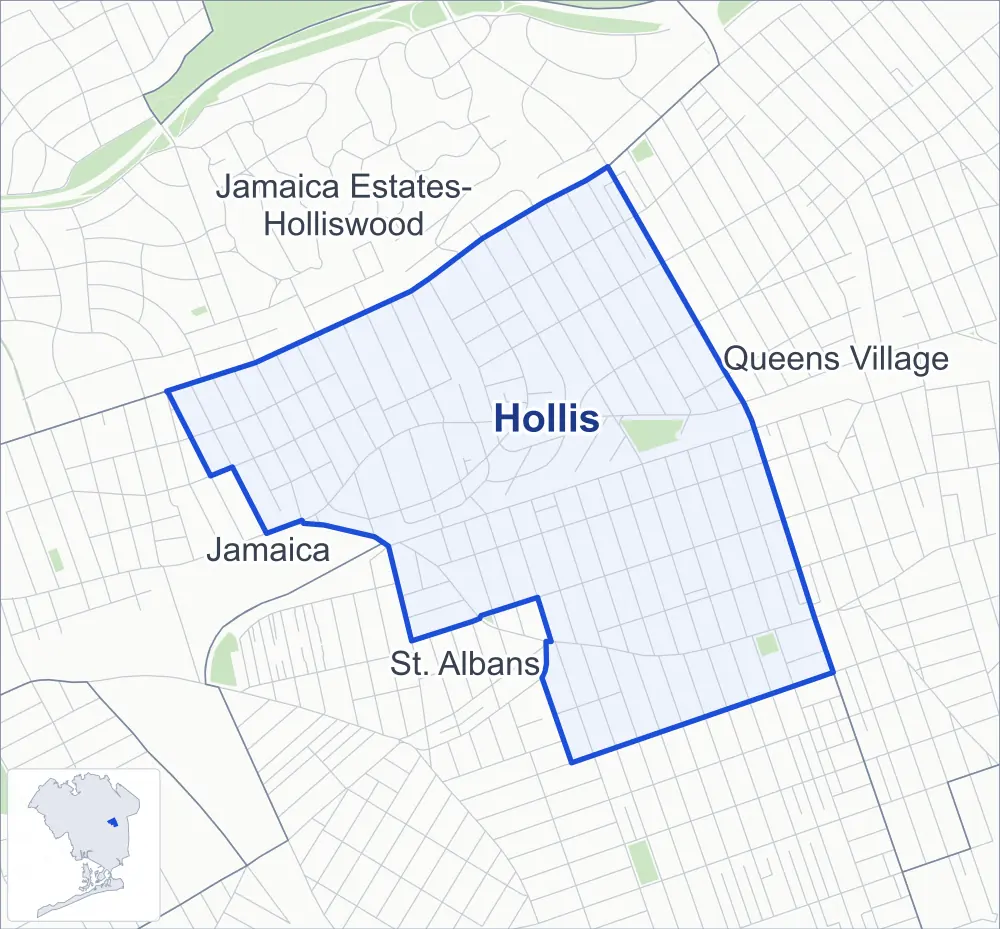
- Hollis
- A neighboring area
- Park
Neighborhood areas and streets: NYC Department of City Planning. Parks: NYC Parks. Stations: MTA.
Neighboring areas
- Queens Village east
- St. Albans south
- Jamaica west
- Jamaica Estates-Holliswood northwest
Getting around
Buses on 13 routes stop in or at the edge of Hollis.
- 12 local bus routes
- 1 express bus route
Local bus routes
- Q1
- Q2
- Q3
- Q4
- Q17
- Q36
- Q43
- Q76
- Q77
- Q82
- Q83
- Q110
Express bus route
- QM68
Safety record
Between 2021 and 2025, its corners averaged more police-reported crashes than the average Queens corner.
- 1,015 police-reported crashes at its corners
- 5.5 a corner, on average
- 5.2 the average Queens corner
- 8 corners with a clean record
Signal or safety changes on City record, at 11 of its corners
- Leading pedestrian intervals
- 9
- Accessible pedestrian signals
- 6
- Turn calming
- 1
- Barnes Dance all-way crossings
- 1
Camera tickets
In 2025 its corners had more school-zone speed camera tickets than red-light or bus-lane tickets.
- 1,897 red-light camera tickets at one corner
- 11,936 school-zone speed camera tickets at eight corners
- 0 bus-lane camera tickets
- Most red-light tickets
- Hillside Avenue & 188th Street, 1,897
- Most speed tickets
- Hillside Avenue & 192nd Street, 4,167
People and homes
The 2020 Census counted 24,576 residents in Hollis, about 27,900 per square mile.
- 7,493 homes, 2020 Census
- 127 homes added since April 2010, net, by City Planning's count
Half of its 3,953 residential lots hold buildings from 1925 or earlier, and 83% of them date from before 1940, by the City's tax lot records.
Parks
- Parkland
- 4.9 acres of NYC Parks property
- The largest pieces
- Haggerty Park (3.9 acres) and Hollis Playground (1 acre)
Streets and trees
- Trees
- 3,074 in NYC Parks' records, most often London planetree, pin oak and thornless honeylocust
- Street with the most corners
- Jamaica Avenue, with 19 of the area's 186
- Height above sea level
- From 44 feet at 196th Street & Hollis Avenue to 90 feet at Hillside Avenue & 205th Street
- Honorary street names
- 4 at its corners, enacted by local law
Schools and libraries
The City lists seven schools and one library in Hollis.
- Public schools
- 5
- Charter and private schools
- 2
- Library
- South Hollis Library
Public safety
How complaints are countedIn 2025 the NYPD recorded 250 major felonies at places in Hollis.
Recorded by the NYPD at places in Hollis
- 244 major felonies in 2024
- 801 other felonies, misdemeanors and violations in 2025
In 2025, on the streets along the edge of Hollis, the NYPD recorded another 55 major felonies. Counting the streets along its edge, in 2025 the NYPD recorded 12.4 major felonies for every thousand residents the 2020 Census counted in Hollis.
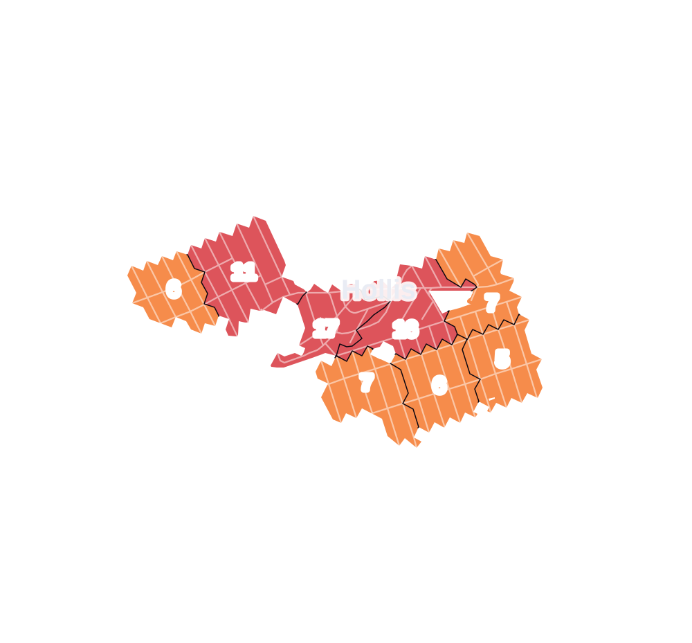
- 5 to 9
- 10 to 19
- 20 to 49
- 50 to 99
- 100 or more
- Not shaded: fewer than 5, held back under the rules in How complaints are counted, parks and public-housing grounds, and land in no patch
- Police precincts
- 103rd (most of the area), 113th
From January to June 2026 the NYPD recorded 117 major felonies at places in Hollis, against 106 in the same months of 2025.
Sources: the NYPD's Complaint Data Historic, updated April 28, 2026, and Complaint Data Current (Year To Date), updated July 27, 2026, on NYC Open Data. Figures to June 30, 2026.
Street corners
- 89th Avenue & 185th Street
- 89th Avenue & 186th Street
- 89th Avenue & 187th Place
- 89th Avenue & 187th Street
- 89th Avenue & 188th Street
- 89th Avenue & 189th Street
- 89th Avenue & 190th Street
- 89th Avenue & 191st Street
- 89th Avenue & 196th Street
- 89th Avenue & 197th Street
- 89th Avenue & 198th Street
- 89th Avenue & 199th Street
- 89th Avenue & 201st Street
- 89th Avenue & 202nd Street
- 89th Avenue & 204th Street
- 89th Avenue & 205th Street
- 90th Avenue & 186th Street
- 90th Avenue & 187th Place
- 90th Avenue & 187th Street
- 90th Avenue & 188th Street
- 90th Avenue & 189th Street
- 90th Avenue & 190th Street
- 90th Avenue & 191st Street
- 90th Avenue & 192nd Street
- 90th Avenue & 193rd Street
- 90th Avenue & 195th Street
- 90th Avenue & 196th Street
- 90th Avenue & 197th Street
- 90th Avenue & 198th Street
- 90th Avenue & 199th Street
- 90th Avenue & 201st Street
- 90th Avenue & 202nd Street
- 90th Avenue & 204th Street
- 90th Avenue & 205th Street
- 91st Avenue & 187th Place
- 91st Avenue & 187th Street
- 91st Avenue & 188th Street
- 91st Avenue & 189th Street
- 91st Avenue & 196th Street
- 91st Avenue & 197th Street
- 93rd Avenue & 199th Street
- 93rd Avenue & 205th Street
- 93rd Avenue & Carpenter Avenue
- 99th Avenue & 205th Place
- 100th Avenue & 205th Place
- 103rd Avenue & Hollis Avenue
- 104th Avenue & 191st Street
- 104th Avenue & 200th Street
- 104th Avenue & 205th Place
- 109th Avenue & 198th Street
- 109th Avenue & 199th Street
- 109th Avenue & 200th Street
- 109th Avenue & 201st Street
- 109th Avenue & 202nd Street
- 109th Avenue & 203rd Street
- 109th Avenue & 204th Street
- 109th Avenue & 205th Place
- 109th Avenue & 205th Street
- 110th Avenue & 198th Street
- 110th Avenue & 205th Street
- 111th Avenue & 196th Street
- 111th Avenue & 197th Street
- 111th Avenue & 198th Street
- 111th Avenue & 199th Street
- 111th Avenue & 200th Street
- 111th Avenue & 203rd Street
- 111th Avenue & 204th Street
- 190th Street & Woodhull Avenue
- 191st Street & 102nd Avenue
- 191st Street & Woodhull Avenue
- 193rd Street & 99th Avenue
- 193rd Street & 100th Avenue
- 193rd Street & 104th Avenue
- 193rd Street & Woodhull Avenue
- 194th Street & 99th Avenue
- 194th Street & 100th Avenue
- 195th Street & 99th Avenue
- 195th Street & 100th Avenue
- 195th Street & 104th Avenue
- 195th Street & 110th Avenue
- 195th Street & Sagamore Avenue
- 195th Street & Woodhull Avenue
- 196th Street & 89th Road
- 196th Street & 99th Avenue
- 196th Street & 100th Avenue
- 196th Street & 104th Avenue
- 196th Street & 110th Avenue
- 196th Street & Hollis Avenue
- 196th Street & Woodhull Avenue
- 197th Street & 89th Road
- 197th Street & 91st Road
- 197th Street & 99th Avenue
- 197th Street & 99th Road
- 197th Street & 100th Avenue
- 197th Street & 104th Avenue
- 197th Street & 110th Avenue
- 197th Street & Carpenter Avenue
- 197th Street & Hiawatha Avenue
- 197th Street & Hollis Avenue
- 198th Street & 89th Road
- 198th Street & 99th Avenue
- 198th Street & 99th Road
- 198th Street & 100th Avenue
- 198th Street & 104th Avenue
- 198th Street & Hollis Avenue
- 199th Street & 99th Avenue
- 199th Street & 100th Avenue
- 199th Street & 104th Avenue
- 199th Street & Hollis Avenue
- 200th Street & 99th Avenue
- 200th Street & 100th Avenue
- 200th Street & Hollis Avenue
- 201st Street & 93rd Avenue
- 201st Street & 99th Avenue
- 201st Street & 100th Avenue
- 201st Street & 104th Avenue
- 201st Street & 111th Avenue
- 201st Street & Hollis Avenue
- 202nd Street & 93rd Avenue
- 202nd Street & 99th Avenue
- 202nd Street & 100th Avenue
- 202nd Street & 104th Avenue
- 202nd Street & 111th Avenue
- 202nd Street & 201st Street
- 202nd Street & Hollis Avenue
- 203rd Street & 99th Avenue
- 203rd Street & 100th Avenue
- 203rd Street & 104th Avenue
- 203rd Street & Hollis Avenue
- 204th Street & 93rd Avenue
- 204th Street & 94th Avenue
- 204th Street & 99th Avenue
- 204th Street & 100th Avenue
- 204th Street & 104th Avenue
- 204th Street & Hollis Avenue
- 205th Street & 94th Avenue
- 205th Street & 99th Avenue
- 205th Street & 100th Avenue
- 205th Street & 104th Avenue
- 205th Street & Hollis Avenue
- Carpenter Avenue & Hiawatha Avenue
- Carpenter Avenue & Sagamore Avenue
- Farmers Boulevard & Hollis Avenue
- Francis Lewis Boulevard & 89th Avenue
- Francis Lewis Boulevard & 104th Avenue
- Francis Lewis Boulevard & 109th Avenue
- Francis Lewis Boulevard & Hollis Avenue
- Hillside Avenue & 186th Street
- Hillside Avenue & 187th Place
- Hillside Avenue & 188th Street
- Hillside Avenue & 190th Street
- Hillside Avenue & 191st Street
- Hillside Avenue & 192nd Street
- Hillside Avenue & 193rd Street
- Hillside Avenue & 195th Place
- Hillside Avenue & 195th Street
- Hillside Avenue & 196th Street
- Hillside Avenue & 197th Street
- Hillside Avenue & 198th Street
- Hillside Avenue & 201st Street
- Hillside Avenue & 205th Street
- Hollis Avenue & 99th Avenue
- Hollis Avenue & 100th Avenue
- Hollis Avenue & 102nd Avenue
- Hollis Avenue & 191st Street
- Hollis Avenue & 205th Place
- Jamaica Avenue & 93rd Avenue
- Jamaica Avenue & 187th Place
- Jamaica Avenue & 188th Street
- Jamaica Avenue & 189th Street
- Jamaica Avenue & 190th Street
- Jamaica Avenue & 191st Street
- Jamaica Avenue & 192nd Street
- Jamaica Avenue & 193rd Street
- Jamaica Avenue & 195th Place
- Jamaica Avenue & 195th Street
- Jamaica Avenue & 196th Street
- Jamaica Avenue & 197th Street
- Jamaica Avenue & 198th Street
- Jamaica Avenue & 201st Street
- Jamaica Avenue & 202nd Street (east)
- Jamaica Avenue & 202nd Street (west)
- Jamaica Avenue & 202nd Street at 199th Street
- Jamaica Avenue & 204th Street
- Jamaica Avenue & 205th Street
- Woodhull Avenue & 195th Place
How the figures above are measured: Methodology.