Jamaica Estates-Holliswood
Neighborhood · Queens
Jamaica Estates-Holliswood spreads across east-central Queens north of Hillside Avenue, from Utopia Parkway east to Francis Lewis Boulevard, on hilly ground shaped by glaciers.
- 1.41 square miles
- 23,576 residents, 2020 Census
- 227 street corners
- 1 subway station
- 24 bus routes
Jamaica Estates began in 1907, when a development company bought 503 acres of moraine for a garden suburb of winding streets and kept many of its trees; Midland Parkway's landscaped malls, with a gatehouse of river stones, came under the Borough President's care in 1917. Holliswood dates to 1884, when Frederick W. Dunton bought 136 acres of farmland, named it for his hometown in New Hampshire and laid out curving roads with Latin and Spanish names such as Palo Alto and Como.
Sources: Jamaica Estates, Queens (Wikipedia); Midland Malls History (NYC Parks); Holliswood, Queens (Wikipedia); Holliswood (Queens Community Board 8).
Jamaica Estates-Holliswood borders seven areas, and Grand Central Parkway holds more of its corners than any other street, 28 of 227.
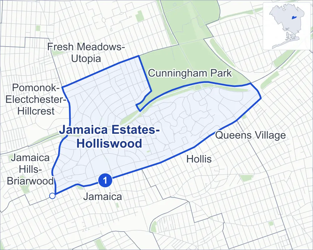
- Jamaica Estates-Holliswood
- A neighboring area
- Park
- A station in the list
- Another station
Neighborhood areas and streets: NYC Department of City Planning. Parks: NYC Parks. Stations: MTA.
Neighboring areas
- Cunningham Park northeast
- Queens Village east
- Hollis southeast
- Jamaica southwest
- Jamaica Hills-Briarwood southwest
- Pomonok-Electchester-Hillcrest west
- Fresh Meadows-Utopia northwest
Subway stations
- Jamaica-179 St lines F accessible
Getting around
One subway station and buses on 24 routes stop in or at the edge of Jamaica Estates-Holliswood.
- 1 subway station
- 1 listed by the MTA as fully accessible
- 15 local bus routes
- 9 express bus routes
Local bus routes
- Q1
- Q2
- Q3
- Q17
- Q30
- Q31
- Q36
- Q43
- Q45
- Q46
- Q48
- Q75
- Q76
- Q77
- Q82
Express bus routes
- QM1
- QM5
- QM6
- QM7
- QM8
- QM31
- QM35
- QM36
- QM68
Safety record
Between 2021 and 2025, its corners averaged fewer police-reported crashes than the average Queens corner.
- 990 police-reported crashes at its corners
- 4.4 a corner, on average
- 5.2 the average Queens corner
- 76 corners with a clean record
Signal or safety changes on City record, at 26 of its corners
- Accessible pedestrian signals
- 15
- Leading pedestrian intervals
- 14
- Turn calming
- 8
- Barnes Dance all-way crossings
- 4
- Safety Improvement Projects
- 2
Camera tickets
In 2025 its corners had more school-zone speed camera tickets than red-light or bus-lane tickets.
- 1,421 red-light camera tickets at one corner
- 38,827 school-zone speed camera tickets at 14 corners
- 0 bus-lane camera tickets
- Most red-light tickets
- Francis Lewis Boulevard & Hillside Avenue, 1,421
- Most speed tickets
- Francis Lewis Boulevard & Whitehall Terrace, 13,585
People and homes
The 2020 Census counted 23,576 residents in Jamaica Estates-Holliswood, about 16,700 per square mile.
- 9,000 homes, 2020 Census
- 469 homes added since April 2010, net, by City Planning's count
Half of its 3,209 residential lots hold buildings from 1940 or earlier, and 33% of them date from before 1940, by the City's tax lot records.
Parks
- Parkland
- 0.3 acre of McLaughlin Playground, as NYC Parks maps it within Jamaica Estates-Holliswood
Streets and trees
- Trees
- 4,205 in NYC Parks' records, most often pin oak, London planetree and Norway maple
- Street with the most corners
- Grand Central Parkway, with 28 of the area's 227
- Height above sea level
- From 57 feet at Union Turnpike & 179th Street to 183 feet at Dunton Street & Romeo Court
- Honorary street names
- 3 at its corners, enacted by local law
Schools and libraries
The City lists eight schools and one library in Jamaica Estates-Holliswood.
- Public schools
- 2
- Charter and private schools
- 6
- Library
- Hollis Library
Public art
The City's public art inventory lists one work in Jamaica Estates-Holliswood: Jamaica Estates (1950).
- 1 work of public art
Public safety
How complaints are countedIn 2025 the NYPD recorded 230 major felonies at places in Jamaica Estates-Holliswood.
Recorded by the NYPD at places in Jamaica Estates-Holliswood
- 194 major felonies in 2024
- 404 other felonies, misdemeanors and violations in 2025
In 2025, on the streets along the edge of Jamaica Estates-Holliswood, the NYPD recorded another 99 major felonies. Counting the streets along its edge, in 2025 the NYPD recorded 14.0 major felonies for every thousand residents the 2020 Census counted in Jamaica Estates-Holliswood.
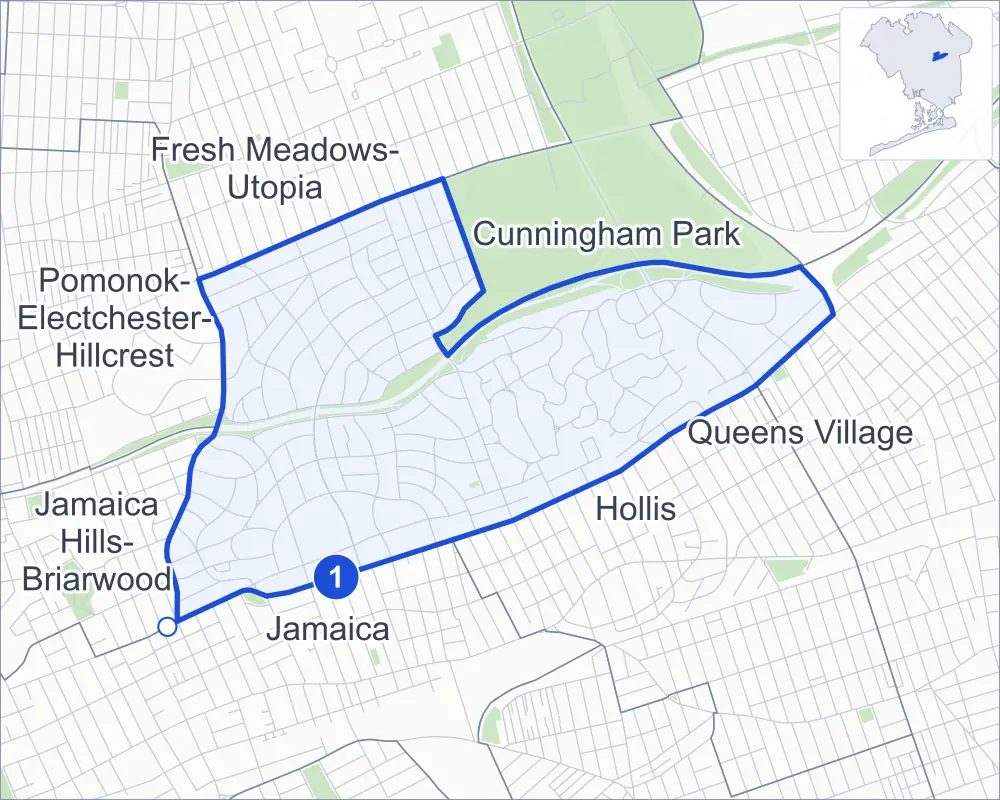
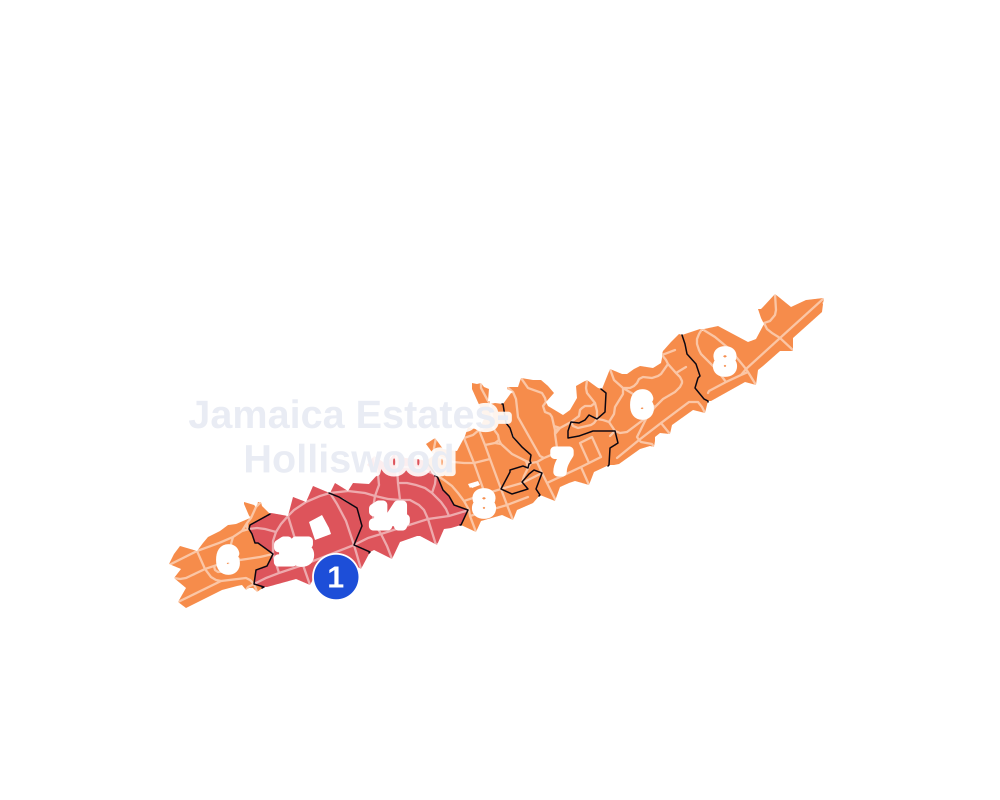
- 5 to 9
- 10 to 19
- 20 to 49
- 50 to 99
- 100 or more
- Not shaded: fewer than 5, held back under the rules in How complaints are counted, parks and public-housing grounds, and land in no patch
- Police precinct
- 107th
From January to June 2026 the NYPD recorded 82 major felonies at places in Jamaica Estates-Holliswood, against 108 in the same months of 2025.
Sources: the NYPD's Complaint Data Historic, updated April 28, 2026, and Complaint Data Current (Year To Date), updated July 27, 2026, on NYC Open Data. Figures to June 30, 2026.
Street corners
- 80th Drive & Dumfries Place
- 80th Drive & Haddon Street
- 80th Drive & Kent Street
- 80th Drive & Surrey Place
- 80th Drive & Tryon Place
- 80th Road & Chevy Chase Street
- 80th Road & Kent Street
- 80th Road & Surrey Place
- 83rd Avenue & Homelawn Street
- 85th Road & Grand Central Parkway
- 85th Road & McLaughlin Avenue
- 87th Road & Chelsea Street
- 87th Road & Chevy Chase Street
- 87th Road & Dunton Avenue
- 173rd Street & Homelawn Street
- 184th Street & Wexford Terrace
- 188th Street & 80th Drive
- 188th Street & 80th Road
- 188th Street & 81st Avenue
- 188th Street & 87th Road
- 188th Street & Aberdeen Road
- 188th Street & Avon Road
- 188th Street & Cambridge Road
- 188th Street & Grand Central Parkway (Exit 19)
- 188th Street & Grand Central Parkway (north-west)
- 188th Street & Grand Central Parkway (south-east)
- 188th Street & Henley Road
- 188th Street & Midland Parkway
- 188th Street & Perth Road
- 188th Street & Radnor Road
- 188th Street & Rio Drive
- 188th Street & Troon Road
- 188th Street & Wexford Terrace
- 188th Street & Wicklow Place
- 189th Street & 81st Avenue
- 189th Street & Aberdeen Road
- 189th Street & Radnor Road
- 190th Street & 81st Avenue
- 190th Street & Aberdeen Road
- 190th Street & Radnor Road
- 191st Street & Foothill Avenue
- 191st Street & Haywood Road
- 191st Street & Palo Alto Avenue
- 192nd Street & 81st Avenue
- 192nd Street & Aberdeen Road
- 192nd Street & Radnor Road
- 193rd Street & 81st Avenue
- 193rd Street & 85th Road
- 193rd Street & Aberdeen Road
- 193rd Street & Foothill Avenue
- 193rd Street & McLaughlin Avenue
- 193rd Street & Radnor Road
- 197th Street & Dunton Avenue
- 197th Street & Foothill Avenue
- 198th Street & Foothill Avenue
- 204th Street & Foothill Avenue
- 208th Street & 86th Road
- 208th Street & 209th Street
- 209th Street & Whitehall Terrace
- Aberdeen Road & Haddon Street
- Aberdeen Road & Kent Street
- Aberdeen Road & Surrey Place
- Aberdeen Road & Tryon Place
- Avon Road & Kent Street
- Avon Street & Kruger Road
- Cambridge Road & Barrington Street
- Cambridge Road & Somerset Street
- Chelsea Street & Barrington Street
- Chelsea Street & Somerset Street
- Chevy Chase Street & 80th Drive
- Chevy Chase Street & Aberdeen Road
- Chevy Chase Street & Avon Road
- Chevy Chase Street & Cambridge Road
- Chevy Chase Street & Hovenden Road
- Chevy Chase Street & Radnor Road
- Chevy Chase Street & Tudor Road
- Croydon Road & Charlecote Ridge
- Croydon Road & Mayfield Road
- Croydon Road & Wareham Place
- Dalny Road & Avon Street
- Dalny Road & Devonshire Road
- Dalny Road & Radnor Street
- Dalny Road & Somerset Street
- Dalny Road & Wareham Place
- Dunton Avenue & Clio Street
- Dunton Avenue & Dunton Street
- Dunton Avenue & Marengo Street
- Dunton Avenue & Pompeii Avenue
- Dunton Avenue & Salerno Avenue
- Dunton Street & Pompeii Avenue
- Dunton Street & Pompeii Road
- Dunton Street & Romeo Court
- Edgerton Boulevard & Croydon Road
- Edgerton Boulevard & Dalny Road
- Edgerton Road & Doncaster Place
- Epsom Course & Dunton Street
- Epsom Course & Romeo Court
- Epsom Course & Sutro Street
- Eton Street & Barrington Street
- Foothill Avenue & Clover Hill Road
- Francis Lewis Boulevard & Epsom Course
- Francis Lewis Boulevard & Hillside Avenue
- Francis Lewis Boulevard & Whitehall Terrace
- Grand Central Parkway & 86th Drive
- Grand Central Parkway & 188th Street
- Grand Central Parkway & 188th Street at McLaughlin Avenue
- Grand Central Parkway & 208th Street
- Grand Central Parkway & Aberdeen Road
- Grand Central Parkway & Avon Road
- Grand Central Parkway & Avon Street
- Grand Central Parkway & Chevy Chase Street (north-west)
- Grand Central Parkway & Chevy Chase Street (south-east)
- Grand Central Parkway & Doncaster Place
- Grand Central Parkway & Edgerton Boulevard
- Grand Central Parkway & Edgerton Road
- Grand Central Parkway & Epsom Course (east)
- Grand Central Parkway & Epsom Course (west)
- Grand Central Parkway & Francis Lewis Boulevard
- Grand Central Parkway & Francis Lewis Boulevard at McLaughlin Avenue
- Grand Central Parkway & Kent Street
- Grand Central Parkway & Radnor Road
- Grand Central Parkway & Radnor Street
- Grand Central Parkway & Somerset Street
- Grand Central Parkway & Tudor Road
- Grand Central Parkway & Wicklow Place
- Haddon Street & Perth Road
- Haddon Street & Troon Road
- Henley Road & Ava Place
- Henley Road & Avon Street
- Henley Road & Barrington Street
- Henley Road & Charlecote Ridge
- Henley Road & Chevy Chase Street
- Henley Road & Devonshire Road
- Henley Road & Edgerton Boulevard
- Henley Road & Homelawn Street
- Henley Road & Kendrick Place
- Henley Road & Kingston Place
- Henley Road & Midland Parkway
- Henley Road & Radnor Street
- Henley Road & Somerset Street
- Henley Road & Wareham Place
- Highland Avenue & Ava Place
- Highland Avenue & Dalny Road
- Highland Avenue & Kingston Place
- Hillside Avenue & 170th Street
- Hillside Avenue & 171st Street
- Hillside Avenue & 173rd Street
- Hillside Avenue & 175th Street
- Hillside Avenue & 178th Street
- Hillside Avenue & 179th Street
- Hillside Avenue & 180th Street
- Hillside Avenue & 181st Street
- Hillside Avenue & 182nd Place
- Hillside Avenue & 182nd Street
- Hillside Avenue & 184th Street
- Hillside Avenue & 185th Street
- Hillside Avenue & 187th Street
- Hillside Avenue & 189th Street
- Hillside Avenue & 199th Street
- Hillside Avenue & 202nd Street
- Hillside Avenue & 204th Street
- Hillside Avenue & 209th Street
- Hillside Avenue & 210th Street
- Hillside Avenue & 211th Street
- Hillside Avenue & Chelsea Street
- Hillside Avenue & Midland Parkway
- Hillside Avenue & Wexford Terrace at Kingston Place
- Homelawn Street & Charlecote Ridge
- Homelawn Street & Kendrick Place
- Keno Avenue & Clio Street
- Keno Avenue & Como Avenue
- Keno Avenue & Dunton Street
- Keno Avenue & Marengo Street
- Keno Avenue & Marengo Street at Pinto Street
- Keno Avenue & Palermo Street
- Keno Avenue & Sancho Street
- Kildare Road & Dumfries Place
- Kildare Road & Tryon Place
- Kingston Place & Cedarcroft Road
- Marengo Street & Pompeii Avenue
- Mayfield Road & Aspen Place
- Mayfield Road & Kendrick Place
- McLaughlin Avenue & Epsom Course
- McLaughlin Avenue & Grand Central Parkway
- McLaughlin Avenue & Grand Central Parkway at Sutro Street
- McLaughlin Avenue & Marengo Street
- McLaughlin Avenue & Palermo Street
- McLaughlin Avenue & Palo Alto Street
- McLaughlin Avenue & Pinto Street
- McLaughlin Avenue & Santiago Street
- Midland Parkway & Chevy Chase Street
- Midland Parkway & Croydon Road
- Midland Parkway & Dalny Road
- Midland Parkway & Kent Street
- Midland Parkway & Surrey Place
- Nero Avenue & Sancho Street
- Palermo Street & Nero Avenue
- Palo Alto Avenue & Haywood Road
- Palo Alto Street & Nero Avenue
- Palo Alto Street & Palo Alto Avenue
- Pinto Street & Como Avenue
- Radnor Road & Kent Street
- Radnor Street & Kruger Road
- Salerno Avenue & Clio Street
- Santiago Street & Nero Avenue
- Santiago Street & Palo Alto Avenue
- Santiago Street & Rio Drive
- Santiago Street & Soho Drive
- Somerset Street & Eton Street
- Somerset Street & Hovenden Road
- Surrey Place & Kildare Road
- Tudor Road & Edgerton Road
- Tudor Road & Kent Street
- Tudor Road & Surrey Place
- Tudor Road & Tryon Place
- Union Turnpike & 179th Street
- Union Turnpike & 184th Street
- Union Turnpike & 188th Street
- Union Turnpike & 193rd Street
- Utopia Parkway & 80th Drive
- Utopia Parkway & University Road
- Wexford Terrace & Avon Street
- Wexford Terrace & Chelsea Street
- Wexford Terrace & Dalny Road
- Wexford Terrace & Edgerton Boulevard
- Wexford Terrace & Eton Street
- Wexford Terrace & Midland Parkway
How the figures above are measured: Methodology.