Howard Beach-Lindenwood
Neighborhood · Queens
On Jamaica Bay, Howard Beach-Lindenwood lies between the Brooklyn border and Kennedy Airport, south of Ozone Park.
- 1.89 square miles
- 27,320 residents, 2020 Census
- 317 street corners
- 1 subway station
- 10 bus routes
Brooklyn glove maker William J. Howard started a goat farm on the meadows here in 1897 to supply kid-glove leather, a beach and fishing pier followed in 1915, and the community became Howard Beach in 1916. Its sections include Old Howard Beach, where Howard built his hotel, and waterside Hamilton Beach and Ramblersville, while Lindenwood rose on landfill in the 1950s and 1960s with garden apartments and brick apartment buildings. The Howard Beach station links the A train with AirTrain JFK.
Sources: Howard Beach (Wikipedia); Queens Community Board 10; AirTrain JFK - JFK Airport (Port Authority of New York and New Jersey).
Howard Beach-Lindenwood borders five areas, and 157th Avenue holds more of its corners than any other street, 29 of 320.
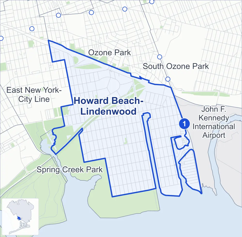
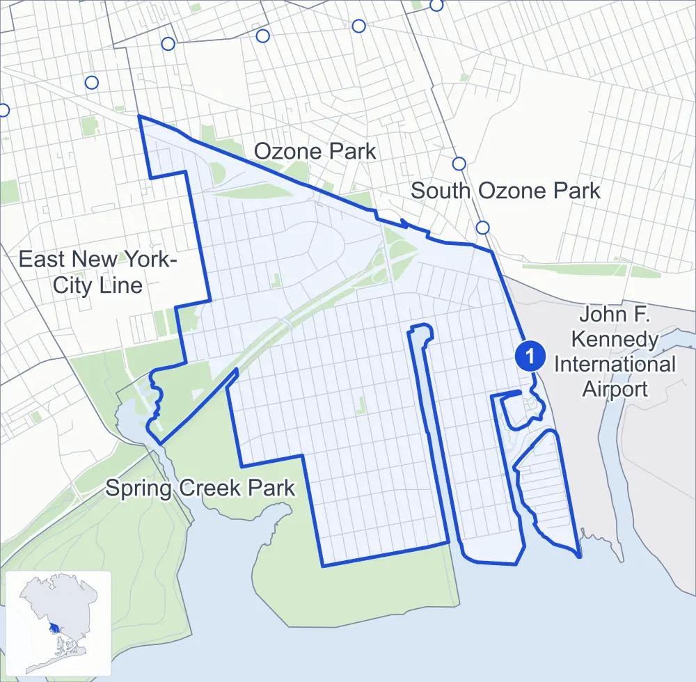
- Howard Beach-Lindenwood
- A neighboring area
- Park
- A station in the list
- Another station
Neighborhood areas and streets: NYC Department of City Planning. Parks: NYC Parks. Stations: MTA.
Neighboring areas
- Ozone Park north
- South Ozone Park northeast
- John F. Kennedy International Airport east
- Spring Creek Park southwest
- East New York-City Line northwest
Subway stations
- Howard Beach-JFK Airport lines A accessible
Getting around
One subway station and buses on ten routes stop in or at the edge of Howard Beach-Lindenwood.
- 1 subway station
- 1 listed by the MTA as fully accessible
- 6 local bus routes
- 4 express bus routes
Local bus routes
- B15
- Q7
- Q11
- Q41
- Q52-SBS
- Q53-SBS
Express bus routes
- BM5
- QM15
- QM16
- QM17
Safety record
Between 2021 and 2025, its corners averaged fewer police-reported crashes than the average Queens corner.
- 1,067 police-reported crashes at its corners
- 3.3 a corner, on average
- 5.2 the average Queens corner
- 129 corners with a clean record
Signal or safety changes on City record, at seven of its corners
- Accessible pedestrian signals
- 4
- Leading pedestrian intervals
- 3
- Turn calming
- 1
- Safety Improvement Projects
- 1
Camera tickets
In 2025 its corners had more school-zone speed camera tickets than red-light or bus-lane tickets.
- 5,282 red-light camera tickets at two corners
- 151,314 school-zone speed camera tickets at 13 corners
- 0 bus-lane camera tickets
- Most red-light tickets
- Nassau Expressway & South Conduit Avenue at 89th Street, 3,947
- Most speed tickets
- North Conduit Avenue & 88th Street, 101,974
People and homes
The 2020 Census counted 27,320 residents in Howard Beach-Lindenwood, about 14,500 per square mile.
- 11,372 homes, 2020 Census
- 132 homes added since April 2010, net, by City Planning's count
Half of its 5,176 residential lots hold buildings from 1960 or earlier, and 18% of them date from before 1940, by the City's tax lot records.
Parks
- Parkland
- 52.7 acres of NYC Parks property
- The largest pieces
- Spring Creek Park Addition (40.1 acres), Gemini Fields (10.8 acres) and Harold Schneiderman Playground (0.9 acre)
Streets and trees
- Trees
- 5,525 in NYC Parks' records, most often London planetree, Callery pear and pin oak
- Street with the most corners
- 157th Avenue, with 29 of the area's 320
- Height above sea level
- From 3 feet at Broadway & Bayview Avenue to 27 feet at Cross Bay Boulevard & South Conduit Avenue
- Honorary street names
- 8 at its corners, enacted by local law
Schools and libraries
The City lists eight schools and one library in Howard Beach-Lindenwood.
- Public schools
- 5
- Charter and private schools
- 3
- Library
- Howard Beach Library
Public safety
How complaints are countedIn 2025 the NYPD recorded 316 major felonies at places in Howard Beach-Lindenwood.
Recorded by the NYPD at places in Howard Beach-Lindenwood
- 276 major felonies in 2024
- 780 other felonies, misdemeanors and violations in 2025
In 2025, on the streets along the edge of Howard Beach-Lindenwood, the NYPD recorded another 17 major felonies. Counting the streets along its edge, in 2025 the NYPD recorded 12.2 major felonies for every thousand residents the 2020 Census counted in Howard Beach-Lindenwood.
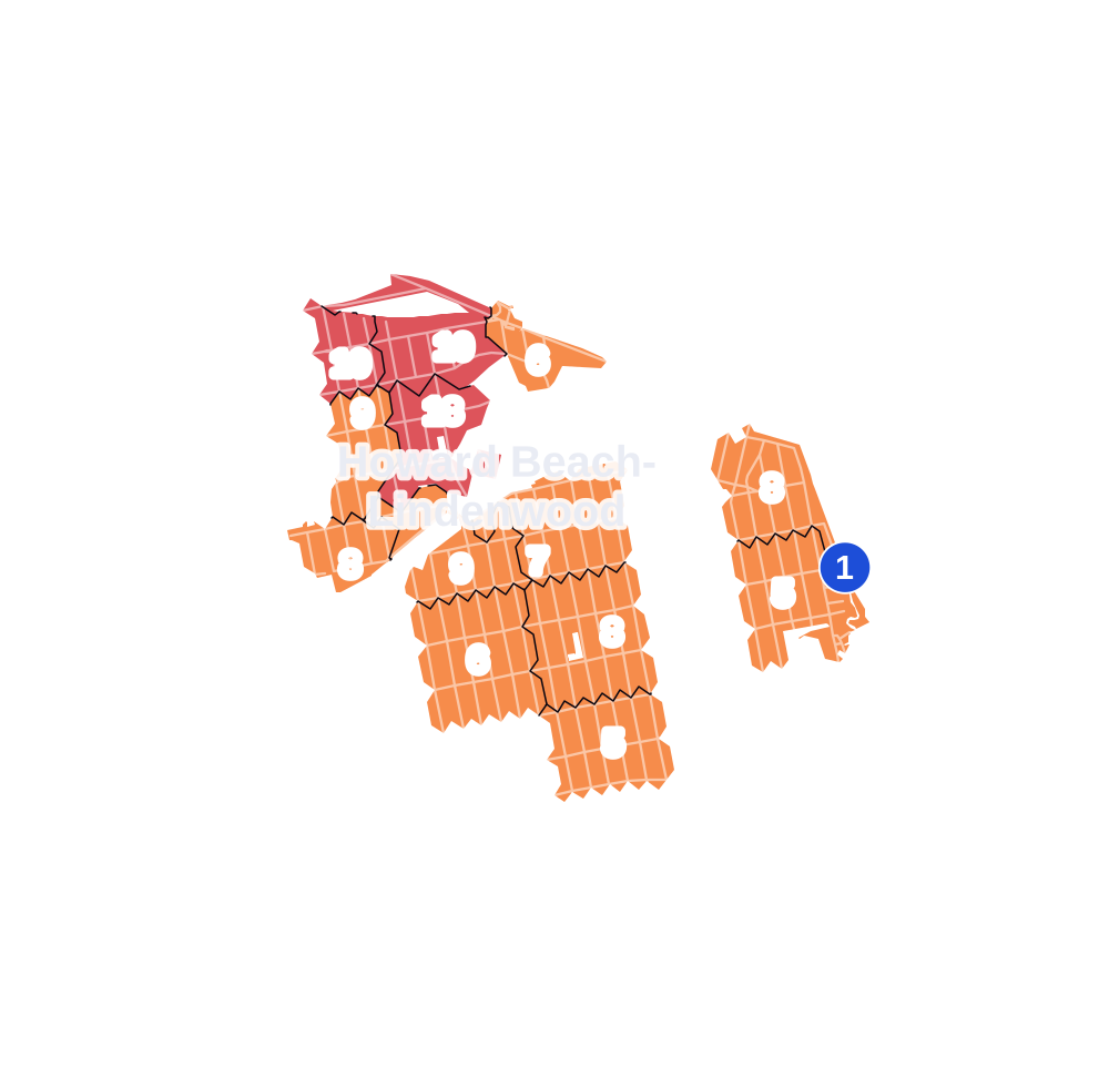
- 5 to 9
- 10 to 19
- 20 to 49
- 50 to 99
- 100 or more
- Not shaded: fewer than 5, held back under the rules in How complaints are counted, parks and public-housing grounds, and land in no patch
- Police precincts
- 106th (most of the area), 75th
From January to June 2026 the NYPD recorded 142 major felonies at places in Howard Beach-Lindenwood, against 126 in the same months of 2025.
Sources: the NYPD's Complaint Data Historic, updated April 28, 2026, and Complaint Data Current (Year To Date), updated July 27, 2026, on NYC Open Data. Figures to June 30, 2026.
Street corners
- 1st Street & Rau Court
- 76th Street & 156th Avenue
- 76th Street & 157th Avenue
- 76th Street & Blake Avenue
- 77th Street & 156th Avenue
- 77th Street & 157th Avenue
- 78th Street & 153rd Avenue
- 78th Street & 155th Avenue
- 78th Street & 155th Avenue at Cozine Avenue
- 78th Street & 156th Avenue
- 78th Street & 157th Avenue
- 78th Street & 159th Avenue
- 78th Street & 160th Avenue
- 78th Street & 161st Avenue
- 79th Street & 149th Avenue
- 79th Street & 151st Avenue
- 79th Street & 153rd Avenue
- 79th Street & 155th Avenue
- 79th Street & 156th Avenue
- 79th Street & 157th Avenue
- 79th Street & 158th Avenue
- 79th Street & 159th Avenue
- 79th Street & 160th Avenue
- 79th Street & 161st Avenue
- 79th Street & South Conduit Avenue
- 80th Street & 149th Avenue
- 80th Street & 151st Avenue
- 80th Street & 153rd Avenue
- 80th Street & 155th Avenue
- 80th Street & 156th Avenue
- 80th Street & 157th Avenue
- 80th Street & 157th Avenue at Shore Parkway
- 80th Street & 158th Avenue
- 80th Street & 159th Avenue
- 80th Street & 160th Avenue
- 80th Street & 161st Avenue
- 81st Street & 149th Avenue
- 81st Street & 151st Avenue
- 81st Street & 153rd Avenue
- 81st Street & 155th Avenue
- 81st Street & 156th Avenue
- 81st Street & 157th Avenue
- 81st Street & 158th Avenue
- 81st Street & 159th Avenue
- 81st Street & 160th Avenue
- 81st Street & 161st Avenue
- 82nd Street & 149th Avenue
- 82nd Street & 151st Avenue
- 82nd Street & 153rd Avenue
- 82nd Street & 155th Avenue
- 82nd Street & 157th Avenue
- 82nd Street & 158th Avenue
- 82nd Street & 159th Avenue
- 82nd Street & 160th Avenue
- 82nd Street & 161st Avenue
- 83rd Street & 149th Avenue
- 83rd Street & 151st Avenue
- 83rd Street & 153rd Avenue
- 83rd Street & 155th Avenue
- 83rd Street & 157th Avenue
- 83rd Street & 158th Avenue
- 83rd Street & 159th Avenue
- 83rd Street & 160th Avenue
- 83rd Street & 161st Avenue
- 83rd Street & 162nd Avenue
- 83rd Street & 163rd Avenue
- 83rd Street & 164th Avenue
- 84th Street & 149th Avenue
- 84th Street & 151st Avenue
- 84th Street & 153rd Avenue
- 84th Street & 155th Avenue
- 84th Street & 157th Avenue
- 84th Street & 158th Avenue
- 84th Street & 159th Avenue
- 84th Street & 160th Avenue
- 84th Street & 161st Avenue
- 84th Street & 162nd Avenue
- 84th Street & 163rd Avenue
- 84th Street & 164th Avenue
- 84th Street & 165th Avenue
- 84th Street & Shore Parkway
- 85th Street & 149th Avenue
- 85th Street & 151st Avenue
- 85th Street & 157th Avenue
- 85th Street & 158th Avenue
- 85th Street & 159th Avenue
- 85th Street & 160th Avenue
- 85th Street & 161st Avenue
- 85th Street & 162nd Avenue
- 85th Street & 163rd Avenue
- 85th Street & 164th Avenue
- 85th Street & 165th Avenue
- 86th Street & 155th Avenue
- 86th Street & 156th Avenue
- 86th Street & 157th Avenue
- 86th Street & 158th Avenue
- 86th Street & 159th Avenue
- 86th Street & 160th Avenue
- 86th Street & 161st Avenue
- 86th Street & 162nd Avenue
- 86th Street & 163rd Avenue
- 86th Street & 164th Avenue
- 86th Street & 165th Avenue
- 86th Street & Shore Parkway
- 87th Street & 156th Avenue
- 87th Street & 157th Avenue
- 87th Street & 158th Avenue
- 87th Street & 159th Avenue
- 87th Street & 160th Avenue
- 87th Street & 161st Avenue
- 87th Street & 162nd Avenue
- 87th Street & 163rd Avenue
- 87th Street & 164th Avenue
- 87th Street & 165th Avenue
- 88th Street & 151st Avenue
- 88th Street & 153rd Avenue
- 88th Street & 155th Avenue
- 88th Street & 156th Avenue
- 88th Street & 157th Avenue
- 88th Street & 158th Avenue
- 88th Street & 159th Avenue
- 88th Street & 160th Avenue
- 88th Street & 161st Avenue
- 88th Street & 162nd Avenue
- 88th Street & 163rd Avenue
- 88th Street & 164th Avenue
- 88th Street & 165th Avenue
- 89th Street & 151st Avenue
- 89th Street & 155th Avenue
- 89th Street & 156th Avenue
- 89th Street & 157th Avenue
- 89th Street & 158th Avenue
- 89th Street & 159th Avenue
- 89th Street & 160th Avenue
- 89th Street & 161st Avenue
- 89th Street & 162nd Avenue
- 89th Street & 163rd Avenue
- 89th Street & 164th Avenue
- 89th Street & 165th Avenue
- 89th Street & Shore Parkway
- 90th Street & 156th Avenue
- 90th Street & 157th Avenue
- 90th Street & 158th Avenue
- 90th Street & 159th Avenue
- 90th Street & 160th Avenue
- 90th Street & 161st Avenue
- 90th Street & 162nd Avenue
- 90th Street & 163rd Avenue
- 90th Street & 164th Avenue
- 90th Street & 165th Avenue
- 91st Street & 156th Avenue
- 91st Street & 157th Avenue
- 91st Street & 158th Avenue
- 91st Street & 159th Avenue
- 91st Street & 160th Avenue
- 91st Street & 161st Avenue
- 91st Street & 162nd Avenue
- 91st Street & 163rd Avenue
- 91st Street & 164th Avenue
- 91st Street & 165th Avenue
- 92nd Street & 156th Avenue
- 92nd Street & 157th Avenue
- 92nd Street & 158th Avenue
- 92nd Street & 159th Avenue
- 92nd Street & 160th Avenue
- 92nd Street & 161st Avenue
- 92nd Street & 162nd Avenue
- 92nd Street & 163rd Avenue
- 92nd Street & 164th Avenue
- 92nd Street & 165th Avenue
- 94th Street & 157th Avenue
- 95th Street & 156th Avenue
- 95th Street & 157th Avenue
- 95th Street & 158th Avenue
- 95th Street & 159th Avenue
- 95th Street & 160th Avenue
- 95th Street & 161st Avenue
- 95th Street & 162nd Avenue
- 95th Street & 163rd Avenue
- 95th Street & 164th Avenue
- 95th Street & 165th Avenue
- 96th Street & 156th Avenue
- 96th Street & 157th Avenue
- 96th Street & 158th Avenue
- 96th Street & 159th Avenue
- 96th Street & 160th Avenue
- 96th Street & 161st Avenue
- 96th Street & 162nd Avenue
- 96th Street & 163rd Avenue
- 96th Street & 164th Avenue
- 96th Street & 165th Avenue
- 97th Street & 157th Avenue
- 97th Street & 158th Avenue
- 97th Street & 159th Avenue
- 97th Street & 160th Avenue
- 97th Street & 161st Avenue
- 97th Street & 162nd Avenue
- 97th Street & 163rd Avenue
- 97th Street & 164th Avenue
- 97th Street & 165th Avenue
- 98th Street & 157th Avenue
- 98th Street & 158th Avenue
- 98th Street & 159th Avenue
- 98th Street & 160th Avenue
- 98th Street & 161st Avenue
- 98th Street & 162nd Avenue
- 98th Street & 163rd Avenue
- 98th Street & 164th Avenue
- 98th Street & 165th Avenue
- 99th Street & 100th Street
- 99th Street & 155th Avenue
- 99th Street & 156th Avenue
- 99th Street & 157th Avenue
- 99th Street & 158th Avenue
- 99th Street & 159th Avenue
- 99th Street & 160th Avenue
- 99th Street & 161st Avenue
- 99th Street & 162nd Avenue
- 99th Street & 163rd Avenue
- 99th Street & 163rd Avenue at Joel A Miele Sr Pedestrian Bridge
- 99th Street & 164th Avenue
- 99th Street & 165th Avenue
- 100th Street & 157th Avenue
- 100th Street & 158th Avenue
- 100th Street & 159th Avenue
- 100th Street & 160th Avenue
- 101st Street & 155th Avenue
- 101st Street & 157th Avenue
- 101st Street & 158th Avenue
- 101st Street & 159th Avenue
- 101st Street & 160th Avenue
- 102nd Street & 1st Street
- 102nd Street & 157th Avenue
- 102nd Street & 158th Avenue
- 102nd Street & 159th Avenue
- 102nd Street & 159th Drive
- 102nd Street & 159th Road
- 102nd Street & 160th Avenue
- 102nd Street & Arcade Place
- 102nd Street & Bridge Street
- 102nd Street & Broadway
- 102nd Street & Russell Street
- 103rd Street & 159th Avenue
- 104th Street & 1st Street
- 104th Street & 163rd Drive
- 104th Street & 163rd Road
- 104th Street & 164th Avenue
- 104th Street & 164th Drive
- 104th Street & 164th Road
- 104th Street & 165th Avenue
- 104th Street & Davenport Court
- 104th Street & Dunton Court
- 104th Street & Rau Court
- 104th Street & Williams Court
- 155th Avenue & 151st Avenue
- 155th Avenue & Belt Parkway (north-east)
- 155th Avenue & Belt Parkway (south-west)
- 155th Avenue & Bridgeton Street
- 155th Avenue & Cohancy Street
- 155th Avenue & Huron Street
- 155th Avenue & Killarney Street
- 155th Avenue & Lahn Street
- 156th Avenue & Bridgeton Street
- 156th Avenue & Cohancy Street
- 156th Avenue & Huron Street
- 156th Avenue & Killarney Street
- 156th Avenue & Lahn Street
- 156th Avenue & Shore Parkway
- 157th Avenue & 156th Avenue
- Belt Parkway & 84th Street
- Belt Parkway & Cohancy Street
- Belt Parkway & Cross Bay Boulevard
- Belt Parkway & Fountain Avenue
- Belt Parkway & Nassau Expressway
- Broadway & Bayview Avenue
- Broadway & Bridge Street
- Broadway & Church Street
- Coleman Square & 159th Road
- Cross Bay Boulevard & 156th Avenue
- Cross Bay Boulevard & 157th Avenue
- Cross Bay Boulevard & 158th Avenue
- Cross Bay Boulevard & 159th Avenue
- Cross Bay Boulevard & 160th Avenue
- Cross Bay Boulevard & 161st Avenue
- Cross Bay Boulevard & 162nd Avenue
- Cross Bay Boulevard & 163rd Avenue
- Cross Bay Boulevard & 164th Avenue
- Cross Bay Boulevard & 165th Avenue
- Cross Bay Boulevard & Nassau Expressway
- Cross Bay Boulevard & Shore Parkway
- Cross Bay Boulevard & Shore Parkway at Belt Parkway
- Cross Bay Boulevard & South Conduit Avenue
- Davenport Court & Joel A Miele Sr Pedestrian Bridge
- Linden Boulevard & 79th Street
- Linden Boulevard & South Conduit Avenue (east)
- Linden Boulevard & South Conduit Avenue (west)
- Nassau Expressway & Belt Parkway
- Nassau Expressway & Cross Bay Boulevard
- Nassau Expressway & South Conduit Avenue at 89th Street
- North Conduit Avenue & 78th Street
- North Conduit Avenue & 79th Street
- North Conduit Avenue & 80th Street
- North Conduit Avenue & 83rd Street
- North Conduit Avenue & 88th Street
- North Conduit Avenue & 149th Avenue
- North Conduit Avenue & Belt Parkway
- North Conduit Avenue & Centreville Street
- North Conduit Avenue & Linden Boulevard
- North Conduit Avenue & North Conduit Avenue Connector
- Rau Court & Joel A Miele Sr Pedestrian Bridge
- Shore Parkway & Belt Parkway
- Shore Parkway & Belt Parkway (Exit 17)
- South Conduit Avenue & 88th Street
- South Conduit Avenue & 90th Street
- South Conduit Avenue & 149th Avenue
- South Conduit Avenue & 149th Avenue at North Conduit Avenue Connector
- South Conduit Avenue & Whitelaw Street Pedestrian Overpass
How the figures above are measured: Methodology.