East New York-City Line
Neighborhood · Brooklyn
Along the Queens border at the eastern edge of East New York lies City Line, bordered by Cypress Hills and by Ozone Park in Queens.
- 1.13 square miles
- 45,559 residents, 2020 Census
- 184 street corners
- 2 subway stations
- 12 bus routes
The name recalls its position in the old City of Brooklyn beside the Queens County line, before Brooklyn and part of Queens County merged into New York City in 1898. City Line Park, on Atlantic Avenue between Fountain and North Conduit Avenues, fills the former site of the Ridgewood Pumping Station, which sent reservoir water to most of fast-growing Brooklyn, on land the City of Brooklyn bought in 1886. Liberty Avenue serves as the neighborhood's main shopping street.
Sources: East New York, Brooklyn (Wikipedia); City Line Park History (NYC Parks); City Line Park (NYC Parks).
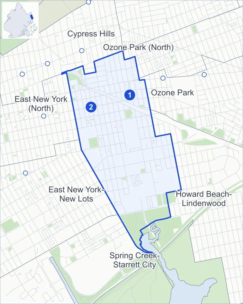
East New York-City Line borders seven areas, and Conduit Boulevard holds more of its corners than any other street, 21 of 186.
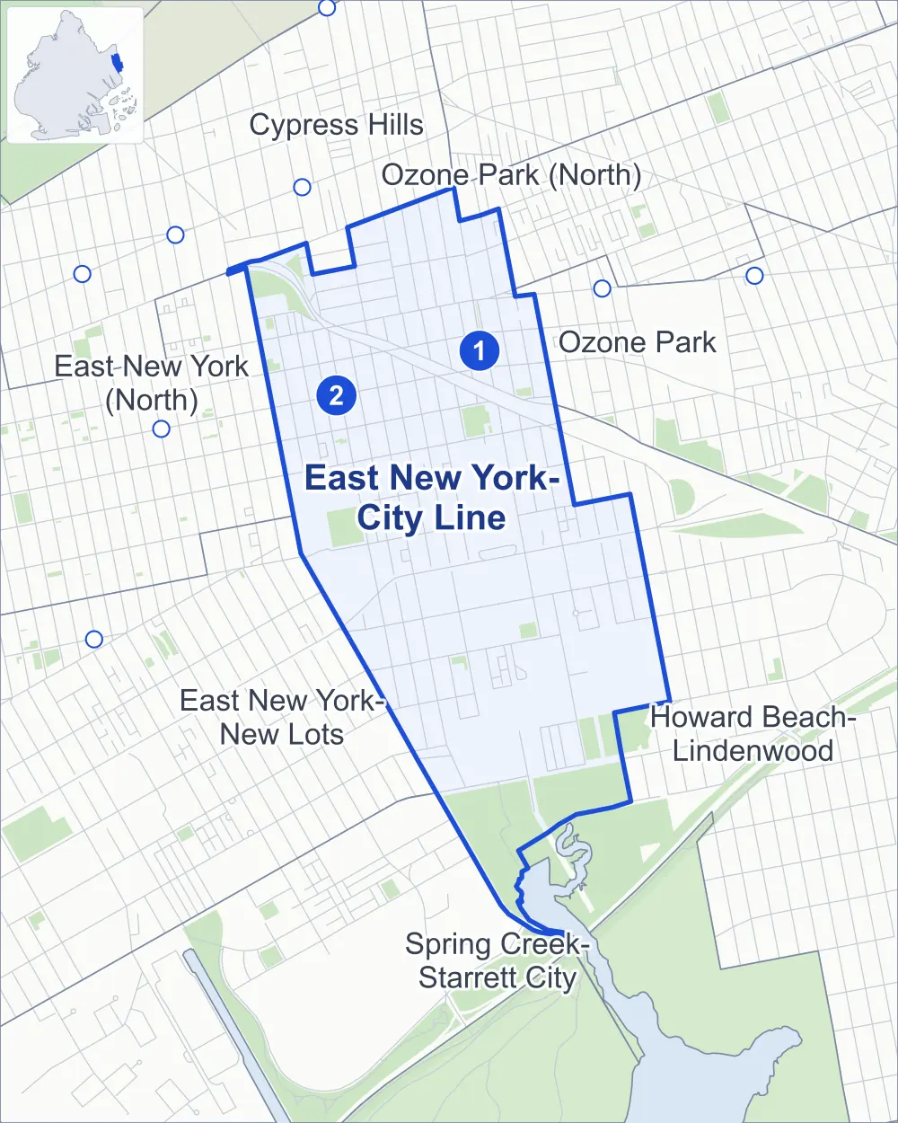
- East New York-City Line
- A neighboring area
- Park
- A station in the list
- Another station
Neighborhood areas and streets: NYC Department of City Planning. Parks: NYC Parks. Stations: MTA.
Neighboring areas
- Ozone Park (North) north
- Ozone Park northeast
- Howard Beach-Lindenwood southeast
- Spring Creek-Starrett City south
- East New York-New Lots southwest
- Cypress Hills northwest
- East New York (North) northwest
Subway stations
- Grant Av lines A
- Euclid Av lines A C accessible
Getting around
Two subway stations and buses on 12 routes stop in or at the edge of East New York-City Line.
- 2 subway stations
- 1 of them listed by the MTA as fully accessible
- 11 local bus routes
- 1 express bus route
Local bus routes
- B13
- B14
- B15
- B20
- B84
- Q8
- Q24
- Q112
- T340
- T430
- T434
Express bus route
- BM5
Safety record
Between 2021 and 2025, its corners averaged fewer police-reported crashes than the average Brooklyn corner.
- 1,628 police-reported crashes at its corners
- 8.8 a corner, on average
- 10.5 the average Brooklyn corner
- 12 corners with a clean record
Signal or safety changes on City record, at 36 of its corners
- Leading pedestrian intervals
- 24
- Accessible pedestrian signals
- 19
- Turn calming
- 3
- Barnes Dance all-way crossings
- 3
- Safety Improvement Projects
- 3
Camera tickets
In 2025 its corners had more school-zone speed camera tickets than red-light or bus-lane tickets.
- 0 red-light camera tickets
- 41,391 school-zone speed camera tickets at 12 corners
- 0 bus-lane camera tickets
- Most speed tickets
- Glenmore Avenue & Conduit Boulevard, 18,699
People and homes
The 2020 Census counted 45,559 residents in East New York-City Line, about 40,300 per square mile.
- 15,597 homes, 2020 Census
- 1,299 homes added since April 2010, net, by City Planning's count
Half of its 3,452 residential lots hold buildings from 1925 or earlier, and 63% of them date from before 1940, by the City's tax lot records.
NYCHA developments
NYCHA's Cypress Hills and Pink developments lie wholly or partly within East New York-City Line.
Parks
- Parkland
- 68.3 acres of NYC Parks property
- The largest pieces
- Spring Creek Park (50.5 acres), City Line Park (6.1 acres) and Cypress Hills Playground (4.9 acres)
Streets and trees
- Trees
- 3,362 in NYC Parks' records, most often London planetree, Japanese flowering cherry and thornless honeylocust
- Street with the most corners
- Conduit Boulevard, with 21 of the area's 186
- Height above sea level
- From 3 feet at 78th Street & Loring Avenue to 40 feet at Euclid Avenue & Weldon Street
- Honorary street names
- 4 at its corners, enacted by local law
Schools and libraries
The City lists six schools and one library in East New York-City Line.
- Public schools
- 4
- Charter and private schools
- 2
- Library
- Cypress Hills Library
Public art
The City's public art inventory lists two works in East New York-City Line: Liberty Avenue War Memorial (1947) and Family Library Table (1995).
- 2 works of public art
Public safety
How complaints are countedIn 2025 the NYPD recorded 580 major felonies at places in East New York-City Line.
Recorded by the NYPD at places in East New York-City Line
- 674 major felonies in 2024
- 2,441 other felonies, misdemeanors and violations in 2025
In 2025, on the streets along the edge of East New York-City Line, the NYPD recorded another 86 major felonies. Counting the streets along its edge, in 2025 the NYPD recorded 14.6 major felonies for every thousand residents the 2020 Census counted in East New York-City Line.
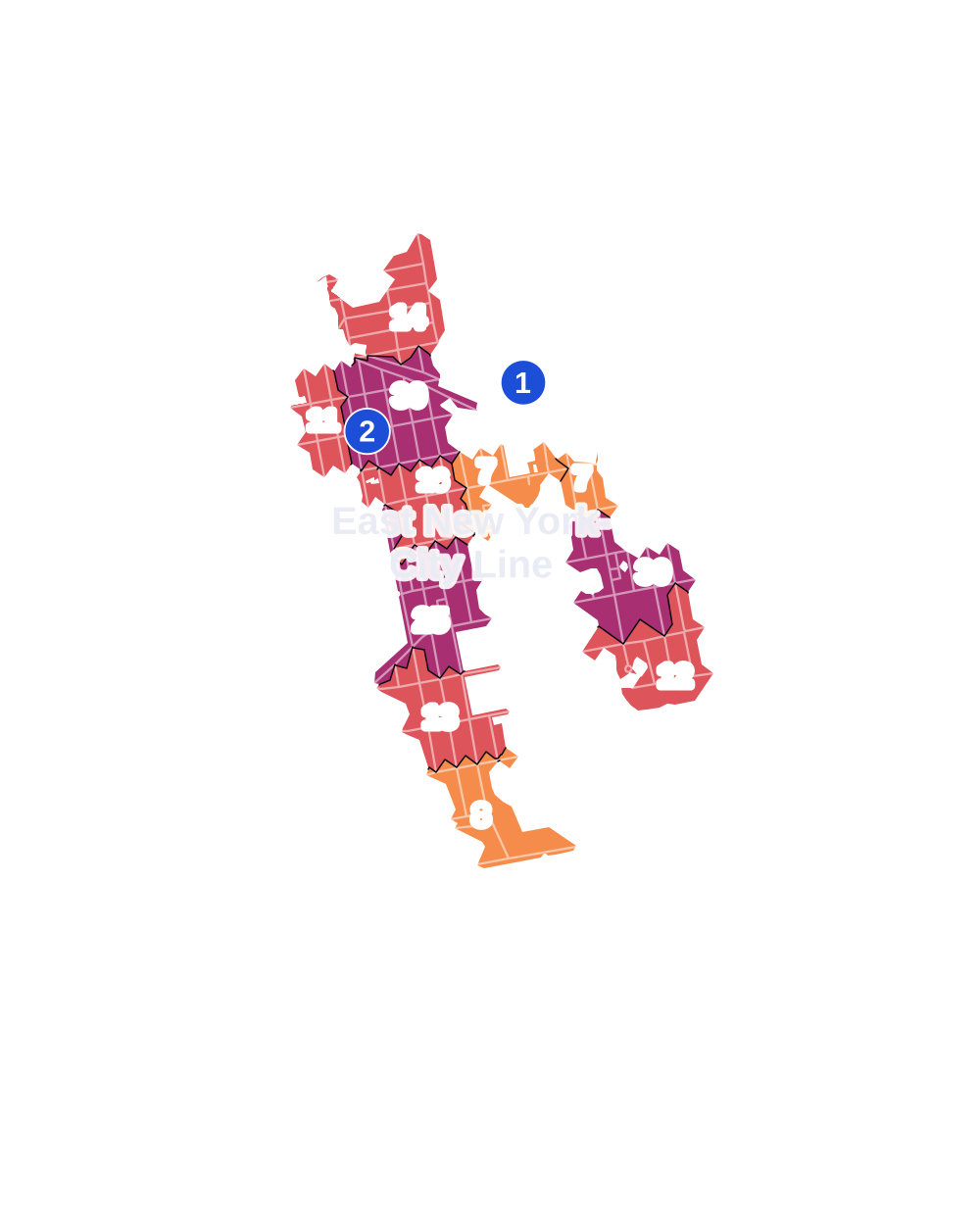
- 5 to 9
- 10 to 19
- 20 to 49
- 50 to 99
- 100 or more
- Not shaded: fewer than 5, held back under the rules in How complaints are counted, parks and public-housing grounds, and land in no patch
- Police precinct
- 75th
From January to June 2026 the NYPD recorded 225 major felonies at places in East New York-City Line, against 288 in the same months of 2025.
Sources: the NYPD's Complaint Data Historic, updated April 28, 2026, and Complaint Data Current (Year To Date), updated July 27, 2026, on NYC Open Data. Figures to June 30, 2026.
Street corners
- 78th Street & Loring Avenue
- Atlantic Avenue & Conduit Boulevard
- Atlantic Avenue & Fountain Avenue
- Atlantic Avenue & Sheridan Avenue
- Autumn Avenue & Glen Street
- Autumn Avenue & Hill Street
- Autumn Avenue & McKinley Avenue
- Autumn Avenue & Weldon Street
- Belmont Avenue & Autumn Avenue
- Belmont Avenue & Chestnut Street
- Belmont Avenue & Conduit Boulevard (east)
- Belmont Avenue & Conduit Boulevard (west)
- Belmont Avenue & Crescent Street
- Belmont Avenue & Crystal Street
- Belmont Avenue & Doscher Street
- Belmont Avenue & Drew Street
- Belmont Avenue & Euclid Avenue
- Belmont Avenue & Fountain Avenue
- Belmont Avenue & Grant Avenue
- Belmont Avenue & Hemlock Street
- Belmont Avenue & Lincoln Avenue
- Belmont Avenue & Pine Street
- Belmont Avenue & Ruby Street
- Belmont Avenue & Sheridan Avenue
- Blake Avenue & Autumn Avenue
- Blake Avenue & Crescent Street
- Blake Avenue & Drew Street
- Blake Avenue & Eldert Lane
- Blake Avenue & Euclid Avenue
- Blake Avenue & Forbell Street
- Blake Avenue & Hemlock Street
- Blake Avenue & Lincoln Avenue
- Blake Avenue & Pine Street
- Blake Avenue & Ruby Street
- Conduit Boulevard & Autumn Avenue
- Conduit Boulevard & Eldert Lane
- Conduit Boulevard & Forbell Street
- Conduit Boulevard & Grant Avenue
- Conduit Boulevard & Hemlock Street
- Conduit Boulevard & Lincoln Avenue
- Conduit Boulevard & McKinley Avenue
- Conduit Boulevard & Pine Street
- Conduit Boulevard & Ruby Street
- Conduit Boulevard & Sheridan Avenue
- Conduit Boulevard & Wells Street
- Cozine Avenue & Eldert Lane
- Cozine Avenue & Forbell Street
- Cozine Avenue & Pine Street
- Crescent Street & Conduit Boulevard
- Crescent Street & Cozine Avenue
- Crescent Street & Glen Street
- Crescent Street & Hill Street
- Crescent Street & Loring Avenue
- Crescent Street & McKinley Avenue
- Crescent Street & Old Mill Road
- Crescent Street & Wortman Avenue
- Crystal Street & Wells Street
- Drew Street & 95th Avenue
- Drew Street & 101st Avenue
- Drew Street & McKinley Avenue
- Dumont Avenue & Amber Street
- Dumont Avenue & Autumn Avenue
- Dumont Avenue & Crescent Street
- Dumont Avenue & Drew Street
- Dumont Avenue & Eldert Lane
- Dumont Avenue & Forbell Street
- Dumont Avenue & Hemlock Street
- Dumont Avenue & Lincoln Avenue
- Dumont Avenue & Pine Street
- Dumont Avenue & Ruby Street
- Eldert Lane & 95th Avenue
- Eldert Lane & McKinley Avenue
- Euclid Avenue & Conduit Boulevard
- Euclid Avenue & Glen Street
- Euclid Avenue & Hill Street
- Euclid Avenue & Loring Avenue
- Euclid Avenue & McKinley Avenue
- Euclid Avenue & Weldon Street
- Euclid Avenue & Wortman Avenue
- Flatlands Avenue & Crescent Street
- Flatlands Avenue & Eldert Lane
- Flatlands Avenue & Fountain Avenue
- Flatlands Avenue & Sheridan Avenue
- Forbell Street & 101st Avenue
- Forbell Street & McKinley Avenue
- Fountain Avenue & Cozine Avenue
- Fountain Avenue & Egan Street
- Fountain Avenue & Hegeman Avenue
- Fountain Avenue & Loring Avenue
- Fountain Avenue & Old Mill Road
- Fountain Avenue & Wells Street
- Fountain Avenue & Wortman Avenue
- Glenmore Avenue & Autumn Avenue
- Glenmore Avenue & Chestnut Street
- Glenmore Avenue & Conduit Boulevard
- Glenmore Avenue & Crescent Street
- Glenmore Avenue & Crystal Street
- Glenmore Avenue & Doscher Street
- Glenmore Avenue & Drew Street
- Glenmore Avenue & Eldert Lane
- Glenmore Avenue & Euclid Avenue
- Glenmore Avenue & Forbell Street
- Glenmore Avenue & Grant Avenue
- Glenmore Avenue & Lincoln Avenue
- Glenmore Avenue & Pine Street
- Glenmore Avenue & Sheridan Avenue
- Grant Avenue & McKinley Avenue
- Liberty Avenue & 101st Avenue
- Liberty Avenue & Autumn Avenue
- Liberty Avenue & Chestnut Street
- Liberty Avenue & Conduit Boulevard
- Liberty Avenue & Crescent Street
- Liberty Avenue & Crystal Street
- Liberty Avenue & Doscher Street
- Liberty Avenue & Eldert Lane
- Liberty Avenue & Forbell Street
- Liberty Avenue & Grant Avenue
- Liberty Avenue & Hemlock Street
- Liberty Avenue & Lincoln Avenue
- Liberty Avenue & Sheridan Avenue
- Lincoln Avenue & McKinley Avenue
- Linden Boulevard & Crescent Street
- Linden Boulevard & Drew Street
- Linden Boulevard & Eldert Lane
- Linden Boulevard & Euclid Avenue
- Loring Avenue & Autumn Avenue
- Loring Avenue & Drew Street
- Loring Avenue & Eldert Lane
- Loring Avenue & Emerald Street
- Loring Avenue & Forbell Street
- Loring Avenue & Holly Street
- Loring Avenue & Pine Street
- Loring Avenue & Ruby Street
- Pitkin Avenue & Autumn Avenue
- Pitkin Avenue & Chestnut Street
- Pitkin Avenue & Conduit Boulevard
- Pitkin Avenue & Crescent Street
- Pitkin Avenue & Crystal Street
- Pitkin Avenue & Doscher Street
- Pitkin Avenue & Drew Street
- Pitkin Avenue & Eldert Lane
- Pitkin Avenue & Euclid Avenue
- Pitkin Avenue & Forbell Street
- Pitkin Avenue & Fountain Avenue
- Pitkin Avenue & Grant Avenue
- Pitkin Avenue & Hemlock Street
- Pitkin Avenue & Lincoln Avenue
- Pitkin Avenue & Pine Street
- Ruby Street & 75th Street
- Ruby Street & 157th Avenue
- Sheridan Avenue & McKinley Avenue
- Stanley Avenue & Amber Street
- Stanley Avenue & Autumn Avenue
- Stanley Avenue & Crescent Street
- Stanley Avenue & Eldert Lane
- Stanley Avenue & Euclid Avenue
- Stanley Avenue & Forbell Street
- Stanley Avenue & Fountain Avenue
- Stanley Avenue & Hemlock Street
- Stanley Avenue & Lincoln Avenue
- Stanley Avenue & Pine Street
- Stanley Avenue & Postal Facility Road
- Stanley Avenue & Sheridan Avenue
- Sutter Avenue & Autumn Avenue
- Sutter Avenue & Chestnut Street
- Sutter Avenue & Conduit Boulevard
- Sutter Avenue & Crescent Street
- Sutter Avenue & Crystal Street
- Sutter Avenue & Doscher Street
- Sutter Avenue & Drew Street
- Sutter Avenue & Eldert Lane
- Sutter Avenue & Euclid Avenue
- Sutter Avenue & Forbell Street
- Sutter Avenue & Fountain Avenue
- Sutter Avenue & Grant Avenue
- Sutter Avenue & Hemlock Street
- Sutter Avenue & Lincoln Avenue
- Sutter Avenue & Pine Street
- Sutter Avenue & Sheridan Avenue
- Wells Street & Chestnut Court
- Wortman Avenue & Autumn Avenue
- Wortman Avenue & Forbell Street
- Wortman Avenue & Hemlock Street
- Wortman Avenue & Pine Street
How the figures above are measured: Methodology.