Ozone Park (North)
Neighborhood · Queens
Ozone Park (North) is the half of Ozone Park between Atlantic Avenue and the line of Liberty and 103rd Avenues, running east from the Brooklyn border.
- 0.65 square miles
- 27,312 residents, 2020 Census
- 141 street corners
- 1 subway station
- 8 bus routes
Benjamin W. Hitchcock and Charles C. Denton bought land in 1882 to develop Ozone Park, choosing a name meant to draw buyers with the promise of fresh Atlantic breezes. It grew as a community of private homes settled largely by Irish, Polish and Italian families, and the 101st Avenue commercial strip has several Italian-American specialty shops.
Sources: Ozone Park (Wikipedia); Ozone Park (Queens Community Board 9); Queens Community Board 10.
Ozone Park (North) borders six areas, and 97th Avenue holds more of its corners than any other street, 35 of 141.
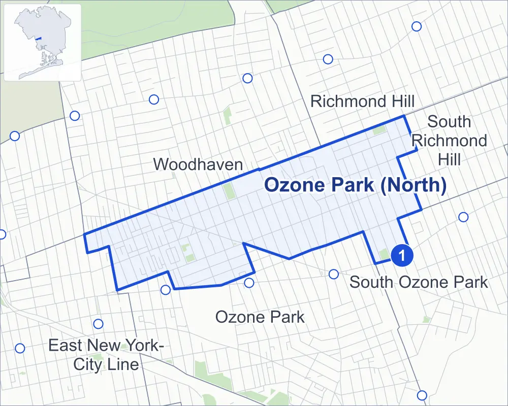
- Ozone Park (North)
- A neighboring area
- Park
- A station in the list
- Another station
Neighborhood areas and streets: NYC Department of City Planning. Parks: NYC Parks. Stations: MTA.
Neighboring areas
- Richmond Hill northeast
- South Richmond Hill east
- South Ozone Park east
- Ozone Park south
- Woodhaven west
- East New York-City Line west
Subway stations
- 104 St lines A
Getting around
One subway station and buses on eight routes stop in or at the edge of Ozone Park (North).
- 1 subway station
- 7 local bus routes
- 1 express bus route
Local bus routes
- Q7
- Q8
- Q11
- Q24
- Q52-SBS
- Q53-SBS
- Q112
Express bus route
- QM15
Safety record
Between 2021 and 2025, its corners averaged fewer police-reported crashes than the average Queens corner.
- 680 police-reported crashes at its corners
- 4.8 a corner, on average
- 5.2 the average Queens corner
- 12 corners with a clean record
Signal or safety changes on City record, at 26 of its corners
- Leading pedestrian intervals
- 21
- Accessible pedestrian signals
- 14
- Turn calming
- 2
- Barnes Dance all-way crossings
- 1
Camera tickets
In 2025 its corners had more bus-lane camera tickets than school-zone speed or red-light tickets.
- 23 red-light camera tickets at one corner
- 1,775 school-zone speed camera tickets at two corners
- 4,654 bus-lane camera tickets at two corners
- Most red-light tickets
- Woodhaven Boulevard & 101st Avenue, 23
- Most speed tickets
- Woodhaven Boulevard & 101st Avenue, 1,433
- Most bus-lane tickets
- Woodhaven Boulevard & 97th Avenue, 2,809
People and homes
The 2020 Census counted 27,312 residents in Ozone Park (North), about 42,000 per square mile.
- 8,146 homes, 2020 Census
- 147 homes added since April 2010, net, by City Planning's count
Half of its 3,537 residential lots hold buildings from 1920 or earlier, and 80% of them date from before 1940, by the City's tax lot records.
Parks
- Parkland
- 5.5 acres of NYC Parks property
- The largest pieces
- London Planetree Playground (1.8 acres), Ampere Playground (1.3 acres) and Maurice A FitzGerald Playground (1.2 acres)
Streets and trees
- Trees
- 2,008 in NYC Parks' records, most often London planetree, pin oak and green ash
- Street with the most corners
- 97th Avenue, with 35 of the area's 141
- Height above sea level
- From 17 feet at 84th Street & 102nd Avenue to 44 feet at 97th Avenue & 105th Street
- Honorary street names
- 5 at its corners, enacted by local law
Schools
The City lists six schools in Ozone Park (North).
- Public schools
- 4
- Charter and private schools
- 2
Public safety
How complaints are countedIn 2025 the NYPD recorded 160 major felonies at places in Ozone Park (North).
Recorded by the NYPD at places in Ozone Park (North)
- 162 major felonies in 2024
- 606 other felonies, misdemeanors and violations in 2025
In 2025, on the streets along the edge of Ozone Park (North), the NYPD recorded another 77 major felonies. Counting the streets along its edge, in 2025 the NYPD recorded 8.7 major felonies for every thousand residents the 2020 Census counted in Ozone Park (North).
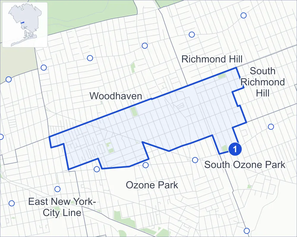
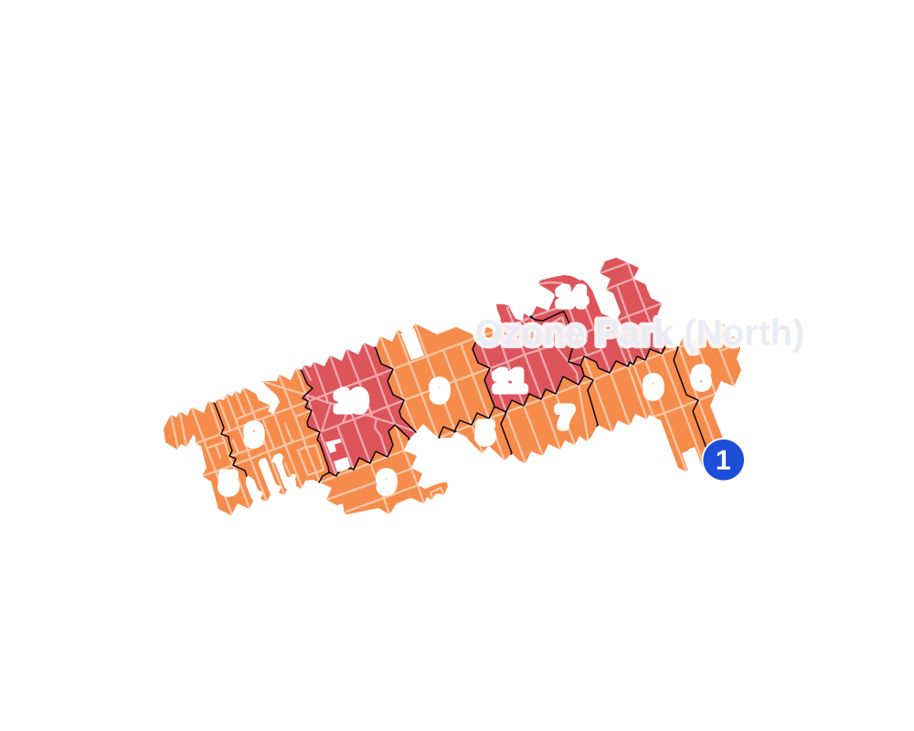
- 5 to 9
- 10 to 19
- 20 to 49
- 50 to 99
- 100 or more
- Not shaded: fewer than 5, held back under the rules in How complaints are counted, parks and public-housing grounds, and land in no patch
- Police precincts
- 102nd (most of the area), 106th
From January to June 2026 the NYPD recorded 89 major felonies at places in Ozone Park (North), against 70 in the same months of 2025.
Sources: the NYPD's Complaint Data Historic, updated April 28, 2026, and Complaint Data Current (Year To Date), updated July 27, 2026, on NYC Open Data. Figures to June 30, 2026.
Street corners
- 75th Street & 95th Avenue
- 75th Street & 97th Avenue
- 75th Street & 101st Avenue
- 76th Street & 95th Avenue
- 76th Street & 97th Avenue
- 76th Street & 101st Avenue
- 77th Street & 95th Avenue
- 77th Street & 97th Avenue
- 78th Street & 95th Avenue
- 78th Street & 97th Avenue
- 78th Street & 101st Avenue
- 80th Street & 95th Avenue
- 80th Street & 97th Avenue
- 80th Street & Atlantic Avenue
- 81st Street & 95th Avenue
- 81st Street & 97th Avenue
- 81st Street & 101st Avenue
- 81st Street & 102nd Avenue
- 81st Street & 102nd Road
- 82nd Street & 95th Avenue
- 82nd Street & 97th Avenue
- 82nd Street & 101st Avenue
- 83rd Street & 95th Avenue
- 83rd Street & 97th Avenue
- 83rd Street & 101st Avenue
- 84th Street & 95th Avenue
- 84th Street & 97th Avenue
- 84th Street & 101st Avenue
- 84th Street & 102nd Avenue
- 84th Street & 102nd Road
- 84th Street & Atlantic Avenue
- 85th Street & 95th Avenue
- 85th Street & 97th Avenue
- 85th Street & 101st Avenue
- 86th Street & 95th Avenue
- 86th Street & 97th Avenue
- 86th Street & 101st Avenue
- 86th Street & 102nd Avenue
- 86th Street & 102nd Road
- 87th Street & 95th Avenue
- 87th Street & 97th Avenue
- 87th Street & 101st Avenue
- 88th Street & 95th Avenue
- 88th Street & 97th Avenue
- 88th Street & 102nd Road
- 89th Street & 95th Avenue
- 89th Street & 97th Avenue
- 89th Street & 101st Avenue
- 90th Street & 95th Avenue
- 90th Street & 97th Avenue
- 90th Street & 101st Avenue
- 91st Street & 97th Avenue
- 91st Street & 101st Avenue
- 92nd Street & 95th Avenue
- 92nd Street & 97th Avenue
- 92nd Street & 101st Avenue
- 92nd Street & 103rd Avenue
- 94th Avenue & 106th Street
- 94th Street & 95th Avenue
- 94th Street & 97th Avenue
- 94th Street & 101st Avenue
- 94th Street & 103rd Avenue
- 95th Avenue & 91st Street
- 95th Avenue & 93rd Street
- 95th Avenue & 100th Street
- 95th Avenue & 101st Street
- 95th Avenue & 103rd Street
- 95th Avenue & 104th Street
- 95th Avenue & 105th Street
- 95th Avenue & 106th Street
- 95th Avenue & 107th Street
- 95th Street & 95th Avenue
- 95th Street & 97th Avenue
- 95th Street & 99th Avenue
- 95th Street & 101st Avenue
- 95th Street & Woodhaven Court
- 96th Street & 95th Avenue
- 96th Street & 103rd Avenue
- 97th Avenue & 93rd Street
- 97th Avenue & 100th Street
- 97th Avenue & 103rd Street
- 97th Avenue & 105th Street
- 97th Avenue & 106th Street
- 97th Avenue & 107th Street
- 97th Avenue & Culloden Place
- 97th Avenue & Digby Place
- 97th Street & 95th Avenue
- 97th Street & 97th Avenue
- 97th Street & 99th Avenue
- 97th Street & 101st Avenue
- 97th Street & 103rd Avenue
- 98th Street & 97th Avenue
- 98th Street & 99th Avenue
- 98th Street & 101st Avenue
- 98th Street & 103rd Avenue
- 99th Street & 97th Avenue
- 99th Street & 101st Avenue
- 99th Street & 103rd Avenue
- 100th Street & 94th Avenue
- 100th Street & 103rd Avenue
- 101st Avenue & 93rd Street
- 101st Avenue & 100th Street
- 101st Avenue & 103rd Street
- 101st Avenue & 104th Street
- 101st Avenue & 105th Street
- 101st Street & 97th Avenue
- 101st Street & 101st Avenue
- 101st Street & 103rd Avenue
- 102nd Street & 94th Avenue
- 102nd Street & 95th Avenue
- 102nd Street & 97th Avenue
- 102nd Street & 101st Avenue
- 102nd Street & 103rd Avenue
- 103rd Avenue & 103rd Street
- 103rd Avenue & 105th Street
- 104th Street & 94th Avenue
- 104th Street & 97th Avenue
- 104th Street & 103rd Avenue
- 105th Street & 101st Road
- Liberty Avenue & 81st Street
- Liberty Avenue & 100th Street
- Liberty Avenue & 101st Street
- Liberty Avenue & 104th Street
- Rockaway Boulevard & 81st Street
- Rockaway Boulevard & 82nd Street
- Rockaway Boulevard & 83rd Street
- Rockaway Boulevard & 84th Street
- Rockaway Boulevard & 85th Street
- Rockaway Boulevard & 86th Street
- Rockaway Boulevard & 87th Street
- Rockaway Boulevard & 88th Street
- Rockaway Boulevard & 91st Street
- Rockaway Boulevard & 95th Avenue
- Rockaway Boulevard & 97th Avenue
- Rockaway Boulevard & 102nd Road
- Rockaway Boulevard & 103rd Avenue
- Rockaway Boulevard & Atlantic Avenue
- Rockaway Boulevard & Culloden Place
- Rockaway Boulevard & Digby Place
- Woodhaven Boulevard & 97th Avenue
- Woodhaven Boulevard & 101st Avenue
How the figures above are measured: Methodology.