South Richmond Hill
Neighborhood · Queens
South Richmond Hill takes in the blocks south of Atlantic Avenue, reaching to Liberty Avenue, the business corridor along its southern edge.
- 0.57 square miles
- 24,141 residents, 2020 Census
- 94 street corners
- 8 bus routes
Its large Indo-Caribbean community has earned it the nickname Little Guyana, and its many Punjabi and Sikh residents the name Little Punjab. Phil "Scooter" Rizzuto Park, on Atlantic Avenue, opened in 1938 and was long known locally as Smokey Oval before its 2019 renaming for the baseball player, who lived and went to high school in Richmond Hill. The park has hosted the annual Phagwah Parade celebration of the Federation of Indian Associations, marking the festival of colors.
Sources: South Richmond Hill, Queens (Wikipedia); Richmond Hill, Queens (Wikipedia); Phil "Scooter" Rizzuto Park History (NYC Parks); Noteworthy People (Richmond Hill Historical Society).
South Richmond Hill borders four areas, and 101st Avenue holds more of its corners than any other street, 27 of 94.
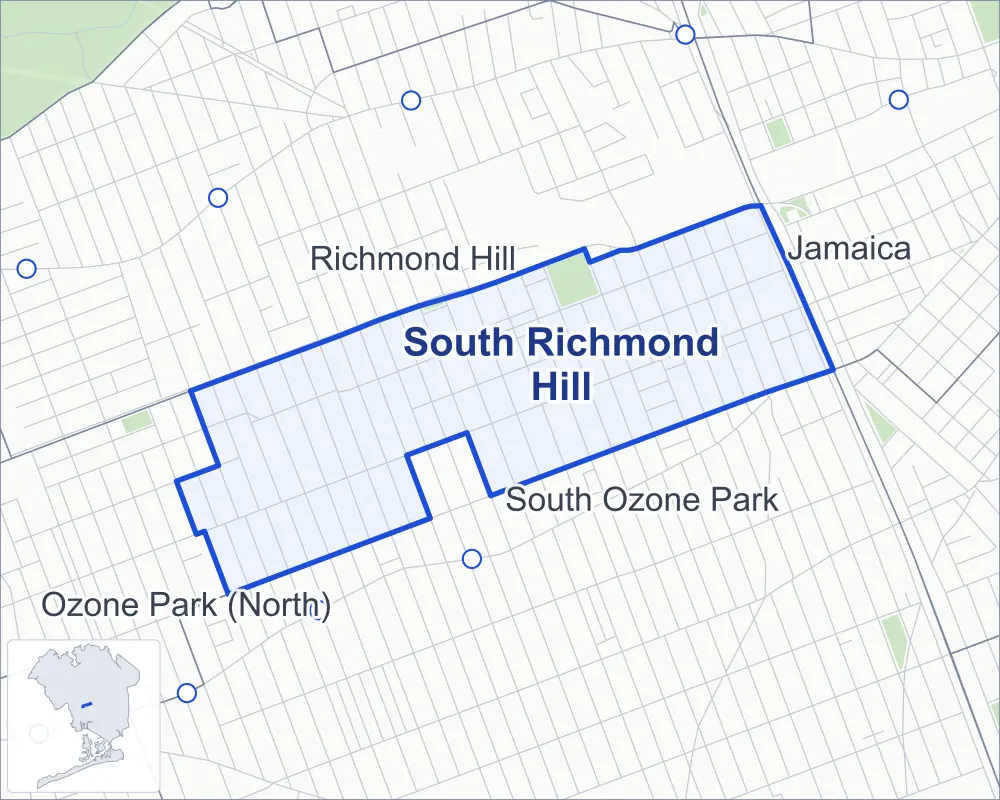
- South Richmond Hill
- A neighboring area
- Park
- Another station
Neighborhood areas and streets: NYC Department of City Planning. Parks: NYC Parks. Stations: MTA.
Neighboring areas
- Richmond Hill north
- Jamaica east
- South Ozone Park south
- Ozone Park (North) west
Getting around
Buses on eight routes stop in or at the edge of South Richmond Hill.
- 7 local bus routes
- 1 express bus route
Local bus routes
- Q8
- Q9
- Q10
- Q24
- Q37
- Q80
- Q112
Express bus route
- QM18
Safety record
Between 2021 and 2025, its corners averaged more police-reported crashes than the average Queens corner.
- 588 police-reported crashes at its corners
- 6.3 a corner, on average
- 5.2 the average Queens corner
- 7 corners with a clean record
Signal or safety changes on City record, at 14 of its corners
- Leading pedestrian intervals
- 10
- Accessible pedestrian signals
- 5
- Turn calming
- 4
Camera tickets
In 2025 its corners had more school-zone speed camera tickets than red-light or bus-lane tickets.
- 0 red-light camera tickets
- 3,837 school-zone speed camera tickets at four corners
- 0 bus-lane camera tickets
- Most speed tickets
- 101st Avenue & 111th Street, 2,445
People and homes
The 2020 Census counted 24,141 residents in South Richmond Hill, about 42,400 per square mile.
- 7,202 homes, 2020 Census
- 234 homes added since April 2010, net, by City Planning's count
Half of its 3,466 residential lots hold buildings from 1920 or earlier, and 88% of them date from before 1940, by the City's tax lot records.
Parks
- Parkland
- 5.3 acres of Phil "Scooter" Rizzuto Park, as NYC Parks maps it within South Richmond Hill
Streets and trees
- Trees
- 1,907 in NYC Parks' records, most often London planetree, pin oak and thornless honeylocust
- Street with the most corners
- 101st Avenue, with 27 of the area's 94
- Height above sea level
- From 39 feet at 103rd Avenue & 106th Street to 56 feet at Lefferts Boulevard & 94th Avenue
- Honorary street names
- 2 at its corners, enacted by local law
Schools
The City lists five schools in South Richmond Hill.
- Public schools
- 5
Public safety
How complaints are countedIn 2025 the NYPD recorded 157 major felonies at places in South Richmond Hill.
Recorded by the NYPD at places in South Richmond Hill
- 153 major felonies in 2024
- 872 other felonies, misdemeanors and violations in 2025
In 2025, on the streets along the edge of South Richmond Hill, the NYPD recorded another 75 major felonies. Counting the streets along its edge, in 2025 the NYPD recorded 9.6 major felonies for every thousand residents the 2020 Census counted in South Richmond Hill.
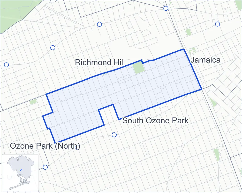
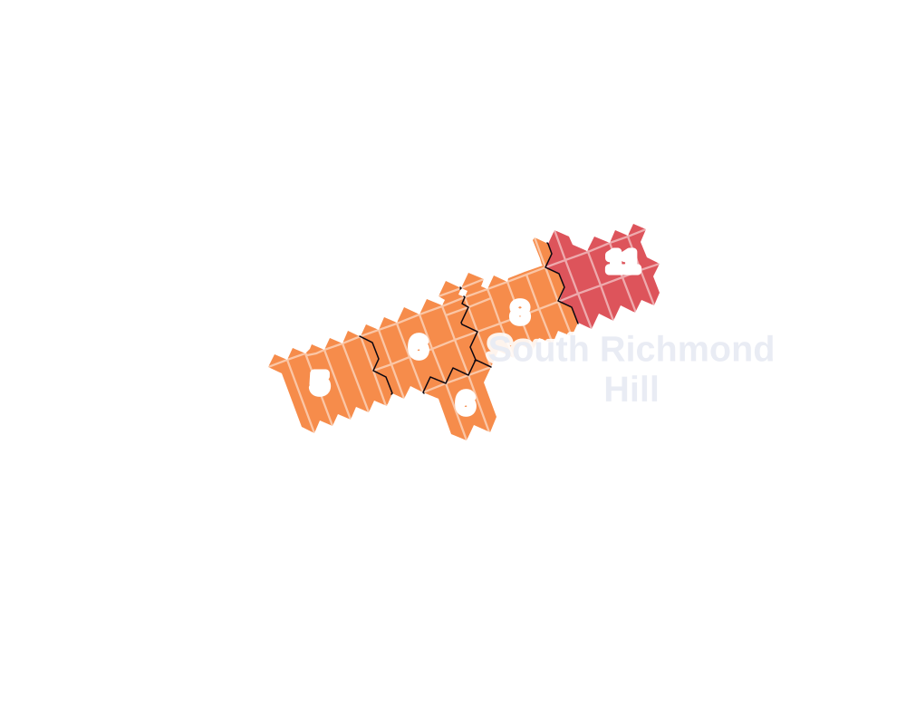
- 5 to 9
- 10 to 19
- 20 to 49
- 50 to 99
- 100 or more
- Not shaded: fewer than 5, held back under the rules in How complaints are counted, parks and public-housing grounds, and land in no patch
- Police precinct
- 102nd
From January to June 2026 the NYPD recorded 87 major felonies at places in South Richmond Hill, against 66 in the same months of 2025.
Sources: the NYPD's Complaint Data Historic, updated April 28, 2026, and Complaint Data Current (Year To Date), updated July 27, 2026, on NYC Open Data. Figures to June 30, 2026.
Street corners
- 95th Avenue & 109th Street
- 95th Avenue & 110th Street
- 95th Avenue & 111th Street
- 95th Avenue & 112th Street
- 95th Avenue & 113th Street
- 95th Avenue & 115th Street
- 95th Avenue & 116th Street
- 95th Avenue & 117th Street
- 95th Avenue & 118th Street
- 95th Avenue & 121st Street
- 95th Avenue & 129th Street
- 95th Avenue & 131st Street
- 95th Avenue & 132nd Street
- 95th Avenue & 133rd Street
- 97th Avenue & 109th Street
- 97th Avenue & 129th Street
- 97th Avenue & 131st Street
- 97th Avenue & 132nd Street
- 97th Avenue & 133rd Street
- 101st Avenue & 106th Street
- 101st Avenue & 107th Street
- 101st Avenue & 109th Street
- 101st Avenue & 110th Street
- 101st Avenue & 111th Street
- 101st Avenue & 112th Street
- 101st Avenue & 113th Street
- 101st Avenue & 115th Street
- 101st Avenue & 116th Street
- 101st Avenue & 117th Street
- 101st Avenue & 118th Street
- 101st Avenue & 121st Street
- 101st Avenue & 129th Street
- 101st Avenue & 131st Street
- 101st Avenue & 132nd Street
- 101st Avenue & 133rd Street
- 103rd Avenue & 106th Street
- 103rd Avenue & 132nd Street
- 108th Street & 95th Avenue
- 108th Street & 97th Avenue
- 108th Street & 101st Avenue
- 108th Street & 103rd Avenue
- 110th Street & 103rd Avenue
- 111th Street & 103rd Avenue
- 114th Street & 95th Avenue
- 114th Street & 101st Avenue
- 114th Street & 103rd Avenue
- 115th Street & 103rd Avenue
- 117th Street & 97th Avenue
- 118th Street & 97th Avenue
- 120th Street & 94th Avenue
- 120th Street & 95th Avenue
- 120th Street & 97th Avenue
- 120th Street & 101st Avenue
- 120th Street & 103rd Avenue
- 121st Street & 97th Avenue
- 123rd Street & 95th Avenue
- 123rd Street & 97th Avenue
- 123rd Street & 101st Avenue
- 124th Street & 94th Avenue
- 124th Street & 95th Avenue
- 124th Street & 97th Avenue
- 124th Street & 101st Avenue
- 125th Street & 94th Avenue
- 125th Street & 95th Avenue
- 125th Street & 97th Avenue
- 125th Street & 101st Avenue
- 126th Street & 95th Avenue
- 126th Street & 97th Avenue
- 126th Street & 101st Avenue
- 126th Street & 103rd Avenue
- 127th Street & 94th Avenue
- 127th Street & 95th Avenue
- 127th Street & 97th Avenue
- 127th Street & 101st Avenue
- 127th Street & 102nd Avenue
- 127th Street & 102nd Road
- 129th Street & 102nd Avenue
- 129th Street & 102nd Road
- 129th Street & 103rd Avenue
- 130th Street & 95th Avenue
- 130th Street & 97th Avenue
- 130th Street & 101st Avenue
- 134th Street & 95th Avenue
- 134th Street & 97th Avenue
- 134th Street & 101st Avenue
- 134th Street & 102nd Avenue
- Lefferts Boulevard & 94th Avenue
- Lefferts Boulevard & 95th Avenue
- Lefferts Boulevard & 97th Avenue
- Lefferts Boulevard & 101st Avenue
- Liberty Avenue & 135th Street
- Van Wyck Expressway & 95th Avenue
- Van Wyck Expressway & 97th Avenue
- Van Wyck Expressway & 102nd Avenue
How the figures above are measured: Methodology.