Mount Hebron & Cedar Grove Cemeteries
Cemetery · Queens
Mount Hebron & Cedar Grove Cemeteries share one large burial ground in Flushing, fronting the Horace Harding Expressway.
- 0.33 square miles
- 1 street corner
- 3 bus routes
Cedar Grove, a nonsectarian cemetery that recorded its first burial in 1893, lies on what was once Spring Hill, the estate of colonial governor Cadwallader Colden. Mount Hebron began in 1903 as Cedar Grove's Jewish section and now fills most of the grounds, with more than 200,000 burials; in its early years most of its land went to Jewish mutual aid, hometown and burial societies. A section set aside for the Yiddish theater world holds performers such as Molly Picon and Boris Thomashevsky.
Sources: Mount Hebron Cemetery (New York City) (Wikipedia); Mount Hebron Cemetery; Cedar Grove Cemetery (Queens) (Wikipedia); Cedar Grove Cemetery.
Mount Hebron & Cedar Grove Cemeteries borders three areas.
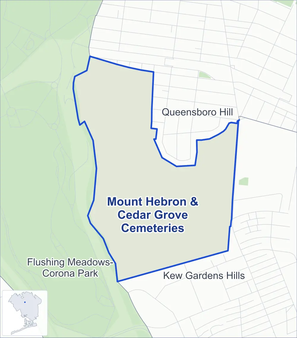
- Mount Hebron & Cedar Grove Cemeteries
- A neighboring area
- Park
Neighborhood areas and streets: NYC Department of City Planning. Parks: NYC Parks. Stations: MTA.
Neighboring areas
- Queensboro Hill north
- Kew Gardens Hills southeast
- Flushing Meadows-Corona Park west
Getting around
Buses on three routes stop in or at the edge of Mount Hebron & Cedar Grove Cemeteries.
- 3 local bus routes
Local bus routes
- Q20
- Q44-SBS
- Q88
Safety record
Between 2021 and 2025, police reported zero crashes at its one corner.
Camera tickets
In 2025 the Department of Finance recorded no red-light, school-zone speed or bus-lane camera ticket at its corners.
Parks
- Parkland
- 1.8 acres of Flushing Meadows Corona Park, as NYC Parks maps it within Mount Hebron & Cedar Grove Cemeteries
Streets and trees
- Trees
- 69 in NYC Parks' records, most often pin oak, northern red oak and thornless honeylocust
The corner
How the figures above are measured: Methodology.