Fordham Heights
Neighborhood · Bronx
Fordham Heights covers the blocks just south of Fordham Road in the west Bronx, between Jerome and Webster avenues, with the Grand Concourse running through them.
- 0.26 square miles
- 32,099 residents, 2020 Census
- 62 street corners
- 4 subway stations
- 11 bus routes
It forms the southern part of Fordham, whose name dates to the colonial Manor of Fordham, in place from 1671 to 1762, and the area stayed largely rural until about 1900, when New York City began to expand. The crossing of Fordham Road and the Grand Concourse became the major commercial hub of the northwest Bronx, and just south of it stands John Eberson's Loew's Paradise Theater, an atmospheric movie palace that opened in 1929 and whose exterior and interior are both city landmarks.
Sources: The City of New York, Borough of the Bronx, Community Board 5: Boundaries, Zip Codes and Mass Transit (2019) (Bronx Community Board 5); Fordham, Bronx (Wikipedia); Loew's Paradise Theater (LP-1891), Designation List 279, April 15, 1997 (NYC Landmarks Preservation Commission); Paradise Theater (Bronx) (Wikipedia).
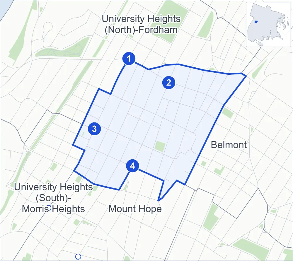
Fordham Heights borders four areas, and Jerome Avenue holds more of its corners than any other street, ten of 62.
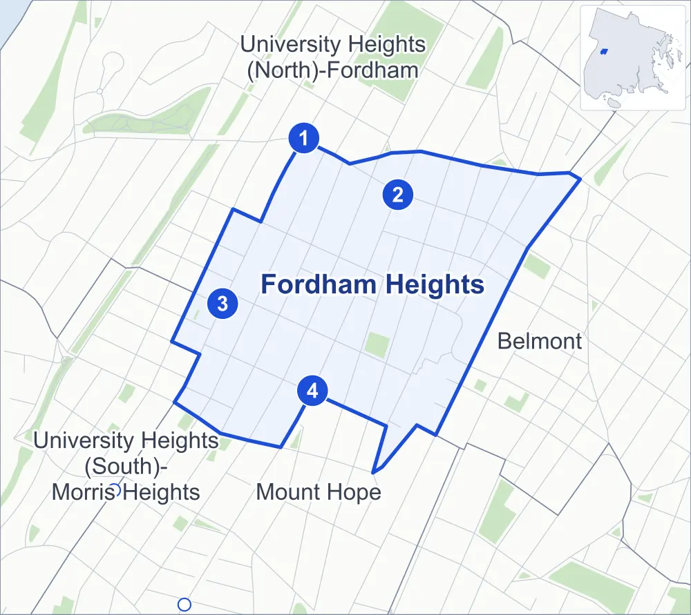
- Fordham Heights
- A neighboring area
- Park
- A station in the list
- Another station
Neighborhood areas and streets: NYC Department of City Planning. Parks: NYC Parks. Stations: MTA.
Neighboring areas
Subway stations
- Fordham Rd lines 4 accessible
- Fordham Rd lines B D
- 183 St lines 4
- 182-183 Sts lines B D
Getting around
Four subway stations and buses on 11 routes stop in or at the edge of Fordham Heights.
- 4 subway stations
- 1 of them listed by the MTA as fully accessible
- 10 local bus routes
- 1 express bus route
Local bus routes
- Bx1
- Bx2
- Bx9
- Bx12
- Bx12-SBS
- Bx22
- Bx32
- Bx34
- Bx41
- Bx41-SBS
Express bus route
- BxM4
Safety record
Between 2021 and 2025, its corners averaged more police-reported crashes than the average Bronx corner.
- 1,246 police-reported crashes at its corners
- 20.1 a corner, on average
- 8.0 the average Bronx corner
- 2 corners with a clean record
Signal or safety changes on City record, at 35 of its corners
- Leading pedestrian intervals
- 32
- Accessible pedestrian signals
- 23
- Barnes Dance all-way crossings
- 2
- Safety Improvement Projects
- 2
- Turn calming
- 1
Camera tickets
In 2025 its corners had more school-zone speed camera tickets than bus-lane or red-light tickets.
- 0 red-light camera tickets
- 18,223 school-zone speed camera tickets at four corners
- 7,350 bus-lane camera tickets at three corners
- Most speed tickets
- Grand Concourse & East 188th Street, 10,085
- Most bus-lane tickets
- Webster Avenue & East 188th Street, 2,825
People and homes
The 2020 Census counted 32,099 residents in Fordham Heights, about 123,500 per square mile.
- 10,627 homes, 2020 Census
- 1,270 homes added since April 2010, net, by City Planning's count
Half of its 504 residential lots hold buildings from 1920 or earlier, and 84% of them date from before 1940, by the City's tax lot records.
Parks and landmarks
- Parkland
- 0.9 acre of Slattery Playground, as NYC Parks maps it within Fordham Heights
- Designated landmark
- The Loew's Paradise Theater
Streets and trees
- Trees
- 1,405 in NYC Parks' records, most often thornless honeylocust, pin oak and Japanese zelkova
- Street with the most corners
- Jerome Avenue, with ten of the area's 62
- Height above sea level
- From 41 feet at Webster Avenue & East 184th Street to 137 feet at Morris Avenue & Field Place
- Honorary street names
- 10 at its corners, enacted by local law
Schools
The City lists seven schools in Fordham Heights.
- Public schools
- 6
- Charter or private school
- 1
Bike share and public art
By the station list of October 3, 2026, eight bike-share stations stand in Fordham Heights. The City's public art inventory lists one work in the area: Honor 2000 (2000).
- 8 bike-share stations
- 1 work of public art
Public safety
How complaints are countedIn 2025 the NYPD recorded 466 major felonies at places in Fordham Heights.
Recorded by the NYPD at places in Fordham Heights
- 511 major felonies in 2024
- 1,807 other felonies, misdemeanors and violations in 2025
In 2025, on the streets along the edge of Fordham Heights, the NYPD recorded another 291 major felonies. Counting the streets along its edge, in 2025 the NYPD recorded 23.6 major felonies for every thousand residents the 2020 Census counted in Fordham Heights.
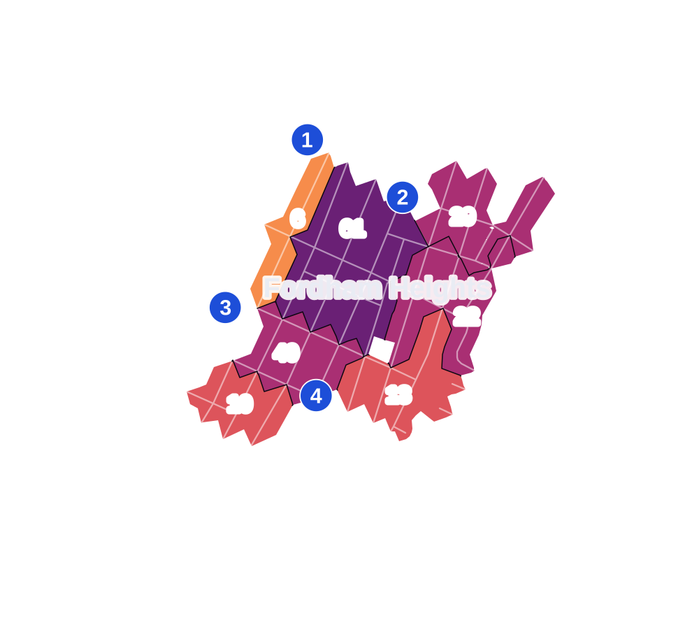
- 5 to 9
- 10 to 19
- 20 to 49
- 50 to 99
- 100 or more
- Not shaded: fewer than 5, held back under the rules in How complaints are counted, parks and public-housing grounds, and land in no patch
- Police precincts
- 46th (most of the area), 52nd
From January to June 2026 the NYPD recorded 301 major felonies at places in Fordham Heights, against 219 in the same months of 2025.
Sources: the NYPD's Complaint Data Historic, updated April 28, 2026, and Complaint Data Current (Year To Date), updated July 27, 2026, on NYC Open Data. Figures to June 30, 2026.
Street corners
- Creston Avenue & East 182nd Street
- Creston Avenue & East 183rd Street
- Creston Avenue & East 184th Street
- Creston Avenue & East 188th Street
- Creston Avenue & Field Place
- Davidson Avenue & Evelyn Place
- Davidson Avenue & North Street
- East 182nd Street & Folin Street
- East 182nd Street & Ryer Avenue
- East 182nd Street & Tiebout Avenue
- East 183rd Street & Ryer Avenue
- East 183rd Street & Tiebout Avenue
- East 184th Street & Ryer Avenue
- East 184th Street & Tiebout Avenue
- East 187th Street & Elm Place
- East 187th Street & Ryer Avenue
- East 187th Street & Tiebout Avenue
- East 188th Street & Elm Place
- East 188th Street & Tiebout Avenue
- East Fordham Road & Bainbridge Avenue
- East Fordham Road & East 188th Street
- East Fordham Road & Elm Place
- East Fordham Road & Marion Avenue
- Grand Concourse & East 181st Street
- Grand Concourse & East 182nd Street
- Grand Concourse & East 183rd Street
- Grand Concourse & East 184th Street
- Grand Concourse & East 187th Street
- Grand Concourse & East 188th Street
- Grand Concourse & East Fordham Road
- Jerome Avenue & 184th Street
- Jerome Avenue & Buchanan Place
- Jerome Avenue & Cameron Place
- Jerome Avenue & Clinton Place
- Jerome Avenue & East 182nd Street
- Jerome Avenue & East 183rd Street
- Jerome Avenue & Evelyn Place
- Jerome Avenue & Fordham Road
- Jerome Avenue & North Street
- Jerome Avenue & West 183rd Street
- Marion Avenue & East 184th Street
- Marion Avenue & East 187th Street
- Marion Avenue & East 188th Street
- Morris Avenue & Cameron Place
- Morris Avenue & East 182nd Street
- Morris Avenue & East 183rd Street
- Morris Avenue & East 184th Street
- Morris Avenue & Field Place
- Ryer Avenue & Field Place
- Valentine Avenue & East 182nd Street
- Valentine Avenue & East 183rd Street
- Valentine Avenue & East 184th Street
- Valentine Avenue & East 187th Street
- Valentine Avenue & East 188th Street
- Walton Avenue & Cameron Place
- Walton Avenue & East 182nd Street
- Walton Avenue & East 183rd Street
- Walton Avenue & East 184th Street
- Webster Avenue & East 184th Street
- Webster Avenue & East 187th Street
- Webster Avenue & East 188th Street
- Webster Avenue & East 189th Street
How the figures above are measured: Methodology.