Belmont
Neighborhood · Bronx
Between Third Avenue and Bronx Park, home of the Bronx Zoo and the New York Botanical Garden, Belmont reaches north across Fordham Road to take in most of the Rose Hill campus of Fordham University, which was founded as St. John's College in 1841.
- 0.59 square miles
- 35,825 residents, 2020 Census
- 115 street corners
- 11 bus routes
The neighborhood is named for the Lorillard tobacco family's Belmont estate; after the family moved away in 1870, part of the land went into Bronx Park and another part became streets. Italian families from Lower Manhattan made it the Little Italy of the Bronx around 1900, and by 1940 the indoor Arthur Avenue Retail Market had become an official home for its vendors.
Sources: Belmont, Bronx (Wikipedia); Must-See Arthur Avenue & Belmont (New York City Tourism); Fordham University (Encyclopaedia Britannica).
Belmont borders seven areas, and East 187th Street holds more of its corners than any other street, 15 of 115.
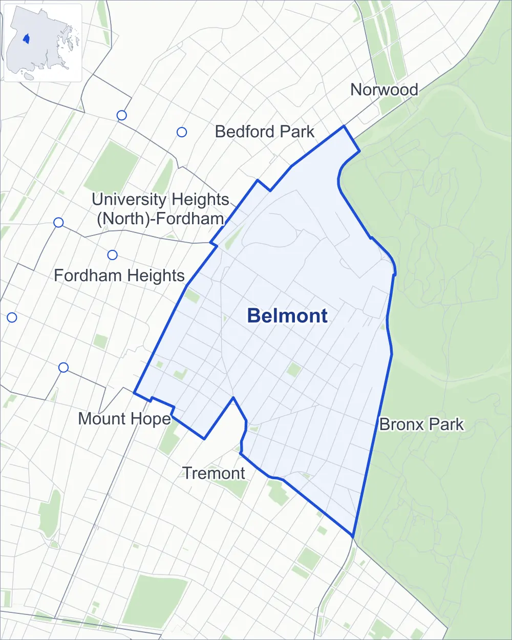
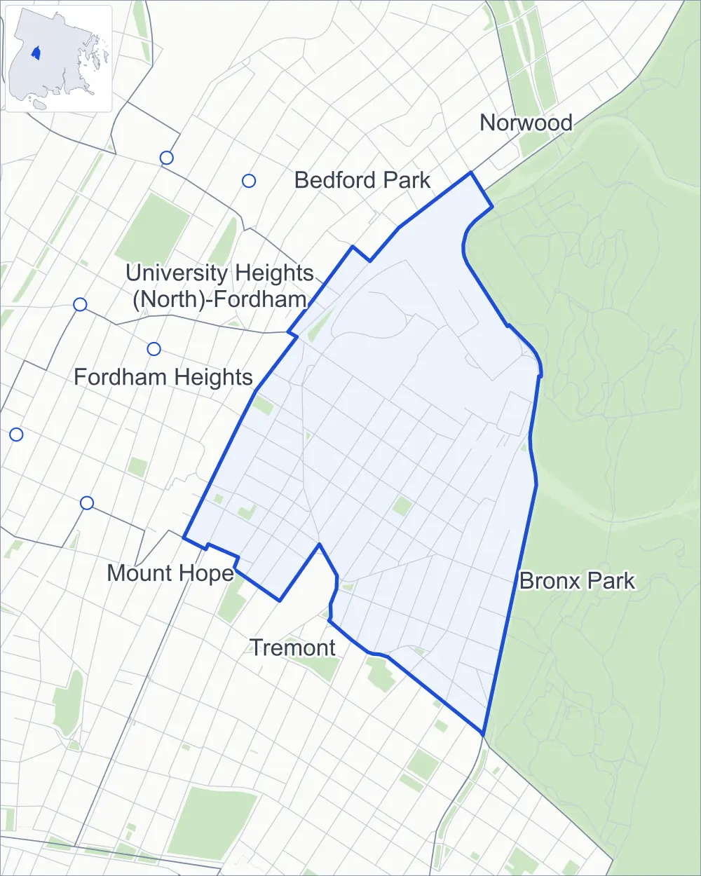
- Belmont
- A neighboring area
- Park
- Another station
Neighborhood areas and streets: NYC Department of City Planning. Parks: NYC Parks. Stations: MTA.
Neighboring areas
- Bedford Park north
- Norwood north
- Bronx Park east
- Tremont south
- Mount Hope southwest
- Fordham Heights west
- University Heights (North)-Fordham northwest
Getting around
Buses on 11 routes stop in or at the edge of Belmont.
- 11 local bus routes
Local bus routes
- Bx9
- Bx12
- Bx12-SBS
- Bx15
- Bx17
- Bx19
- Bx22
- Bx25
- Bx26
- Bx41
- Bx41-SBS
Safety record
Between 2021 and 2025, its corners averaged more police-reported crashes than the average Bronx corner.
- 1,357 police-reported crashes at its corners
- 11.8 a corner, on average
- 8.0 the average Bronx corner
- 7 corners with a clean record
Signal or safety changes on City record, at 40 of its corners
- Leading pedestrian intervals
- 28
- Accessible pedestrian signals
- 23
- Barnes Dance all-way crossings
- 5
- Safety Improvement Projects
- 3
- Turn calming
- 2
- Enhanced crossings
- 1
Camera tickets
In 2025 its corners had more bus-lane camera tickets than school-zone speed or red-light tickets.
- 0 red-light camera tickets
- 7,755 school-zone speed camera tickets at six corners
- 10,522 bus-lane camera tickets at three corners
- Most speed tickets
- Southern Boulevard & East 187th Street, 5,306
- Most bus-lane tickets
- Webster Avenue & East 194th Street, 5,421
People and homes
The 2020 Census counted 35,825 residents in Belmont, about 60,700 per square mile.
- 12,658 homes, 2020 Census
- 2,045 homes added since April 2010, net, by City Planning's count
Half of its 1,286 residential lots hold buildings from 1920 or earlier, and 79% of them date from before 1940, by the City's tax lot records.
Parks and landmarks
- Parkland
- 3.6 acres of NYC Parks property
- The largest pieces
- Ciccarone Park (0.8 acre), Webster Playground (0.8 acre) and Rose Hill Park (0.7 acre)
- Designated landmarks
- The Engine Company 88 / Ladder Company 38, the Alumni House, Saint John's Hall and Saint John's Church
Streets and trees
- Trees
- 2,279 in NYC Parks' records, most often thornless honeylocust, London planetree and Japanese zelkova
- Street with the most corners
- East 187th Street, with 15 of the area's 115
- Height above sea level
- From 40 feet at Webster Avenue & East 183rd Street to 104 feet at Cambreleng Avenue & Grote Street
- Honorary street names
- 18 at its corners, enacted by local law
Schools and libraries
The City lists 21 schools and one library in Belmont.
- Public schools
- 18
- Charter and private schools
- 3
- Library
- Belmont Library and Enrico Fermi Cultural Center
Bike share and public art
By the station list of October 3, 2026, 12 bike-share stations stand in Belmont. The City's public art inventory lists one work in the area: Christopher Columbus (1926).
- 12 bike-share stations
- 1 work of public art
Public safety
How complaints are countedIn 2025 the NYPD recorded 732 major felonies at places in Belmont.
Recorded by the NYPD at places in Belmont
- 873 major felonies in 2024 141 fewer in 2025
- 2,341 other felonies, misdemeanors and violations in 2025
In 2025, on the streets along the edge of Belmont, the NYPD recorded another 314 major felonies. Counting the streets along its edge, in 2025 the NYPD recorded 29.2 major felonies for every thousand residents the 2020 Census counted in Belmont.
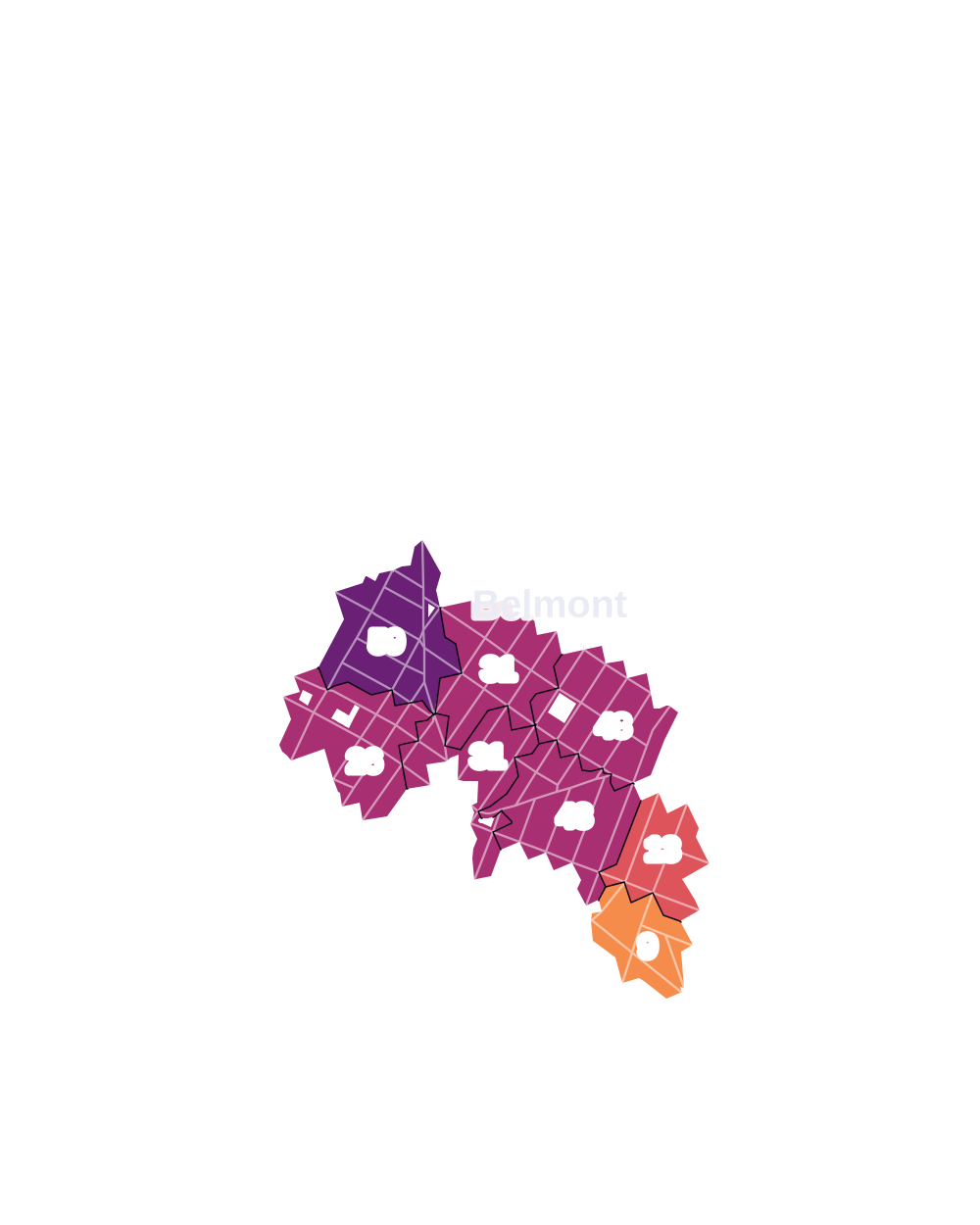
- 5 to 9
- 10 to 19
- 20 to 49
- 50 to 99
- 100 or more
- Not shaded: fewer than 5, held back under the rules in How complaints are counted, parks and public-housing grounds, and land in no patch
- Police precincts
- 48th (most of the area), 52nd
From January to June 2026 the NYPD recorded 340 major felonies at places in Belmont, against 373 in the same months of 2025.
Sources: the NYPD's Complaint Data Historic, updated April 28, 2026, and Complaint Data Current (Year To Date), updated July 27, 2026, on NYC Open Data. Figures to June 30, 2026.
Street corners
- 3rd Avenue & Bassford Avenue
- 3rd Avenue & Bathgate Avenue
- 3rd Avenue & Cyrus Place
- 3rd Avenue & East 184th Street
- 3rd Avenue & East 186th Street
- 3rd Avenue & East 187th Street
- 3rd Avenue & East 188th Street
- 3rd Avenue & East 189th Street
- 3rd Avenue & East Fordham Road
- 3rd Avenue & Lorillard Place
- 3rd Avenue & Washington Avenue
- Arthur Avenue & East 184th Street
- Arthur Avenue & East 186th Street
- Arthur Avenue & East 187th Street
- Arthur Avenue & East 188th Street
- Arthur Avenue & East 189th Street
- Bassford Avenue & Fletcher Place
- Bathgate Avenue & East 182nd Street
- Bathgate Avenue & East 183rd Street
- Bathgate Avenue & East 184th Street
- Bathgate Avenue & East 187th Street
- Bathgate Avenue & East 188th Street
- Bathgate Avenue & East 189th Street
- Belmont Avenue & Crescent Avenue
- Belmont Avenue & East 186th Street
- Belmont Avenue & East 187th Street
- Belmont Avenue & East 188th Street
- Belmont Avenue & East 189th Street
- Cambreleng Avenue & Crescent Avenue
- Cambreleng Avenue & Grote Street
- Constitution Row & Mill River Road
- Crescent Avenue & Adams Place
- Crotona Avenue & East 183rd Street
- Crotona Avenue & East 187th Street
- Crotona Avenue & East 189th Street
- Crotona Avenue & Garden Street
- Crotona Avenue & Grote Street
- Decatur Avenue & East 195th Street
- East 182nd Street & Belmont Avenue
- East 183rd Street & Adams Place
- East 183rd Street & Bassford Avenue
- East 183rd Street & Beaumont Avenue
- East 183rd Street & Belmont Avenue
- East 183rd Street & Cambreleng Avenue
- East 183rd Street & Hughes Avenue
- East 184th Street & Bassford Avenue
- East 185th Street & Bassford Avenue
- East 186th Street & Crescent Avenue
- East 187th Street & Beaumont Avenue
- East 187th Street & Cambreleng Avenue
- East 187th Street & Crescent Avenue
- East 187th Street & Hoffman Street
- East 187th Street & Lorillard Place
- East 188th Street & Beaumont Avenue
- East 188th Street & Cambreleng Avenue
- East 188th Street & Hoffman Street
- East 188th Street & Lorillard Place
- East 189th Street & Beaumont Avenue
- East 189th Street & Cambreleng Avenue
- East 189th Street & Hoffman Street
- East 189th Street & Lorillard Place
- East 191st Street & Hoffman Street
- East Fordham Road & Arthur Avenue
- East Fordham Road & Bathgate Avenue
- East Fordham Road & Crotona Avenue
- East Fordham Road & Hoffman Street
- East Fordham Road & Hughes Avenue
- East Fordham Road & Lorillard Place
- East Fordham Road & Washington Avenue
- Grote Street & Beaumont Avenue
- Grote Street & Garden Street
- Grote Street & Old Kingsbridge Road
- Hughes Avenue & Crescent Avenue
- Hughes Avenue & East 186th Street
- Hughes Avenue & East 187th Street
- Hughes Avenue & East 188th Street
- Hughes Avenue & East 189th Street
- Hughes Avenue & East 191st Street
- Old Elm Road & Fordham University Path
- Old Elm Road & Mill River Road
- Park Avenue & East 183rd Street
- Park Avenue & East 187th Street
- Park Avenue & East 188th Street
- Park Avenue & East 189th Street
- Prospect Avenue & East 182nd Street
- Prospect Avenue & East 183rd Street
- Prospect Avenue & East 185th Street
- Prospect Avenue & East 187th Street
- Prospect Avenue & Garden Street
- Prospect Avenue & Grote Street
- Southern Boulevard & Bedford Park Boulevard
- Southern Boulevard & Crotona Parkway
- Southern Boulevard & East 183rd Street
- Southern Boulevard & East 185th Street
- Southern Boulevard & East 187th Street
- Southern Boulevard & East Fordham Road
- Southern Boulevard & Fordham University Path
- Southern Boulevard & Grote Street
- Southern Boulevard & Old Kingsbridge Road
- Southern Boulevard & Southern Boulevard Entrance Path
- Southern Boulevard & Xavier Way (north-west)
- Southern Boulevard & Xavier Way (south-east)
- Washington Avenue & East 182nd Street at Fletcher Place
- Washington Avenue & East 183rd Street
- Washington Avenue & East 184th Street
- Washington Avenue & East 185th Street
- Washington Avenue & East 186th Street
- Washington Avenue & East 187th Street
- Washington Avenue & East 188th Street
- Washington Avenue & East 189th Street
- Webster Avenue & East 183rd Street
- Webster Avenue & East 193rd Street
- Webster Avenue & East 194th Street
- Webster Avenue & East Fordham Road
- Webster Avenue & Ford Street
How the figures above are measured: Methodology.