Woodlawn Cemetery
Cemetery · Bronx
Woodlawn Cemetery covers about 400 acres of rolling ground in the Bronx, just south of Woodlawn Heights and overlooking the Bronx River.
- 0.64 square miles
- 1 street corner
- 5 bus routes
It opened in 1863, during the Civil War, on land that was then part of Westchester County, and from 1867 its trustees began moving from the rural-cemetery style toward a lawn-cemetery plan. It holds more than 300,000 graves and nearly 1,300 private mausoleums, many designed by leading architects and landscape designers, and was named a National Historic Landmark in 2011. A nonprofit conservancy, begun in 1999, offers tours and educational programs.
Sources: Woodlawn Cemetery (Bronx, New York) (Wikipedia); Our History (The Woodlawn Cemetery); Woodlawn Cemetery - Bronx (The Cultural Landscape Foundation).
Woodlawn Cemetery borders four areas.
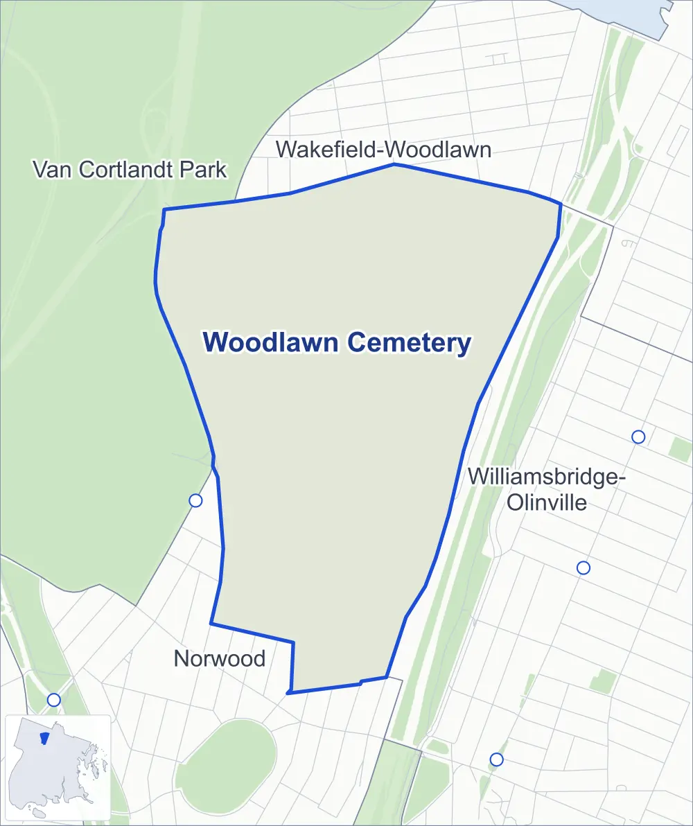
- Woodlawn Cemetery
- A neighboring area
- Park
- Another station
Neighborhood areas and streets: NYC Department of City Planning. Parks: NYC Parks. Stations: MTA.
Neighboring areas
- Wakefield-Woodlawn north
- Williamsbridge-Olinville east
- Norwood south
- Van Cortlandt Park northwest
Getting around
Buses on five routes stop in or at the edge of Woodlawn Cemetery.
- 4 local bus routes
- 1 express bus route
Local bus routes
- Bx16
- Bx31
- Bx34
- BX95
Express bus route
- BxM4
Safety record
Between 2021 and 2025, police reported 1 crash at its one corner; the average Bronx corner had 8.0.
Camera tickets
In 2025 the Department of Finance recorded no red-light, school-zone speed or bus-lane camera ticket at its corners.
Streets and trees
- Trees
- 328 in NYC Parks' records, most often Japanese tree lilac, eastern redbud and hawthorn
The corner
How the figures above are measured: Methodology.