Gravesend (South)
Neighborhood · Brooklyn
Gravesend (South) is the lower end of Gravesend, in south-central Brooklyn, running down to the Belt Parkway, with Coney Island just to the south.
- 0.93 square miles
- 30,366 residents, 2020 Census
- 134 street corners
- 3 subway stations
- 10 bus routes
Gravesend began as a town settled under a 1645 patent granted to Lady Deborah Moody, an Englishwoman who brought religious dissenters here from Lynn, Massachusetts, and it was the only English community in a largely Dutch area. The City of Brooklyn annexed the town in 1894. The area holds the 74-acre Coney Island Complex, a subway yard built in 1926 on former marshland and the largest rapid transit yard in New York State.
Sources: Gravesend Cemetery (LP-0921) (NYC Landmarks Preservation Commission); Gravesend, Brooklyn (Wikipedia); List of New York City Subway yards (Wikipedia); Coney Island (Wikipedia).
Gravesend (South) borders six areas, and Avenue Z holds more of its corners than any other street, 16 of 134.
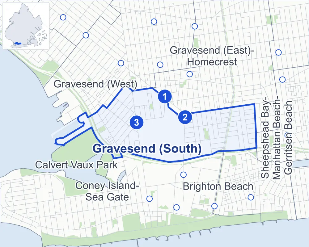
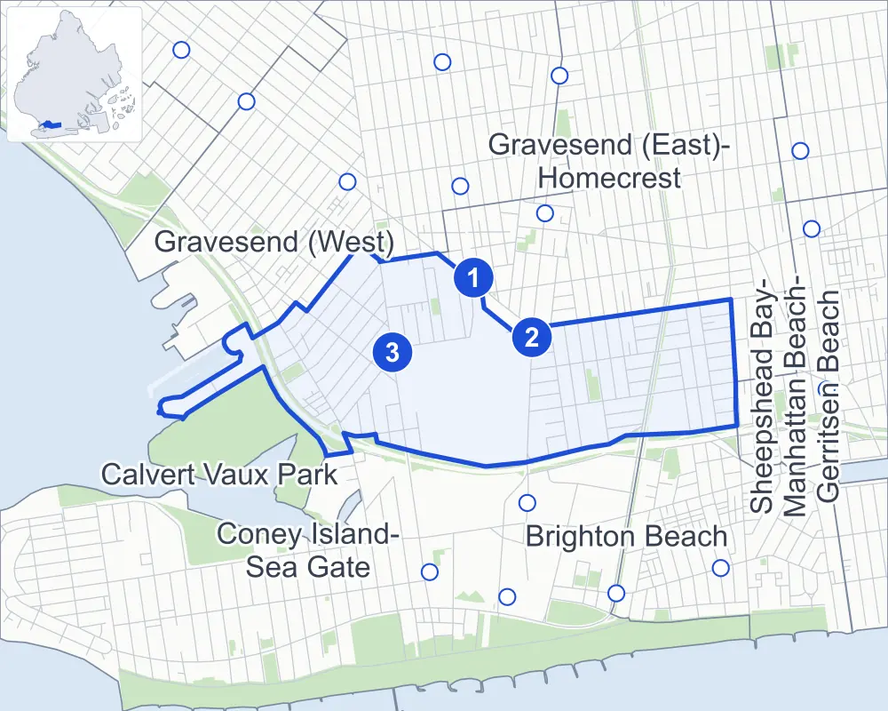
- Gravesend (South)
- A neighboring area
- Park
- A station in the list
- Another station
Neighborhood areas and streets: NYC Department of City Planning. Parks: NYC Parks. Stations: MTA.
Neighboring areas
- Gravesend (East)-Homecrest northeast
- Brighton Beach east
- Sheepshead Bay-Manhattan Beach-Gerritsen Beach east
- Coney Island-Sea Gate south
- Calvert Vaux Park west
- Gravesend (West) northwest
Subway stations
- 86 St lines N
- Avenue X lines F
- Bay 50 St lines D
Getting around
Three subway stations and buses on ten routes stop in or at the edge of Gravesend (South).
- 3 subway stations
- 8 local bus routes
- 2 express bus routes
Local bus routes
- B1
- B4
- B6
- B36
- B64
- B68
- B82
- B90
Express bus routes
- X28
- X38
Safety record
Between 2021 and 2025, its corners averaged fewer police-reported crashes than the average Brooklyn corner.
- 876 police-reported crashes at its corners
- 6.5 a corner, on average
- 10.5 the average Brooklyn corner
- 18 corners with a clean record
Signal or safety changes on City record, at 14 of its corners
- Accessible pedestrian signals
- 8
- Leading pedestrian intervals
- 7
- Turn calming
- 2
- Barnes Dance all-way crossings
- 1
Camera tickets
In 2025 its corners had more school-zone speed camera tickets than red-light or bus-lane tickets.
- 0 red-light camera tickets
- 10,074 school-zone speed camera tickets at seven corners
- 0 bus-lane camera tickets
- Most speed tickets
- Cropsey Avenue & Bay 47th Street, 6,964
People and homes
The 2020 Census counted 30,366 residents in Gravesend (South), about 32,700 per square mile.
- 12,099 homes, 2020 Census
- 247 homes added since April 2010, net, by City Planning's count
Half of its 2,250 residential lots hold buildings from 1945 or earlier, and 43% of them date from before 1940, by the City's tax lot records.
NYCHA development
NYCHA's Marlboro development lies wholly or partly within Gravesend (South).
Parks
- Parkland
- 5.3 acres of NYC Parks property
- The largest pieces
- West Playground (2.4 acres), Calvert Vaux Park (1.9 acres) and Marlboro Playground (1.1 acres)
Streets and trees
- Trees
- 2,149 in NYC Parks' records, most often London planetree, thornless honeylocust and pin oak
- Street with the most corners
- Avenue Z, with 16 of the area's 134
- Height above sea level
- From 5 feet at Bath Avenue & Bay 46th Street to 18 feet at Avenue W & West 7th Street
- Honorary street names
- 6 at its corners, enacted by local law
Schools
The City lists 13 schools in Gravesend (South).
- Public schools
- 10
- Charter and private schools
- 3
Public safety
How complaints are countedIn 2025 the NYPD recorded 227 major felonies at places in Gravesend (South).
Recorded by the NYPD at places in Gravesend (South)
- 188 major felonies in 2024
- 808 other felonies, misdemeanors and violations in 2025
In 2025, on the streets along the edge of Gravesend (South), the NYPD recorded another 69 major felonies. Counting the streets along its edge, in 2025 the NYPD recorded 9.7 major felonies for every thousand residents the 2020 Census counted in Gravesend (South).
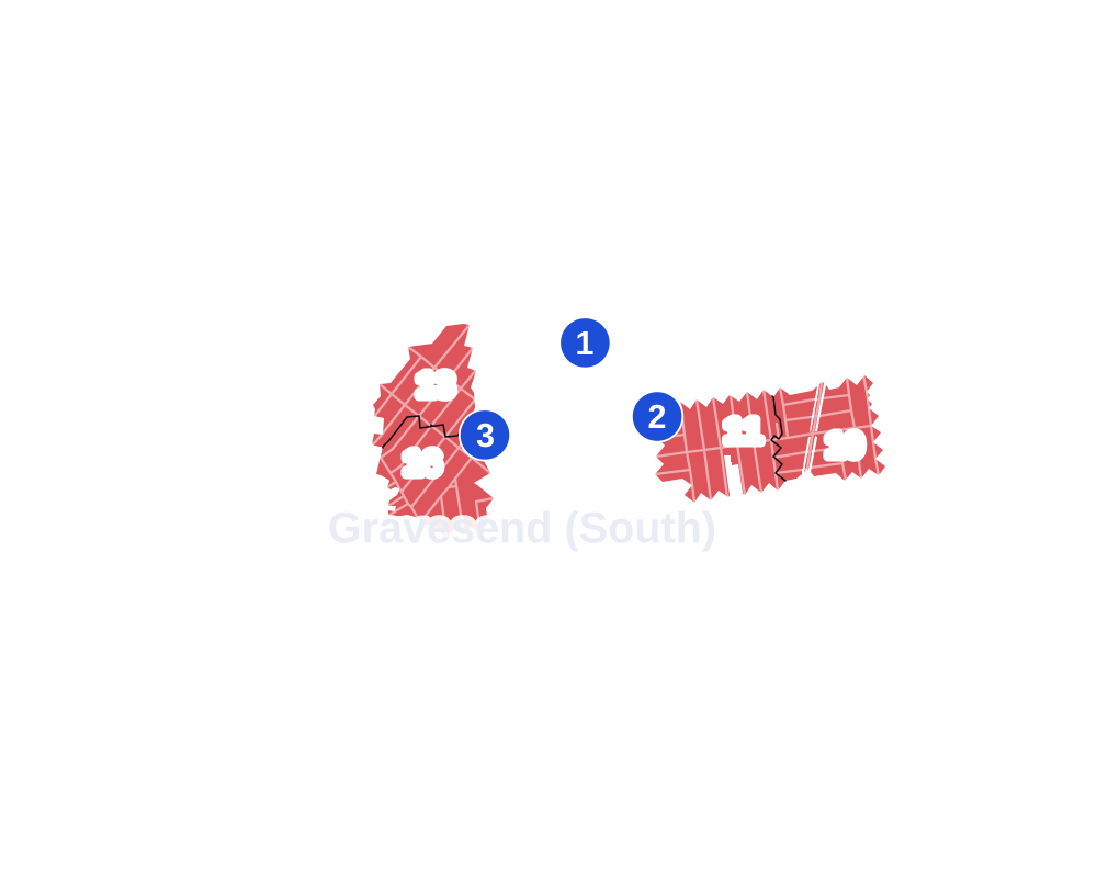
- 5 to 9
- 10 to 19
- 20 to 49
- 50 to 99
- 100 or more
- Not shaded: fewer than 5, held back under the rules in How complaints are counted, parks and public-housing grounds, and land in no patch
- Police precincts
- 60th (most of the area), 61st
From January to June 2026 the NYPD recorded 98 major felonies at places in Gravesend (South), against 105 in the same months of 2025.
Sources: the NYPD's Complaint Data Historic, updated April 28, 2026, and Complaint Data Current (Year To Date), updated July 27, 2026, on NYC Open Data. Figures to June 30, 2026.
Street corners
- 27th Avenue & Harway Avenue
- 27th Avenue & Mill Road
- 86th Street & Avenue V
- 86th Street & West 9th Street
- Avenue V & West 13th Street
- Avenue W & West 7th Street
- Avenue W & West 11th Street
- Avenue W & West 12th Street
- Avenue W & West 13th Street
- Avenue X & Boynton Place
- Avenue X & Hubbard Street
- Avenue X & Stillwell Avenue
- Avenue X & West 3rd Street
- Avenue X & West 11th Street
- Avenue X & West 12th Street
- Avenue X & West 13th Street
- Avenue Y & East 1st Street
- Avenue Y & East 6th Street
- Avenue Y & Hubbard Street
- Avenue Y & Shell Road
- Avenue Y & West 1st Street
- Avenue Y & West 2nd Street
- Avenue Y & West 3rd Street
- Avenue Y & West Street
- Avenue Z & Belt Parkway
- Avenue Z & East 1st Street
- Avenue Z & East 6th Street
- Avenue Z & Hubbard Street
- Avenue Z & Shell Road
- Avenue Z & West 1st Street
- Avenue Z & West 2nd Street
- Avenue Z & West 3rd Street
- Avenue Z & West 13th Street
- Avenue Z & West 15th Street
- Avenue Z & West 16th Street
- Avenue Z & West Street
- Bath Avenue & 27th Avenue
- Bath Avenue & 28th Avenue
- Bath Avenue & Bay 44th Street
- Bath Avenue & Bay 46th Street
- Bath Avenue & Bay 47th Street
- Bay 43rd Street & Hunter Avenue
- Bay 44th Street & Hunter Avenue
- Bay 44th Street & Mill Road
- Bay 50th Street & Private Catanzaro Square
- Belt Parkway & 26th Avenue
- Belt Parkway & Cropsey Avenue
- Benson Avenue & Bay 43rd Street
- Coney Island Avenue & Avenue Y
- Coney Island Avenue & Gerald Court
- Coney Island Avenue & Montauk Court
- Cropsey Avenue & 26th Avenue
- Cropsey Avenue & 27th Avenue
- Cropsey Avenue & 28th Avenue
- Cropsey Avenue & Bay 43rd Street
- Cropsey Avenue & Bay 44th Street
- Cropsey Avenue & Bay 46th Street
- Cropsey Avenue & Bay 47th Street
- Cropsey Avenue & Bay 48th Street
- Cropsey Avenue & Bay 49th Street
- Cropsey Avenue & Bay 50th Street
- East 2nd Street & Avenue Y
- East 2nd Street & Avenue Z
- East 2nd Street & Brighton Court
- East 2nd Street & Manhattan Court
- East 3rd Street & Avenue X
- East 3rd Street & Avenue Y
- East 3rd Street & Ocean Court
- East 3rd Street & Parkway Court
- East 4th Street & Avenue X
- East 6th Street & Brighton Court
- East 6th Street & Manhattan Court
- East 7th Street & Avenue X
- East 7th Street & Avenue Y
- East 7th Street & Avenue Z
- East 7th Street & Desmond Court
- East 7th Street & Dunne Court
- East 7th Street & Gerald Court
- East 7th Street & Kathleen Place
- East 7th Street & Manor Court
- East 7th Street & Montauk Court
- Harway Avenue & 26th Avenue
- Harway Avenue & 28th Avenue
- Harway Avenue & Bay 43rd Street
- Harway Avenue & Bay 44th Street
- Harway Avenue & Bay 46th Street
- Harway Avenue & Bay 47th Street
- Harway Avenue & Bay 49th Street
- Harway Avenue & Bay 50th Street
- Hubbard Street & Ocean Court
- Hubbard Street & Parkway Court
- McDonald Avenue & 86th Street
- Ocean Parkway & Avenue Y
- Ocean Parkway & Avenue Z
- Shell Road & Cobeck Court
- Shell Road & Dank Court
- Shore Parkway & 27th Avenue
- Shore Parkway & Bay 44th Street
- Shore Parkway & Bay 46th Street
- Shore Parkway & Bay 48th Street
- Shore Parkway & Bay 49th Street
- Shore Parkway & Bay 50th Street
- Shore Parkway & Belt Parkway
- Shore Parkway & Belt Parkway (Exit 6)
- Shore Parkway & Belt Parkway (Exit 7A)
- Shore Parkway & Colby Court
- Shore Parkway & Cropsey Avenue
- Shore Parkway & East 6th Street
- Shore Parkway & Ocean Parkway
- Shore Parkway & West 3rd Street
- Shore Parkway & West 15th Street
- Stillwell Avenue & 27th Avenue
- Stillwell Avenue & 28th Avenue
- Stillwell Avenue & Avenue W
- Stillwell Avenue & Avenue Z
- Stillwell Avenue & Bath Avenue
- Stillwell Avenue & Bay 46th Street
- Stillwell Avenue & Bay 47th Street
- Stillwell Avenue & Bay 49th Street
- Stillwell Avenue & Bay 50th Street
- Stillwell Avenue & Harway Avenue
- Stillwell Avenue & West 15th Place
- West 3rd Street & Atwater Court
- West 3rd Street & Bokee Court
- West 3rd Street & Bouck Court
- West 3rd Street & Cobeck Court
- West 3rd Street & Dank Court
- West 7th Street & Boynton Place
- West 15th Street & West 15th Place
- West 16th Street & Bay 50th Street
- West 16th Street & Private Catanzaro Square
- West 17th Street & Bay 50th Street
- West Street & Murdock Court
- West Street & Nixon Court
How the figures above are measured: Methodology.