Gravesend (West)
Neighborhood · Brooklyn
The western part of Gravesend, this area extends from Bay Parkway eastward and from around Avenue P south to the Belt Parkway.
- 1.21 square miles
- 60,523 residents, 2020 Census
- 211 street corners
- 6 subway stations
- 10 bus routes
Gravesend began with a land patent granted on December 19, 1645, to Lady Deborah Moody and a band of English settlers, making it the first English settlement in New York and one of the first towns founded by a woman. It became one of the six original towns of Kings County and stayed independent until the City of Brooklyn annexed it in 1894.
Sources: Gravesend, Brooklyn (Wikipedia); Gravesend Park History (NYC Parks).
Gravesend (West) borders five areas, and Kings Highway and Stillwell Avenue hold more of its corners than any other street, 20 each of 211.
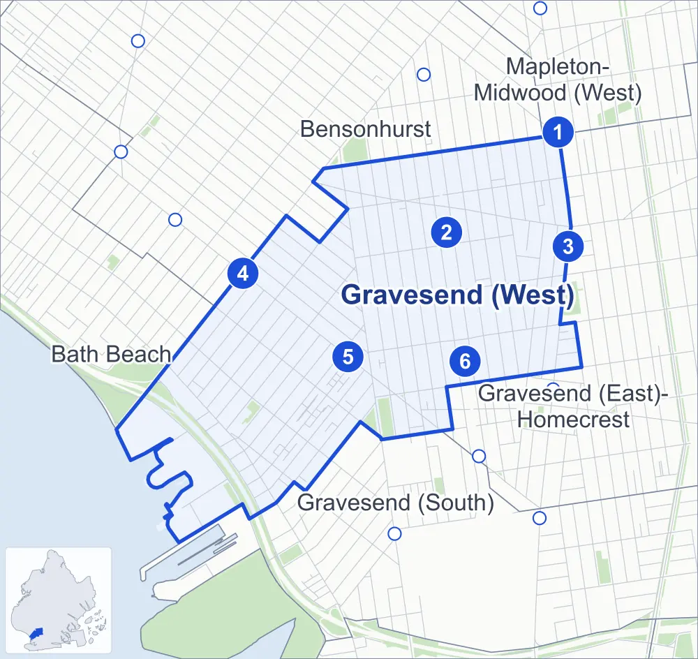
- Gravesend (West)
- A neighboring area
- Park
- A station in the list
- Another station
Neighborhood areas and streets: NYC Department of City Planning. Parks: NYC Parks. Stations: MTA.
Neighboring areas
- Bensonhurst north
- Mapleton-Midwood (West) northeast
- Gravesend (East)-Homecrest east
- Gravesend (South) south
- Bath Beach west
Subway stations
- Avenue P lines F
- Kings Hwy lines N
- Kings Hwy lines F accessible
- Bay Pkwy lines D accessible
- 25 Av lines D
- Avenue U lines N
Getting around
Six subway stations and buses on ten routes stop in or at the edge of Gravesend (West).
- 6 subway stations
- 2 of them listed by the MTA as fully accessible
- 8 local bus routes
- 2 express bus routes
Local bus routes
- B1
- B3
- B4
- B6
- B64
- B82
- B82-SBS
- B90
Express bus routes
- X28
- X38
Safety record
Between 2021 and 2025, its corners averaged fewer police-reported crashes than the average Brooklyn corner.
- 1,505 police-reported crashes at its corners
- 7.1 a corner, on average
- 10.5 the average Brooklyn corner
- 11 corners with a clean record
Signal or safety changes on City record, at 52 of its corners
- Leading pedestrian intervals
- 38
- Accessible pedestrian signals
- 27
- Turn calming
- 7
- Barnes Dance all-way crossings
- 2
- Safety Improvement Projects
- 1
Camera tickets
In 2025 its corners had more school-zone speed camera tickets than red-light or bus-lane tickets.
- 0 red-light camera tickets
- 14,251 school-zone speed camera tickets at 12 corners
- 0 bus-lane camera tickets
- Most speed tickets
- Bay Parkway & Benson Avenue, 4,820
People and homes
The 2020 Census counted 60,523 residents in Gravesend (West), about 50,000 per square mile.
- 21,754 homes, 2020 Census
- 972 homes added since April 2010, net, by City Planning's count
Half of its 6,442 residential lots hold buildings from 1930 or earlier, and 74% of them date from before 1940, by the City's tax lot records.
Parks and landmarks
- Parkland
- 5.7 acres of NYC Parks property
- The largest pieces
- Police Officer John G. Scarangella Park (3.3 acres), Lafayette Playground (1.2 acres) and Bath Playground (1.1 acres)
- Designated landmark
- The Fire Engine Company 253
Streets and trees
- Trees
- 4,211 in NYC Parks' records, most often London planetree, thornless honeylocust and pin oak
- Street with the most corners
- Kings Highway, with 20 of the area's 211
- Height above sea level
- From 6 feet at Shore Parkway & Bay Parkway at Belt Parkway to 31 feet at Kings Highway & 78th Street at Bay Parkway
- Honorary street names
- 7 at its corners, enacted by local law
Schools and libraries
The City lists 15 schools and two libraries in Gravesend (West).
- Public schools
- 7
- Charter and private schools
- 8
- Libraries
- Highlawn Library and Ulmer Park Library
Public art
The City's public art inventory lists one work in Gravesend (West): Antonio Meucci Memorial (1989).
- 1 work of public art
Public safety
How complaints are countedIn 2025 the NYPD recorded 330 major felonies at places in Gravesend (West).
Recorded by the NYPD at places in Gravesend (West)
- 335 major felonies in 2024
- 1,243 other felonies, misdemeanors and violations in 2025
In 2025, on the streets along the edge of Gravesend (West), the NYPD recorded another 141 major felonies. Counting the streets along its edge, in 2025 the NYPD recorded 7.8 major felonies for every thousand residents the 2020 Census counted in Gravesend (West).
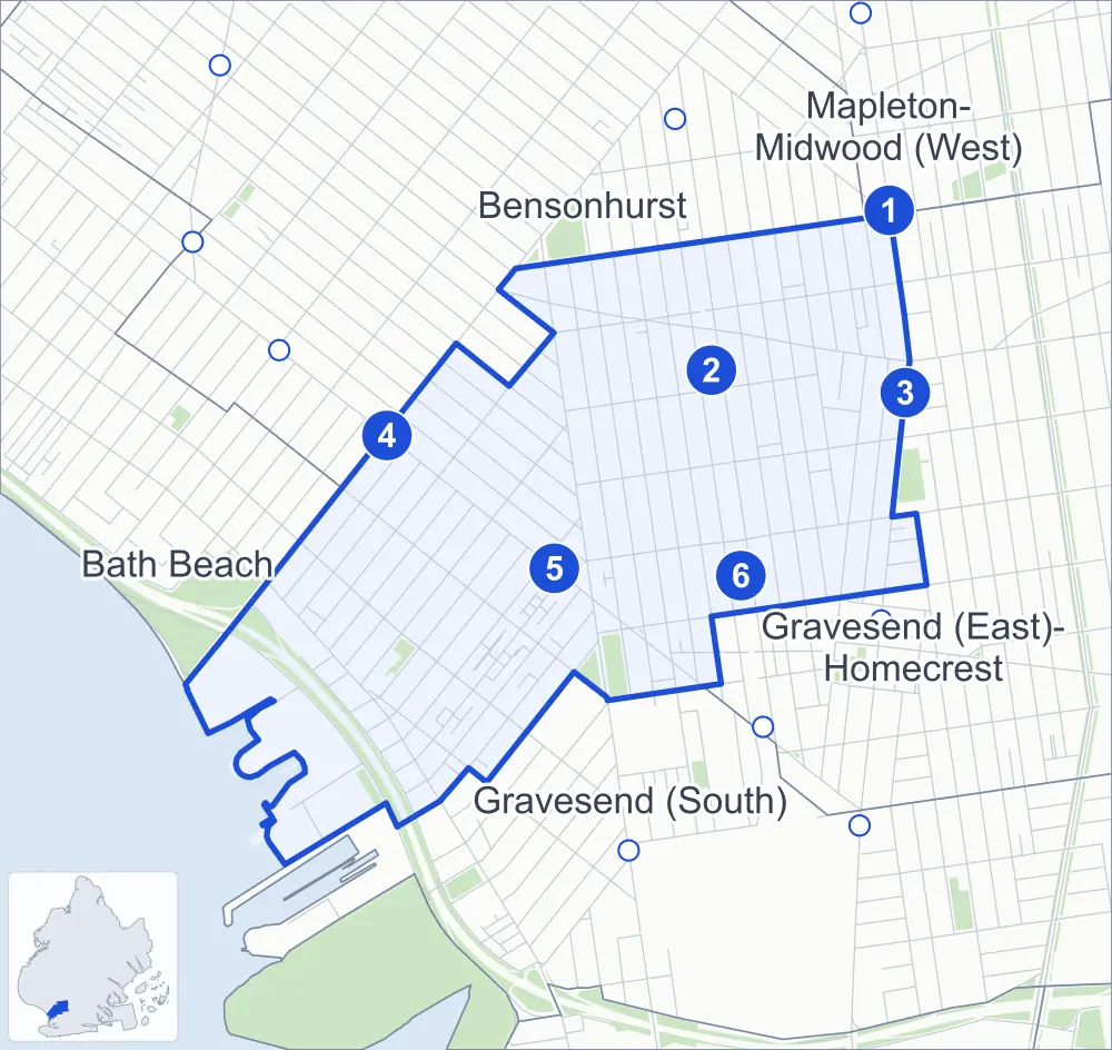
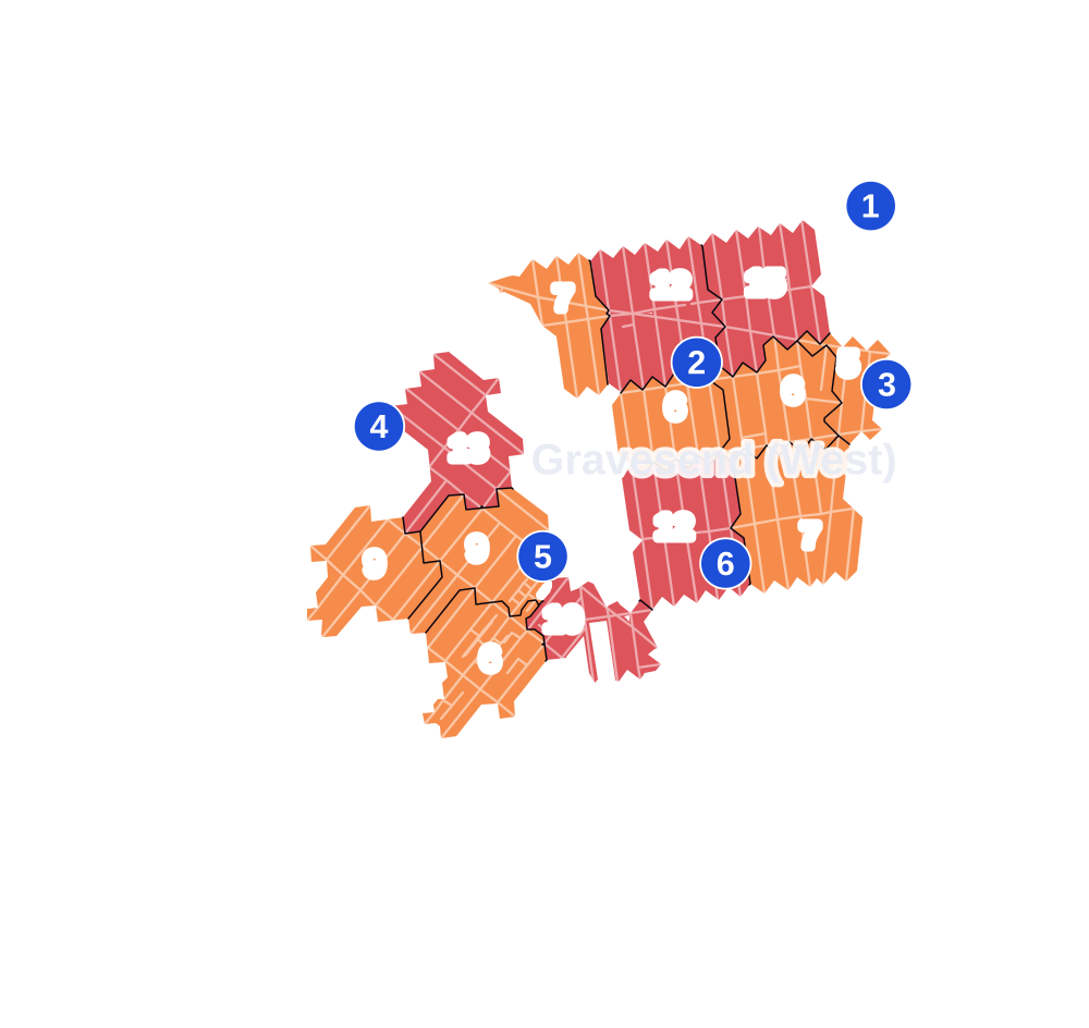
- 5 to 9
- 10 to 19
- 20 to 49
- 50 to 99
- 100 or more
- Not shaded: fewer than 5, held back under the rules in How complaints are counted, parks and public-housing grounds, and land in no patch
- Police precincts
- 62nd (most of the area), 60th, 61st
From January to June 2026 the NYPD recorded 175 major felonies at places in Gravesend (West), against 162 in the same months of 2025.
Sources: the NYPD's Complaint Data Historic, updated April 28, 2026, and Complaint Data Current (Year To Date), updated July 27, 2026, on NYC Open Data. Figures to June 30, 2026.
Street corners
- 25th Avenue & Harway Avenue
- 65th Street & Avenue P
- 79th Street & 23rd Avenue
- 79th Street & Stillwell Avenue
- 80th Street & 23rd Avenue
- 80th Street & Stillwell Avenue
- 81st Street & 23rd Avenue
- 81st Street & 24th Avenue
- 81st Street & Stillwell Avenue
- 82nd Street & 23rd Avenue
- 82nd Street & 24th Avenue
- 82nd Street & Bay Parkway
- 82nd Street & Stillwell Avenue
- 83rd Street & 23rd Avenue
- 83rd Street & 24th Avenue
- 83rd Street & Stillwell Avenue
- 84th Street & 23rd Avenue
- 84th Street & 24th Avenue
- 84th Street & 25th Avenue
- 84th Street & Bay Parkway
- 84th Street & Stillwell Avenue
- 85th Street & 23rd Avenue
- 85th Street & 24th Avenue
- 85th Street & 25th Avenue
- 85th Street & Stillwell Avenue
- 86th Street & 23rd Avenue
- 86th Street & 24th Avenue
- 86th Street & 25th Avenue
- 86th Street & Bay 31st Street
- 86th Street & Bay 32nd Street
- 86th Street & Bay 34th Street
- 86th Street & Bay 35th Street
- 86th Street & Bay 37th Street
- 86th Street & Bay 38th Street
- 86th Street & Bay 40th Street
- 86th Street & Bay 41st Street
- 86th Street & Bay Parkway
- 86th Street & Stillwell Avenue
- 86th Street & West 10th Street
- 86th Street & West 11th Street
- 86th Street & West 12th Street
- 86th Street & West 13th Street
- Avenue P & Bay Parkway
- Avenue P & Dahill Road
- Avenue P & Stillwell Avenue
- Avenue P & West 1st Street
- Avenue P & West 2nd Street
- Avenue P & West 3rd Street
- Avenue P & West 4th Street
- Avenue P & West 5th Street
- Avenue P & West 6th Street
- Avenue P & West 7th Street
- Avenue P & West 11th Street
- Avenue P & West 13th Street
- Avenue S & Lake Street
- Avenue S & Stillwell Avenue
- Avenue S & Van Sicklen Street
- Avenue S & West 3rd Street
- Avenue S & West 4th Street
- Avenue S & West 5th Street
- Avenue S & West 6th Street
- Avenue S & West 7th Street
- Avenue S & West 8th Street
- Avenue S & West 9th Street
- Avenue S & West 10th Street
- Avenue S & West 11th Street
- Avenue S & West 12th Street
- Avenue S & West 13th Street
- Avenue T & Lake Street
- Avenue T & Stillwell Avenue
- Avenue T & Van Sicklen Street
- Avenue T & West 3rd Street
- Avenue T & West 4th Street
- Avenue T & West 5th Street
- Avenue T & West 6th Street
- Avenue T & West 7th Street
- Avenue T & West 8th Street
- Avenue T & West 9th Street
- Avenue T & West 10th Street
- Avenue T & West 11th Street
- Avenue T & West 12th Street
- Avenue T & West 13th Street
- Avenue U & 86th Street
- Avenue U & Lake Street
- Avenue U & Stillwell Avenue
- Avenue U & West 5th Street
- Avenue U & West 6th Street
- Avenue U & West 7th Street
- Avenue U & West 9th Street
- Avenue U & West 10th Street
- Avenue U & West 11th Street
- Avenue U & West 12th Street
- Avenue U & West 13th Street
- Avenue V & Stillwell Avenue
- Avenue V & West 11th Street
- Avenue V & West 12th Street
- Bath Avenue & 23rd Avenue
- Bath Avenue & 24th Avenue
- Bath Avenue & 25th Avenue
- Bath Avenue & 26th Avenue
- Bath Avenue & Bay 31st Street
- Bath Avenue & Bay 32nd Street
- Bath Avenue & Bay 34th Street
- Bath Avenue & Bay 35th Street
- Bath Avenue & Bay 37th Street
- Bath Avenue & Bay 38th Street
- Bath Avenue & Bay 40th Street
- Bath Avenue & Bay 41st Street
- Bath Avenue & Bay 43rd Street
- Bay 41st Street & Harway Avenue
- Bay Parkway & Benson Avenue
- Bay Parkway & Cropsey Avenue
- Belt Parkway & Bay Parkway
- Benson Avenue & 23rd Avenue
- Benson Avenue & 24th Avenue
- Benson Avenue & 25th Avenue
- Benson Avenue & 26th Avenue
- Benson Avenue & Bay 31st Street
- Benson Avenue & Bay 32nd Street
- Benson Avenue & Bay 34th Street
- Benson Avenue & Bay 35th Street
- Benson Avenue & Bay 37th Street
- Benson Avenue & Bay 38th Street
- Benson Avenue & Bay 40th Street
- Benson Avenue & Bay 41st Street
- Cropsey Avenue & 23rd Avenue
- Cropsey Avenue & 24th Avenue
- Cropsey Avenue & 25th Avenue
- Cropsey Avenue & Bay 31st Street
- Cropsey Avenue & Bay 32nd Street
- Cropsey Avenue & Bay 34th Street
- Cropsey Avenue & Bay 35th Street
- Cropsey Avenue & Bay 37th Street
- Cropsey Avenue & Bay 38th Street
- Cropsey Avenue & Bay 40th Street
- Cropsey Avenue & Bay 41st Street
- Harway Avenue & Bay 37th Street
- Harway Avenue & Bay 38th Street
- Harway Avenue & Bay 40th Street
- Kings Highway & 78th Street
- Kings Highway & 78th Street at Bay Parkway
- Kings Highway & Dahill Road
- Kings Highway & Kings Place
- Kings Highway & Lake Street
- Kings Highway & Quentin Road
- Kings Highway & Stillwell Avenue
- Kings Highway & Van Sicklen Street
- Kings Highway & West 1st Street
- Kings Highway & West 2nd Street
- Kings Highway & West 3rd Street
- Kings Highway & West 4th Street
- Kings Highway & West 5th Street
- Kings Highway & West 6th Street
- Kings Highway & West 7th Street
- Kings Highway & West 8th Street
- Kings Highway & West 9th Street
- Kings Highway & West 11th Street
- Kings Highway & West 12th Street
- Kings Highway & West 13th Street
- McDonald Avenue & Avenue S
- McDonald Avenue & Avenue T
- McDonald Avenue & Quentin Road
- McDonald Avenue & Sloan Place
- McDonald Avenue & Whitney Place
- Quentin Road & Dahill Road
- Quentin Road & West 1st Street
- Quentin Road & West 2nd Street
- Quentin Road & West 3rd Street
- Quentin Road & West 4th Street
- Quentin Road & West 5th Street
- Quentin Road & West 6th Street
- Quentin Road & West 7th Street
- Quentin Road & West 8th Street
- Quentin Road & West 9th Street
- Quentin Road & West 11th Street
- Quentin Road & West 12th Street
- Quentin Road & West 13th Street
- Shore Parkway & 24th Avenue
- Shore Parkway & 25th Avenue
- Shore Parkway & 26th Avenue
- Shore Parkway & Bay 37th Street
- Shore Parkway & Bay 38th Street
- Shore Parkway & Bay 40th Street
- Shore Parkway & Bay 41st Street
- Shore Parkway & Bay Parkway
- Shore Parkway & Bay Parkway at Belt Parkway
- Shore Parkway & Belt Parkway
- Stillwell Avenue & 24th Avenue
- Stillwell Avenue & 25th Avenue
- Stillwell Avenue & 26th Avenue
- Stillwell Avenue & Bay 43rd Street
- Stillwell Avenue & Benson Avenue
- Stillwell Avenue & Highlawn Avenue
- Van Sicklen Street & Lloyd Court
- West 3rd Street & Applegate Court
- West 3rd Street & Highlawn Avenue
- West 3rd Street & Lloyd Court
- West 4th Street & Applegate Court
- West 4th Street & Highlawn Avenue
- West 5th Street & Highlawn Avenue
- West 6th Street & Highlawn Avenue
- West 7th Street & Highlawn Avenue
- West 8th Street & Highlawn Avenue
- West 9th Street & Highlawn Avenue
- West 10th Street & Highlawn Avenue
- West 10th Street & Lake Place
- West 11th Street & Highlawn Avenue
- West 11th Street & Lake Place
- West 12th Street & Highlawn Avenue
- West 13th Street & Highlawn Avenue
- West Street & Whitney Place
How the figures above are measured: Methodology.