Midwood
Neighborhood · Brooklyn
Bounded on the north by the Brooklyn College campus and the Bay Ridge Branch rail line and on the south by Avenue P and Kings Highway, Midwood is a south-central Brooklyn neighborhood with Avenue J and Avenue M among its shopping streets.
- 1.16 square miles
- 52,891 residents, 2020 Census
- 162 street corners
- 3 subway stations
- 14 bus routes
Its name comes from Midwout, or middle woods, the Dutch settlers' name for the forest here. The area stayed largely rural until it joined the City of Brooklyn in the 1890s and filled with houses and apartments in the 1920s. Vitagraph opened film studios near Avenue M in 1907, and the Van Nuyse-Magaw House, a Dutch Colonial farmhouse from about 1800, became a city landmark in 1969.
Sources: Midwood, Brooklyn (Wikipedia); Van Nuyse-Magaw House (LP-0175) (NYC Landmarks Preservation Commission).
Midwood borders six areas, and Avenue K and Avenue M hold more of its corners than any other street, 20 each of 162.
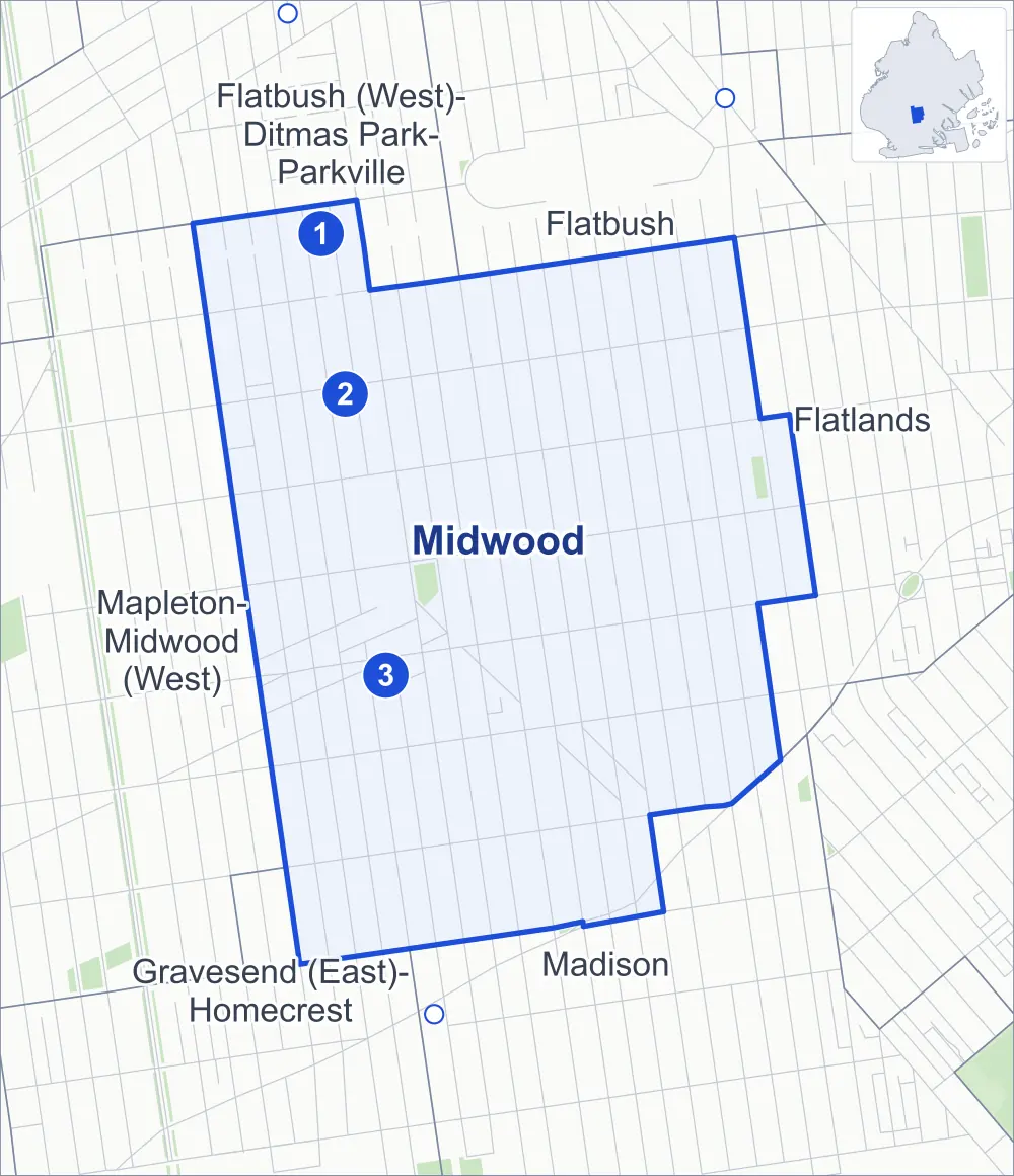
- Midwood
- A neighboring area
- Park
- A station in the list
- Another station
Neighborhood areas and streets: NYC Department of City Planning. Parks: NYC Parks. Stations: MTA.
Neighboring areas
- Flatbush north
- Flatlands east
- Madison south
- Gravesend (East)-Homecrest southwest
- Mapleton-Midwood (West) west
- Flatbush (West)-Ditmas Park-Parkville northwest
Subway stations
- Avenue H lines Q accessible
- Avenue J lines Q
- Avenue M lines Q
Getting around
Three subway stations and buses on 14 routes stop in or at the edge of Midwood.
- 3 subway stations
- 1 of them listed by the MTA as fully accessible
- 11 local bus routes
- 3 express bus routes
Local bus routes
- B6
- B7
- B9
- B11
- B44
- B44-SBS
- B49
- B68
- B82
- B82-SBS
- T464
Express bus routes
- BM1
- BM3
- BM4
Safety record
Between 2021 and 2025, its corners averaged fewer police-reported crashes than the average Brooklyn corner.
- 1,193 police-reported crashes at its corners
- 7.4 a corner, on average
- 10.5 the average Brooklyn corner
- 8 corners with a clean record
Signal or safety changes on City record, at 59 of its corners
- Leading pedestrian intervals
- 37
- Accessible pedestrian signals
- 30
- Turn calming
- 11
- Barnes Dance all-way crossings
- 3
- Safety Improvement Projects
- 1
Camera tickets
In 2025 its corners had more school-zone speed camera tickets than red-light or bus-lane tickets.
- 0 red-light camera tickets
- 16,570 school-zone speed camera tickets at 17 corners
- 0 bus-lane camera tickets
- Most speed tickets
- Ocean Avenue & Bay Avenue, 2,700
People and homes
The 2020 Census counted 52,891 residents in Midwood, about 45,600 per square mile.
- 19,397 homes, 2020 Census
- 1,370 homes added since April 2010, net, by City Planning's count
Half of its 5,338 residential lots hold buildings from 1925 or earlier, and 90% of them date from before 1940, by the City's tax lot records.
Parks and landmarks
- Parkland
- 2.6 acres of NYC Parks property
- The largest pieces
- Kolbert Playground (1.7 acres) and Andries Playground (1 acre)
- Designated landmark
- The Avenue H Station House
Streets and trees
- Trees
- 4,967 in NYC Parks' records, most often London planetree, Japanese zelkova and thornless honeylocust
- Street with the most corners
- Avenue K, with 20 of the area's 162
- Height above sea level
- From 17 feet at East 24th Street & Avenue P to 40 feet at Coney Island Avenue & Avenue I
- Honorary street names
- 5 at its corners, enacted by local law
Schools and libraries
The City lists 30 schools and one library in Midwood.
- Public schools
- 7
- Charter and private schools
- 23
- Library
- Midwood Library
Public safety
How complaints are countedIn 2025 the NYPD recorded 294 major felonies at places in Midwood.
Recorded by the NYPD at places in Midwood
- 282 major felonies in 2024
- 962 other felonies, misdemeanors and violations in 2025
In 2025, on the streets along the edge of Midwood, the NYPD recorded another 82 major felonies. Counting the streets along its edge, in 2025 the NYPD recorded 7.1 major felonies for every thousand residents the 2020 Census counted in Midwood.
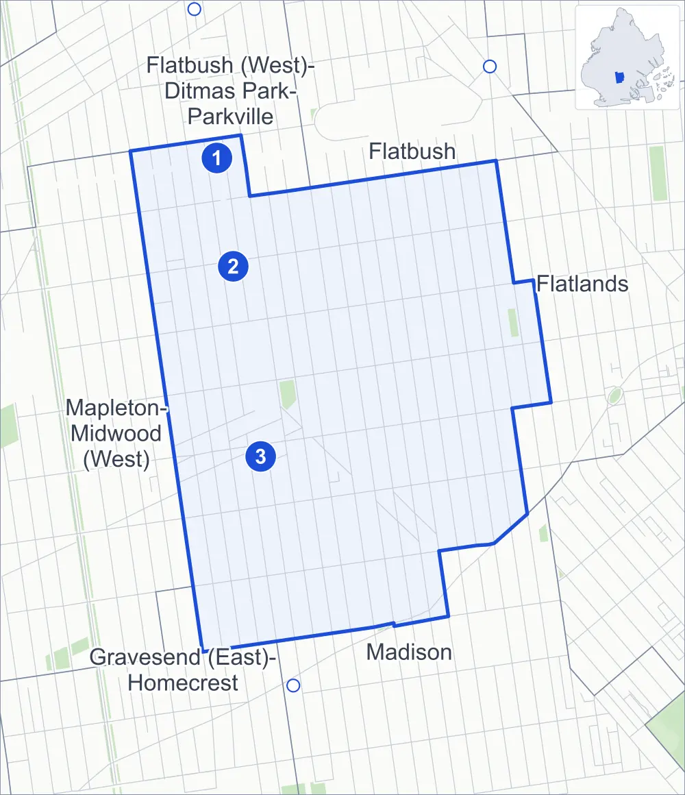
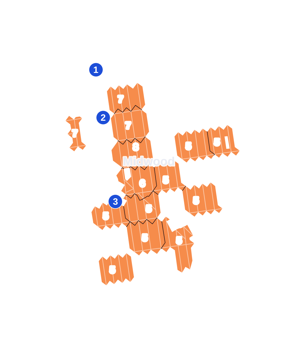
- 5 to 9
- 10 to 19
- 20 to 49
- 50 to 99
- 100 or more
- Not shaded: fewer than 5, held back under the rules in How complaints are counted, parks and public-housing grounds, and land in no patch
- Police precincts
- 70th (most of the area), 63rd, 61st
From January to June 2026 the NYPD recorded 108 major felonies at places in Midwood, against 147 in the same months of 2025.
Sources: the NYPD's Complaint Data Historic, updated April 28, 2026, and Complaint Data Current (Year To Date), updated July 27, 2026, on NYC Open Data. Figures to June 30, 2026.
Street corners
- Avenue J & East 12th Street
- Avenue J & East 13th Street
- Avenue J & East 14th Street
- Avenue J & East 15th Street
- Avenue J & East 16th Street
- Avenue J & East 17th Street
- Avenue J & East 19th Street
- Avenue J & East 23rd Street
- Avenue J & East 24th Street
- Avenue J & East 26th Street
- Avenue J & East 27th Street
- Avenue J & East 28th Street
- Avenue J & East 29th Street
- Avenue K & East 12th Street
- Avenue K & East 13th Street
- Avenue K & East 14th Street
- Avenue K & East 15th Street
- Avenue K & East 16th Street
- Avenue K & East 17th Street
- Avenue K & East 18th Street
- Avenue K & East 19th Street
- Avenue K & East 23rd Street
- Avenue K & East 24th Street
- Avenue K & East 26th Street
- Avenue K & East 27th Street
- Avenue K & East 28th Street
- Avenue K & East 29th Street
- Avenue L & East 12th Street
- Avenue L & East 13th Street
- Avenue L & East 14th Street
- Avenue L & East 15th Street
- Avenue L & East 17th Street
- Avenue L & East 18th Street
- Avenue L & East 19th Street
- Avenue L & East 22nd Street
- Avenue L & East 23rd Street
- Avenue L & East 24th Street
- Avenue L & East 26th Street
- Avenue L & East 27th Street
- Avenue L & East 28th Street
- Avenue L & East 29th Street
- Avenue M & Bay Avenue
- Avenue M & East 12th Street
- Avenue M & East 13th Street
- Avenue M & East 14th Street
- Avenue M & East 15th Street
- Avenue M & East 16th Street
- Avenue M & East 17th Street
- Avenue M & East 18th Street
- Avenue M & East 19th Street
- Avenue M & East 22nd Street
- Avenue M & East 23rd Street
- Avenue M & East 24th Street
- Avenue M & East 26th Street
- Avenue M & East 27th Street
- Avenue M & East 28th Street
- Avenue M & Elm Avenue
- Avenue N & East 12th Street
- Avenue N & East 13th Street
- Avenue N & East 14th Street
- Avenue N & East 15th Street
- Avenue N & East 16th Street
- Avenue N & East 17th Street
- Avenue N & East 18th Street
- Avenue N & East 19th Street
- Avenue N & East 22nd Street
- Avenue N & East 23rd Street
- Avenue N & East 24th Street
- Avenue N & East 26th Street
- Avenue N & East 27th Street
- Avenue N & East 28th Street
- Avenue N & East 29th Street
- Bedford Avenue & Avenue J
- Bedford Avenue & Avenue K
- Bedford Avenue & Avenue L
- Bedford Avenue & Avenue M
- Bedford Avenue & Avenue N
- Coney Island Avenue & Avenue I
- Coney Island Avenue & Avenue J
- Coney Island Avenue & Avenue K
- Coney Island Avenue & Avenue L
- Coney Island Avenue & Avenue M
- Coney Island Avenue & Avenue O
- Coney Island Avenue & Chestnut Avenue
- Coney Island Avenue & Roder Avenue
- East 12th Street & Avenue H
- East 12th Street & Avenue I
- East 12th Street & Avenue O
- East 12th Street & Cary Court
- East 12th Street & Elm Avenue
- East 12th Street & Locust Avenue
- East 13th Street & Avenue H
- East 13th Street & Avenue I
- East 13th Street & Avenue O
- East 13th Street & Avenue P
- East 13th Street & Elm Avenue
- East 13th Street & Locust Avenue
- East 14th Street & Avenue I
- East 14th Street & Avenue O
- East 14th Street & Chestnut Avenue
- East 14th Street & Elm Avenue
- East 14th Street & Locust Avenue
- East 15th Street & Avenue H
- East 15th Street & Avenue I
- East 15th Street & Avenue O
- East 15th Street & Chestnut Avenue
- East 15th Street & East 15th Street Footbridge
- East 15th Street & Elm Avenue
- East 15th Street & Locust Avenue
- East 16th Street & Avenue H
- East 16th Street & Avenue I
- East 16th Street & Avenue O
- East 16th Street & Cedar Street
- East 17th Street & Avenue O
- East 17th Street & Avenue P
- East 17th Street & Bay Avenue
- East 17th Street & Cedar Street
- East 17th Street & Chestnut Avenue
- East 17th Street & Elm Avenue
- East 18th Street & Avenue J
- East 18th Street & Avenue O
- East 18th Street & Elm Avenue
- East 19th Street & Avenue I
- East 19th Street & Avenue O
- East 19th Street & Bay Avenue
- East 21st Street & Avenue J
- East 21st Street & Avenue K
- East 21st Street & Avenue L
- East 21st Street & Avenue M
- East 21st Street & Avenue N
- East 21st Street & Avenue O
- East 21st Street & Bay Avenue
- East 22nd Street & Avenue I
- East 22nd Street & Avenue J
- East 22nd Street & Avenue K
- East 22nd Street & Avenue O
- East 22nd Street & Avenue P
- East 22nd Street & Bay Avenue
- East 22nd Street & Olean Street
- East 23rd Street & Avenue I
- East 23rd Street & Avenue O
- East 23rd Street & Bay Avenue
- East 23rd Street & Olean Street
- East 24th Street & Avenue O
- East 24th Street & Avenue P
- East 24th Street & Olean Street
- East 27th Street & Avenue I
- Kings Highway & East 21st Street
- Kings Highway & East 22nd Street
- Kings Highway & East 23rd Street
- Kings Highway & East 28th Street
- Kings Highway & East 29th Street
- Nostrand Avenue & Avenue K
- Nostrand Avenue & Avenue L
- Ocean Avenue & Avenue I
- Ocean Avenue & Avenue J
- Ocean Avenue & Avenue K
- Ocean Avenue & Avenue L
- Ocean Avenue & Avenue M
- Ocean Avenue & Avenue N
- Ocean Avenue & Avenue O
- Ocean Avenue & Bay Avenue
How the figures above are measured: Methodology.