Madison
Neighborhood · Brooklyn
Just south of Midwood, with Kings Highway along its northern edge, Madison is a residential section of Sheepshead Bay in southern Brooklyn, and it takes its name from James Madison High School.
- 0.98 square miles
- 41,465 residents, 2020 Census
- 154 street corners
- 2 subway stations
- 16 bus routes
Two early houses survive here. The Wyckoff-Bennett Homestead on East 22nd Street, a Dutch Colonial farmhouse built about 1766, housed Hessian officers during the American Revolution and passed to the Bennett family with its farm of about 100 acres in 1835. On East 28th Street, the Elias Hubbard Ryder House, built in 1834 with Dutch Colonial touches, was later moved to its present lot; both are city landmarks.
Sources: Sheepshead Bay, Brooklyn (Wikipedia); Wyckoff-Bennett Homestead (LP-0173) (NYC Landmarks Preservation Commission); Elias Hubbard Ryder House (LP-0920) (NYC Landmarks Preservation Commission).
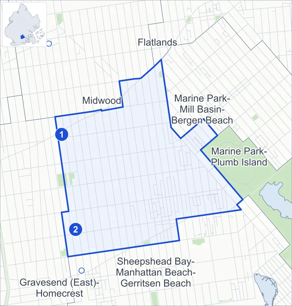
Madison borders six areas, and Avenue T holds more of its corners than any other street, 23 of 154.
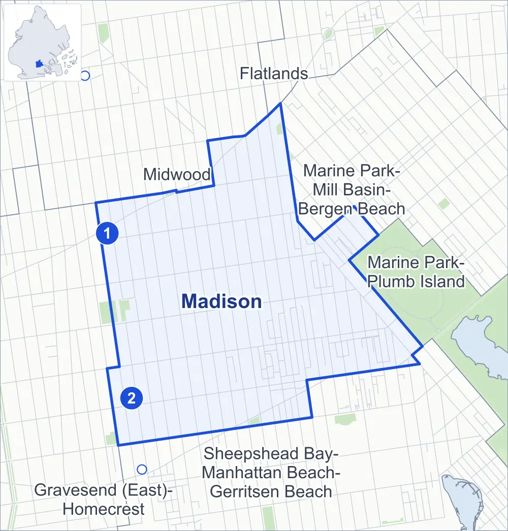
- Madison
- A neighboring area
- Park
- A station in the list
- Another station
Neighborhood areas and streets: NYC Department of City Planning. Parks: NYC Parks. Stations: MTA.
Neighboring areas
- Midwood north
- Flatlands north
- Marine Park-Mill Basin-Bergen Beach northeast
- Marine Park-Plumb Island east
- Sheepshead Bay-Manhattan Beach-Gerritsen Beach southeast
- Gravesend (East)-Homecrest west
Subway stations
- Kings Hwy lines B Q accessible
- Avenue U lines Q
Getting around
Two subway stations and buses on 16 routes stop in or at the edge of Madison.
- 2 subway stations
- 1 of them listed by the MTA as fully accessible
- 14 local bus routes
- 2 express bus routes
Local bus routes
- B2
- B3
- B7
- B31
- B36
- B41
- B44
- B44-SBS
- B49
- B82
- B82-SBS
- B100
- B102
- T464
Express bus routes
- BM3
- BM4
Safety record
Between 2021 and 2025, its corners averaged fewer police-reported crashes than the average Brooklyn corner.
- 1,176 police-reported crashes at its corners
- 7.6 a corner, on average
- 10.5 the average Brooklyn corner
- 8 corners with a clean record
Signal or safety changes on City record, at 82 of its corners
- Leading pedestrian intervals
- 72
- Accessible pedestrian signals
- 26
- Turn calming
- 18
Camera tickets
In 2025 its corners had more school-zone speed camera tickets than bus-lane or red-light tickets.
- 431 red-light camera tickets at one corner
- 15,687 school-zone speed camera tickets at 15 corners
- 1,832 bus-lane camera tickets at four corners
- Most red-light tickets
- Nostrand Avenue & Kings Highway, 431
- Most speed tickets
- Gerritsen Avenue & Ford Street, 3,257
- Most bus-lane tickets
- Kings Highway & East 16th Street, 1,404
People and homes
The 2020 Census counted 41,465 residents in Madison, about 42,300 per square mile.
- 16,183 homes, 2020 Census
- 938 homes added since April 2010, net, by City Planning's count
Half of its 5,614 residential lots hold buildings from 1930 or earlier, and 78% of them date from before 1940, by the City's tax lot records.
Parks
- Parkland
- 3.7 acres of NYC Parks property
- The largest pieces
- Kelly Park Playground (1.4 acres), Kelly Park Playground (1.1 acres) and Galapo Playground (0.6 acre)
Streets and trees
- Trees
- 3,966 in NYC Parks' records, most often London planetree, pin oak and Japanese flowering cherry
- Street with the most corners
- Avenue T, with 23 of the area's 154
- Height above sea level
- From 9 feet at East 28th Street & Gravesend Neck Road to 24 feet at Nostrand Avenue & Kings Highway
- Honorary street names
- 6 at its corners, enacted by local law
Schools and libraries
The City lists 15 schools and one library in Madison.
- Public schools
- 3
- Charter and private schools
- 12
- Library
- Kings Highway Library
Public safety
How complaints are countedIn 2025 the NYPD recorded 318 major felonies at places in Madison.
Recorded by the NYPD at places in Madison
- 324 major felonies in 2024
- 914 other felonies, misdemeanors and violations in 2025
In 2025, on the streets along the edge of Madison, the NYPD recorded another 57 major felonies. Counting the streets along its edge, in 2025 the NYPD recorded 9.0 major felonies for every thousand residents the 2020 Census counted in Madison.
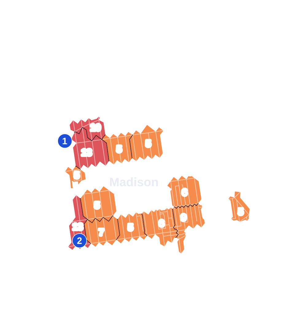
- 5 to 9
- 10 to 19
- 20 to 49
- 50 to 99
- 100 or more
- Not shaded: fewer than 5, held back under the rules in How complaints are counted, parks and public-housing grounds, and land in no patch
- Police precincts
- 61st (most of the area), 70th, 63rd
From January to June 2026 the NYPD recorded 140 major felonies at places in Madison, against 152 in the same months of 2025.
Sources: the NYPD's Complaint Data Historic, updated April 28, 2026, and Complaint Data Current (Year To Date), updated July 27, 2026, on NYC Open Data. Figures to June 30, 2026.
Street corners
- Avenue P & East 15th Street
- Avenue P & East 16th Street
- Avenue R & Haring Street
- Avenue R & Stuart Street
- Avenue S & Batchelder Street
- Avenue S & Brown Street
- Avenue S & East 15th Street
- Avenue S & East 16th Street
- Avenue S & Gerritsen Avenue
- Avenue S & Haring Street
- Avenue S & Stuart Street
- Avenue T & Batchelder Street
- Avenue T & Brown Street
- Avenue T & Coyle Street
- Avenue T & East 15th Street
- Avenue T & East 16th Street
- Avenue T & East 17th Street
- Avenue T & East 19th Street
- Avenue T & East 23rd Street
- Avenue T & East 24th Street
- Avenue T & East 26th Street
- Avenue T & East 27th Street
- Avenue T & East 28th Street
- Avenue T & East 29th Street
- Avenue T & Ford Street
- Avenue T & Gerritsen Avenue
- Avenue T & Haring Street
- Avenue T & Stuart Street
- Avenue U & Batchelder Street
- Avenue U & Coyle Street
- Avenue U & East 14th Street
- Avenue U & East 15th Street
- Avenue U & East 16th Street
- Avenue U & East 17th Street
- Avenue U & East 18th Street
- Avenue U & East 19th Street
- Avenue U & East 21st Street
- Avenue U & East 22nd Street
- Avenue U & East 23rd Street
- Avenue U & East 24th Street
- Avenue U & East 26th Street
- Avenue U & East 27th Street
- Avenue U & East 28th Street
- Avenue U & East 29th Street
- Avenue U & Ford Street
- Avenue U & Haring Street
- Avenue U & Stuart Street
- Avenue V & East 16th Street
- Avenue V & Gravesend Neck Road
- Bedford Avenue & Avenue O
- Bedford Avenue & Avenue P
- Bedford Avenue & Avenue R
- Bedford Avenue & Avenue S
- Bedford Avenue & Avenue T
- Bedford Avenue & Avenue U
- Bedford Avenue & Avenue V
- Bedford Avenue & Gravesend Neck Road
- Bedford Avenue & Kings Highway
- Bedford Avenue & Quentin Road
- East 16th Street & Avenue R
- East 16th Street & Moore Place
- East 16th Street & Quentin Road
- East 17th Street & Avenue R
- East 17th Street & Avenue S
- East 17th Street & Avenue V
- East 17th Street & Moore Place
- East 17th Street & Quentin Road
- East 18th Street & Avenue P
- East 18th Street & Avenue R
- East 18th Street & Avenue S
- East 18th Street & Avenue T
- East 18th Street & Quentin Road
- East 19th Street & Avenue P
- East 19th Street & Avenue R
- East 19th Street & Avenue S
- East 19th Street & Avenue V
- East 19th Street & Quentin Road
- East 21st Street & Avenue R
- East 21st Street & Avenue S
- East 21st Street & Avenue T
- East 21st Street & Quentin Road
- East 22nd Street & Avenue R
- East 22nd Street & Avenue S
- East 22nd Street & Avenue T
- East 22nd Street & Quentin Road
- East 23rd Street & Avenue P
- East 23rd Street & Avenue R
- East 23rd Street & Avenue S
- East 23rd Street & Avenue V
- East 23rd Street & Gravesend Neck Road
- East 23rd Street & Quentin Road
- East 24th Street & Avenue R
- East 24th Street & Avenue S
- East 24th Street & Avenue V
- East 24th Street & Gravesend Neck Road
- East 24th Street & Quentin Road
- East 26th Street & Avenue O
- East 26th Street & Avenue P
- East 26th Street & Avenue R
- East 26th Street & Avenue S
- East 26th Street & Avenue V
- East 26th Street & Gravesend Neck Road
- East 26th Street & Quentin Road
- East 27th Street & Avenue P
- East 27th Street & Avenue R
- East 27th Street & Avenue S
- East 27th Street & Avenue V
- East 27th Street & Gravesend Neck Road
- East 27th Street & Quentin Road
- East 28th Street & Avenue P
- East 28th Street & Avenue R
- East 28th Street & Avenue S
- East 28th Street & Avenue V
- East 28th Street & Gravesend Neck Road
- East 28th Street & Quentin Road
- East 29th Street & Avenue P
- East 29th Street & Avenue R
- East 29th Street & Avenue S
- East 29th Street & Gravesend Neck Road
- East 29th Street & Quentin Road
- Fillmore Avenue & Burnett Street
- Fillmore Avenue & Madison Place
- Fillmore Avenue & Stuart Street
- Gerritsen Avenue & Avenue R
- Gerritsen Avenue & Avenue R at Haring Street
- Gerritsen Avenue & Batchelder Street
- Gerritsen Avenue & Bragg Street
- Gerritsen Avenue & Brown Street
- Gerritsen Avenue & Coyle Street
- Gerritsen Avenue & Fillmore Avenue
- Gerritsen Avenue & Ford Street
- Kings Highway & East 15th Street
- Kings Highway & East 16th Street
- Kings Highway & East 17th Street
- Kings Highway & East 18th Street
- Kings Highway & East 19th Street
- Kings Highway & East 24th Street
- Kings Highway & East 26th Street
- Kings Highway & East 27th Street
- Nostrand Avenue & Avenue R
- Nostrand Avenue & Avenue S
- Nostrand Avenue & Avenue T
- Nostrand Avenue & Avenue U
- Nostrand Avenue & Kings Highway
- Nostrand Avenue & Madison Place
- Nostrand Avenue & Marine Parkway
- Nostrand Avenue & Quentin Road
- Ocean Avenue & Avenue P
- Ocean Avenue & Avenue R
- Ocean Avenue & Avenue S
- Ocean Avenue & Avenue T
- Ocean Avenue & Avenue U
- Ocean Avenue & Kings Highway
- Ocean Avenue & Quentin Road
How the figures above are measured: Methodology.