Prospect Park
Park · Brooklyn
Laid out by Frederick Law Olmsted and Calvert Vaux, Prospect Park is a landscaped public park rather than a neighborhood, bordered by Park Slope, Prospect Heights, Prospect Lefferts Gardens, Flatbush and Windsor Terrace.
- 0.98 square miles
- 21 street corners
- 3 subway stations
- 9 bus routes
Work began in 1866, and the first section opened on October 19, 1867. Its 90-acre Long Meadow, 146-acre Ravine and 60-acre Prospect Lake, Brooklyn's only lake, share the grounds with a zoo, the Boathouse and Lefferts Historic House, an 18th-century Flatbush farmhouse moved here in 1918. The area also takes in the Central Library, the Brooklyn Botanic Garden and the Brooklyn Museum, on land the original park plan included.
Sources: Prospect Park (Brooklyn) (Wikipedia); Prospect Park (The Cultural Landscape Foundation); Lefferts Historic House (Prospect Park Alliance).
Prospect Park borders seven areas, and East Drive holds more of its corners than any other street, eight of 21.
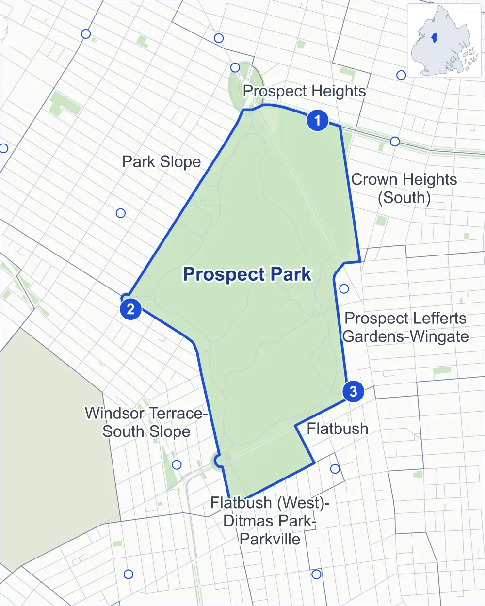
- Prospect Park
- A neighboring area
- Park
- A station in the list
- Another station
Neighborhood areas and streets: NYC Department of City Planning. Parks: NYC Parks. Stations: MTA.
Neighboring areas
- Prospect Heights north
- Crown Heights (South) northeast
- Prospect Lefferts Gardens-Wingate southeast
- Flatbush south
- Flatbush (West)-Ditmas Park-Parkville south
- Windsor Terrace-South Slope southwest
- Park Slope northwest
Subway stations
- Eastern Pkwy-Brooklyn Museum lines 2 3 accessible
- 15 St-Prospect Park lines F G
- Parkside Av lines Q
Getting around
Three subway stations and buses on nine routes stop in or at the edge of Prospect Park.
- 3 subway stations
- 1 of them listed by the MTA as fully accessible
- 9 local bus routes
Local bus routes
- B12
- B16
- B41
- B43
- B48
- B61
- B68
- B116
- T464
Safety record
Between 2021 and 2025, its corners averaged fewer police-reported crashes than the average Brooklyn corner.
- 32 police-reported crashes at its corners
- 1.5 a corner, on average
- 10.5 the average Brooklyn corner
- 14 corners with a clean record
Signal or safety changes on City record, at six of its corners
- Barnes Dance all-way crossings
- 4
- Accessible pedestrian signals
- 3
Camera tickets
In 2025 the Department of Finance recorded no red-light, school-zone speed or bus-lane camera ticket at its corners.
Parks and landmarks
- Parkland
- 478.7 acres of Prospect Park, as NYC Parks maps it within the area's boundary
- Designated landmarks
- The Lullwater Boathouse (now the Prospect Park Audubon Center); the Brooklyn Public Library, Central Building; the Peter Lefferts House; and the Brooklyn Central Office, Bureau of Fire Communications, among others
Streets and trees
- Trees
- 12,955 in NYC Parks' records, most often black cherry, American elm and northern red oak
- Street with the most corners
- East Drive, with eight of the area's 21
- Height above sea level
- From 54 feet at Parkside Avenue & Park Circle to 156 feet at West Drive & Prospect Park Driveway
Libraries
The City lists two libraries in Prospect Park.
- Libraries
- Central Library and Central Library Learning Center
Bike share and public art
By the station list of October 3, 2026, 13 bike-share stations stand in Prospect Park. The City's public art inventory lists 21 works in the area, among them Abraham Lincoln (1869), Washington Irving Memorial (1871) and Thomas Moore (1879).
- 13 bike-share stations
- 21 works of public art
Street corners
- Center Drive & Prospect Park Path
- Drive & South Lake Drive
- East Drive & Center Drive
- East Drive & East Lake Drive
- East Drive & South Lake Drive
- East Drive & Wellhouse Drive
- East Lake Drive & Prospect Park Path
- Flatbush Avenue & East Drive
- Flatbush Avenue & Grand Army Plaza
- Nethermead Arches & Center Drive
- Parkside Avenue & East Drive
- Parkside Avenue & Park Circle
- Prospect Park Path & Lullwater Bridge
- Terrace Bridge & Wellhouse Drive
- Wellhouse Drive & East Lake Drive
- West Drive & East Drive (north)
- West Drive & East Drive (south)
- West Drive & Prospect Park Driveway (north-east)
- West Drive & Prospect Park Driveway (south-west)
- West Drive & Prospect Park West
- West Drive & Wellhouse Drive
How the figures above are measured: Methodology.