Park Slope
Neighborhood · Brooklyn
Park Slope runs between Fourth Avenue and Prospect Park West, from Flatbush Avenue south to 15th Street, along the western side of Prospect Park.
- 0.93 square miles
- 57,405 residents, 2020 Census
- 169 street corners
- 6 subway stations
- 10 bus routes
The name describes ground that falls from Mount Prospect toward Gowanus Bay next to the 585-acre park, begun in 1866 and opened to the public in 1871. Once large-scale building got under way in the late 1870s and early 1880s, mansions rose on Prospect Park West, Eighth Avenue and Plaza Street while row houses, brownstones among them, filled the side streets, and the Park Slope Historic District, designated in 1973, keeps a cohesive feel thanks to its tree-lined streets and intact architecture.
Sources: Park Slope Historic District Extension Designation Report (NYC Landmarks Preservation Commission); The Crown Jewel of Brooklyn (Museum of the City of New York).
Park Slope borders six areas, and 5th Avenue holds more of its corners than any other street, 32 of 169.
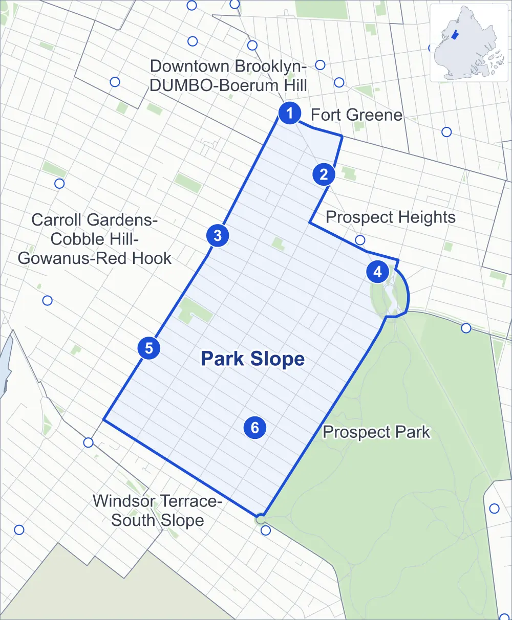
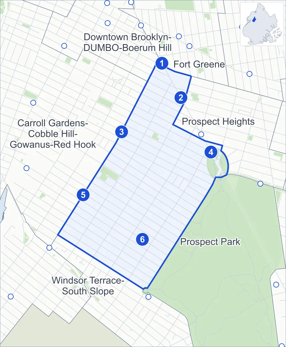
- Park Slope
- A neighboring area
- Park
- A station in the list
- Another station
Neighborhood areas and streets: NYC Department of City Planning. Parks: NYC Parks. Stations: MTA.
Neighboring areas
- Fort Greene north
- Downtown Brooklyn-DUMBO-Boerum Hill north
- Prospect Heights northeast
- Prospect Park southeast
- Windsor Terrace-South Slope southwest
- Carroll Gardens-Cobble Hill-Gowanus-Red Hook northwest
Subway stations
- Atlantic Av-Barclays Ctr lines 2 3 4 5 D N R accessible
- Bergen St lines 2 3
- Union St lines R
- Grand Army Plaza lines 2 3
- 4 Av-9 St lines R
- 7 Av lines F G accessible
Getting around
Six subway stations and buses on ten routes stop in or at the edge of Park Slope.
- 6 subway stations
- 2 of them listed by the MTA as fully accessible
- 10 local bus routes
Local bus routes
- B37
- B41
- B45
- B61
- B63
- B65
- B67
- B69
- B103
- B116
Safety record
Between 2021 and 2025, its corners averaged more police-reported crashes than the average Brooklyn corner.
- 1,823 police-reported crashes at its corners
- 10.8 a corner, on average
- 10.5 the average Brooklyn corner
- 6 corners with a clean record
Signal or safety changes on City record, at 83 of its corners
- Leading pedestrian intervals
- 76
- Accessible pedestrian signals
- 16
- Turn calming
- 8
- Safety Improvement Projects
- 6
- Barnes Dance all-way crossings
- 4
Camera tickets
In 2025 its corners had more school-zone speed camera tickets than red-light or bus-lane tickets.
- 1,579 red-light camera tickets at two corners
- 30,883 school-zone speed camera tickets at eight corners
- 0 bus-lane camera tickets
- Most red-light tickets
- Flatbush Avenue & Bergen Street, 1,121
- Most speed tickets
- Prospect Park West & 2nd Street, 11,158
People and homes
The 2020 Census counted 57,405 residents in Park Slope, about 61,700 per square mile.
- 27,020 homes, 2020 Census
- 2,604 homes added since April 2010, net, by City Planning's count
Half of its 6,464 residential lots hold buildings from 1901 or earlier, and 96% of them date from before 1940, by the City's tax lot records.
Parks and landmarks
- Parkland
- 18.9 acres of NYC Parks property
- The largest pieces
- Grand Army Plaza (12.5 acres), Washington Park (3.3 acres) and Washington Skate Park (1.5 acres)
- Designated landmarks
- The Soldiers' and Sailors' Memorial Arch, Public School 39, the Brooklyn Public Library's Park Slope Branch and the Public Bath No. 7, among others
- Historic district
- Park Slope Historic District, wholly or partly within Park Slope
Streets and trees
- Trees
- 5,173 in NYC Parks' records, most often London planetree, pin oak and thornless honeylocust
- Street with the most corners
- 5th Avenue, with 32 of the area's 169
- Height above sea level
- From 17 feet at 4th Avenue & Carroll Street to 164 feet at Prospect Park West & 7th Street
- Honorary street names
- 6 at its corners, enacted by local law
Schools and libraries
The City lists 18 schools and two libraries in Park Slope.
- Public schools
- 15
- Charter and private schools
- 3
- Libraries
- Pacific Library and Park Slope Library
Bike share and public art
By the station list of October 3, 2026, 26 bike-share stations stand in Park Slope. The City's public art inventory lists 11 works in the area, among them Soldiers and Sailors Memorial Arch (1892), General Gouverneur Kemble Warren (1896) and Quadriga: the Triumphal Progress of Columbia (1898).
- 26 bike-share stations
- 11 works of public art
Public safety
How complaints are countedIn 2025 the NYPD recorded 319 major felonies at places in Park Slope.
Recorded by the NYPD at places in Park Slope
- 394 major felonies in 2024 75 fewer in 2025
- 1,006 other felonies, misdemeanors and violations in 2025
In 2025, on the streets along the edge of Park Slope, the NYPD recorded another 206 major felonies.
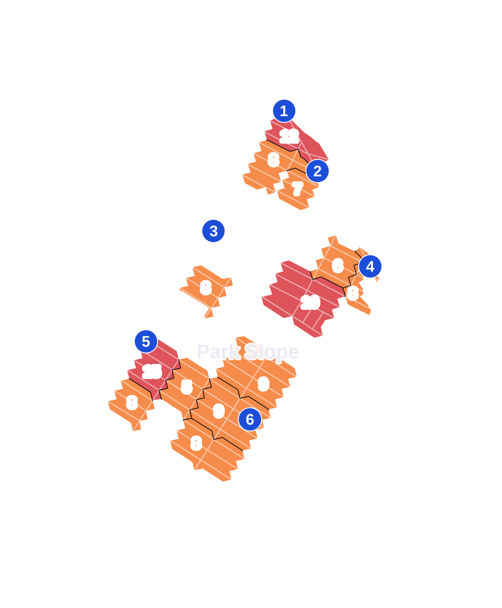
- 5 to 9
- 10 to 19
- 20 to 49
- 50 to 99
- 100 or more
- Not shaded: fewer than 5, held back under the rules in How complaints are counted, parks and public-housing grounds, and land in no patch
- Police precinct
- 78th
From January to June 2026 the NYPD recorded 137 major felonies at places in Park Slope, against 162 in the same months of 2025.
Sources: the NYPD's Complaint Data Historic, updated April 28, 2026, and Complaint Data Current (Year To Date), updated July 27, 2026, on NYC Open Data. Figures to June 30, 2026.
Street corners
- 4th Avenue & 1st Street
- 4th Avenue & 2nd Street
- 4th Avenue & 3rd Street
- 4th Avenue & 5th Street
- 4th Avenue & 6th Street
- 4th Avenue & 7th Street
- 4th Avenue & 13th Street
- 4th Avenue & 14th Street
- 4th Avenue & Baltic Street
- 4th Avenue & Carroll Street
- 4th Avenue & Douglass Street
- 4th Avenue & Garfield Place
- 4th Avenue & President Street
- 4th Avenue & Union Street
- 5th Avenue & 1st Street
- 5th Avenue & 2nd Street
- 5th Avenue & 3rd Street
- 5th Avenue & 4th Street
- 5th Avenue & 5th Street
- 5th Avenue & 6th Street
- 5th Avenue & 7th Street
- 5th Avenue & 8th Street
- 5th Avenue & 9th Street
- 5th Avenue & 10th Street
- 5th Avenue & 11th Street
- 5th Avenue & 12th Street
- 5th Avenue & 13th Street
- 5th Avenue & 14th Street
- 5th Avenue & Baltic Street
- 5th Avenue & Bergen Street
- 5th Avenue & Carroll Street
- 5th Avenue & Dean Street
- 5th Avenue & Douglass Street
- 5th Avenue & Garfield Place
- 5th Avenue & Lincoln Place
- 5th Avenue & Park Place
- 5th Avenue & Paseo Place
- 5th Avenue & President Street
- 5th Avenue & Prospect Place
- 5th Avenue & Sackett Street
- 5th Avenue & St Johns Place
- 5th Avenue & St Marks Avenue
- 5th Avenue & Sterling Place
- 5th Avenue & Union Street
- 5th Avenue & Warren Street
- 6th Avenue & 1st Street
- 6th Avenue & 2nd Street
- 6th Avenue & 3rd Street
- 6th Avenue & 4th Street
- 6th Avenue & 5th Street
- 6th Avenue & 6th Street
- 6th Avenue & 7th Street
- 6th Avenue & 8th Street
- 6th Avenue & 9th Street
- 6th Avenue & 10th Street
- 6th Avenue & 11th Street
- 6th Avenue & 12th Street
- 6th Avenue & 13th Street
- 6th Avenue & 14th Street
- 6th Avenue & 15th Street
- 6th Avenue & Berkeley Place
- 6th Avenue & Garfield Place
- 6th Avenue & Lincoln Place
- 6th Avenue & St Johns Place
- 6th Avenue & Sterling Place
- 7th Avenue & 1st Street
- 7th Avenue & 2nd Street
- 7th Avenue & 3rd Street
- 7th Avenue & 4th Street
- 7th Avenue & 5th Street
- 7th Avenue & 6th Street
- 7th Avenue & 7th Street
- 7th Avenue & 8th Street
- 7th Avenue & 9th Street
- 7th Avenue & 10th Street
- 7th Avenue & 11th Street
- 7th Avenue & 12th Street
- 7th Avenue & 13th Street
- 7th Avenue & 14th Street
- 7th Avenue & 15th Street
- 7th Avenue & Berkeley Place
- 7th Avenue & Carroll Street
- 7th Avenue & Garfield Place
- 7th Avenue & Lincoln Place
- 7th Avenue & President Street
- 7th Avenue & St Johns Place
- 7th Avenue & Sterling Place
- 7th Avenue & Union Street
- 8th Avenue & 1st Street
- 8th Avenue & 2nd Street
- 8th Avenue & 3rd Street
- 8th Avenue & 4th Street
- 8th Avenue & 5th Street
- 8th Avenue & 6th Street
- 8th Avenue & 7th Street
- 8th Avenue & 8th Street
- 8th Avenue & 9th Street
- 8th Avenue & 10th Street
- 8th Avenue & 11th Street
- 8th Avenue & 12th Street
- 8th Avenue & 13th Street
- 8th Avenue & 14th Street
- 8th Avenue & 15th Street
- 8th Avenue & Berkeley Place
- 8th Avenue & Garfield Place
- 8th Avenue & Montgomery Place
- 8th Avenue & St Johns Place
- Atlantic Avenue & 4th Avenue
- Baltic Street & Gregory Place
- Berkeley Place & Plaza Street West
- Butler Street & Gregory Place
- Carroll Street & 6th Avenue
- Carroll Street & 8th Avenue
- Carroll Street & Fiske Place
- Carroll Street & Polhemus Place
- Carroll Street & Prospect Park West
- Dean Street & 6th Avenue
- East Drive & Grand Army Plaza
- Flatbush Avenue & 5th Avenue
- Flatbush Avenue & 8th Avenue
- Flatbush Avenue & Atlantic Avenue
- Flatbush Avenue & Bergen Street
- Flatbush Avenue & Dean Street
- Flatbush Avenue & Grand Army Plaza
- Flatbush Avenue & Pacific Street
- Flatbush Avenue & St Johns Place
- Flatbush Avenue & Sterling Place
- Garfield Place & Fiske Place
- Garfield Place & Polhemus Place
- Grand Army Plaza & Plaza Street East
- Grand Army Plaza & Plaza Street East at Plaza Street West
- Grand Army Plaza & Plaza Street West
- Lincoln Place & 8th Avenue
- Lincoln Place & Plaza Street West
- Pacific Street & 4th Avenue
- Pacific Street & 6th Avenue
- Park Place & 6th Avenue
- Plaza Street East & Butler Place
- President Street & 6th Avenue
- President Street & 8th Avenue
- President Street & Prospect Park West
- Prospect Park West & 1st Street
- Prospect Park West & 2nd Street
- Prospect Park West & 4th Street
- Prospect Park West & 5th Street
- Prospect Park West & 6th Street
- Prospect Park West & 7th Street
- Prospect Park West & 8th Street
- Prospect Park West & 9th Street
- Prospect Park West & 10th Street
- Prospect Park West & 11th Street
- Prospect Park West & 12th Street
- Prospect Park West & 13th Street
- Prospect Park West & 14th Street
- Prospect Park West & 15th Street
- Prospect Park West & Garfield Place
- Prospect Park West & Grand Army Plaza
- Prospect Park West & Montgomery Place
- Prospect Park West & Plaza Street West
- Prospect Park West & Prospect Park Driveway (north-east)
- Prospect Park West & Prospect Park Driveway (south-west)
- St Johns Place & Plaza Street East
- Union Street & 6th Avenue
- Union Street & 8th Avenue
- Union Street & Grand Army Plaza Oval
- Union Street & Plaza Street West
- Vanderbilt Avenue & Grand Army Plaza
- West Drive & Grand Army Plaza
- West Drive & Prospect Park West at 3rd Street
How the figures above are measured: Methodology.