Sunset Park (Central)
Neighborhood · Brooklyn
The middle of Sunset Park, this area surrounds the park itself, which spans 41st to 44th Streets between Fifth and Seventh Avenues.
- 0.67 square miles
- 55,606 residents, 2020 Census
- 89 street corners
- 1 subway station
- 6 bus routes
The City of Brooklyn planned the 18-acre park in 1890, and from its highest point visitors can pick out the Statue of Liberty and the hills of Staten Island and New Jersey; its pool first opened in 1936. The surrounding blocks hold rowhouses built in the late 1800s and early 1900s for port workers and for professionals commuting to jobs in Downtown Brooklyn and Manhattan, and parts of 44th, 47th and 48th Streets became city historic districts in 2019.
Sources: Sunset Park (NYC Parks); Firehouse, Engine Company 28 (now Engine Company 228) (NYC Landmarks Preservation Commission); LPC Designates Four Historic Districts in Sunset Park (NYC Landmarks Preservation Commission).
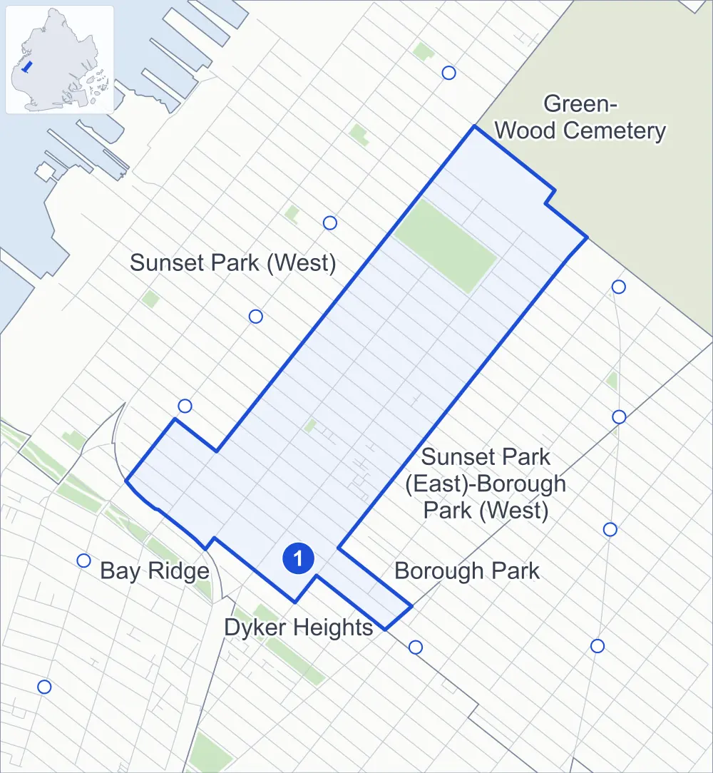
Sunset Park (Central) borders six areas, and 7th Avenue holds more of its corners than any other street, 24 of 89.
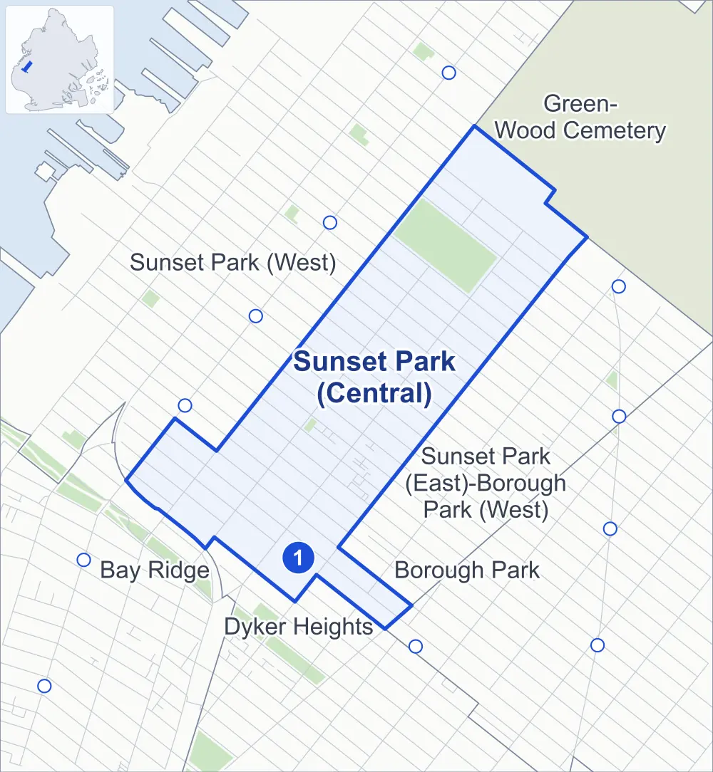
- Sunset Park (Central)
- A neighboring area
- Park
- A station in the list
- Another station
Neighborhood areas and streets: NYC Department of City Planning. Parks: NYC Parks. Stations: MTA.
Neighboring areas
- Green-Wood Cemetery northeast
- Sunset Park (East)-Borough Park (West) southeast
- Dyker Heights south
- Borough Park south
- Bay Ridge southwest
- Sunset Park (West) northwest
Subway stations
- 8 Av lines N accessible
Getting around
One subway station and buses on six routes stop in or at the edge of Sunset Park (Central).
- 1 subway station
- 1 listed by the MTA as fully accessible
- 6 local bus routes
Local bus routes
- B9
- B11
- B16
- B35
- B63
- B70
Safety record
Between 2021 and 2025, its corners averaged more police-reported crashes than the average Brooklyn corner.
- 1,234 police-reported crashes at its corners
- 13.9 a corner, on average
- 10.5 the average Brooklyn corner
Signal or safety changes on City record, at 59 of its corners
- Leading pedestrian intervals
- 56
- Turn calming
- 15
- Accessible pedestrian signals
- 12
- Safety Improvement Projects
- 6
Camera tickets
In 2025 its corners had more red-light camera tickets than school-zone speed or bus-lane tickets.
- 1,527 red-light camera tickets at one corner
- 15 school-zone speed camera tickets at one corner
- 0 bus-lane camera tickets
- Most red-light tickets
- 4th Avenue & 60th Street, 1,527
- Most speed tickets
- 6th Avenue & 53rd Street, 15
People and homes
The 2020 Census counted 55,606 residents in Sunset Park (Central), about 83,000 per square mile.
- 16,563 homes, 2020 Census
- 765 homes added since April 2010, net, by City Planning's count
Half of its 3,924 residential lots hold buildings from 1915 or earlier, and 94% of them date from before 1940, by the City's tax lot records.
Parks and landmarks
- Parkland
- 23.4 acres of Sunset Park, as NYC Parks maps it within the area's boundary
- Designated landmark
- The Sunset Play Center
- Historic districts
- Central Sunset Park and Sunset Park North, wholly or partly within Sunset Park (Central)
Streets and trees
- Trees
- 2,784 in NYC Parks' records, most often London planetree, pin oak and thornless honeylocust
- Street with the most corners
- 7th Avenue, with 24 of the area's 89
- Height above sea level
- From 56 feet at 5th Avenue & 36th Street to 169 feet at 6th Avenue & 44th Street
- Honorary street names
- 6 at its corners, enacted by local law
Schools
The City lists six schools in Sunset Park (Central).
- Public schools
- 4
- Charter and private schools
- 2
Bike share
By the station list of October 3, 2026, 16 bike-share stations stand in Sunset Park (Central).
- 16 bike-share stations
Public safety
How complaints are countedIn 2025 the NYPD recorded 292 major felonies at places in Sunset Park (Central).
Recorded by the NYPD at places in Sunset Park (Central)
- 403 major felonies in 2024 111 fewer in 2025
- 1,127 other felonies, misdemeanors and violations in 2025
In 2025, on the streets along the edge of Sunset Park (Central), the NYPD recorded another 183 major felonies. Counting the streets along its edge, in 2025 the NYPD recorded 8.5 major felonies for every thousand residents the 2020 Census counted in Sunset Park (Central).
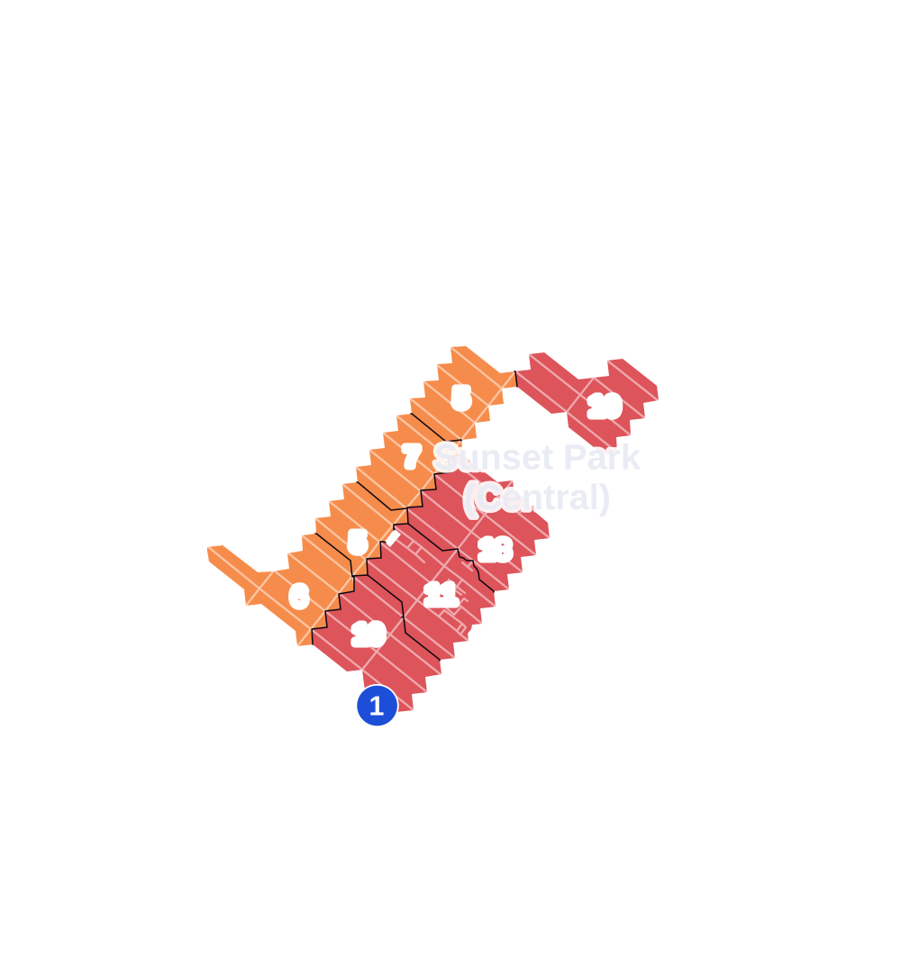
- 5 to 9
- 10 to 19
- 20 to 49
- 50 to 99
- 100 or more
- Not shaded: fewer than 5, held back under the rules in How complaints are counted, parks and public-housing grounds, and land in no patch
- Police precincts
- 72nd (most of the area), 66th, 68th
From January to June 2026 the NYPD recorded 148 major felonies at places in Sunset Park (Central), against 146 in the same months of 2025.
Sources: the NYPD's Complaint Data Historic, updated April 28, 2026, and Complaint Data Current (Year To Date), updated July 27, 2026, on NYC Open Data. Figures to June 30, 2026.
Street corners
- 4th Avenue & 60th Street
- 4th Avenue & 61st Street
- 4th Avenue & 62nd Street
- 4th Avenue & 63rd Street
- 4th Avenue & 64th Street
- 4th Avenue & Gowanus Expressway
- 5th Avenue & 36th Street
- 5th Avenue & 37th Street
- 5th Avenue & 39th Street
- 5th Avenue & 41st Street
- 5th Avenue & 42nd Street
- 5th Avenue & 44th Street
- 5th Avenue & 48th Street
- 5th Avenue & 51st Street
- 5th Avenue & 52nd Street
- 5th Avenue & 53rd Street
- 5th Avenue & 54th Street
- 5th Avenue & 55th Street
- 5th Avenue & 57th Street
- 5th Avenue & 58th Street
- 5th Avenue & 59th Street
- 5th Avenue & 60th Street
- 5th Avenue & 61st Street
- 5th Avenue & 62nd Street
- 5th Avenue & 63rd Street
- 5th Avenue & 64th Street
- 6th Avenue & 39th Street
- 6th Avenue & 40th Street
- 6th Avenue & 41st Street
- 6th Avenue & 44th Street
- 6th Avenue & 45th Street
- 6th Avenue & 46th Street
- 6th Avenue & 47th Street
- 6th Avenue & 48th Street
- 6th Avenue & 49th Street
- 6th Avenue & 50th Street
- 6th Avenue & 51st Street
- 6th Avenue & 52nd Street
- 6th Avenue & 53rd Street
- 6th Avenue & 54th Street
- 6th Avenue & 55th Street
- 6th Avenue & 56th Street
- 6th Avenue & 57th Street
- 6th Avenue & 58th Street
- 6th Avenue & 59th Street
- 6th Avenue & 60th Street
- 6th Avenue & 61st Street
- 6th Avenue & 62nd Street
- 6th Avenue & 63rd Street
- 7th Avenue & 39th Street
- 7th Avenue & 40th Street
- 7th Avenue & 41st Street
- 7th Avenue & 42nd Street
- 7th Avenue & 43rd Street
- 7th Avenue & 44th Street
- 7th Avenue & 45th Street
- 7th Avenue & 46th Street
- 7th Avenue & 47th Street
- 7th Avenue & 48th Street
- 7th Avenue & 49th Street
- 7th Avenue & 50th Street
- 7th Avenue & 51st Street
- 7th Avenue & 52nd Street
- 7th Avenue & 53rd Street
- 7th Avenue & 54th Street
- 7th Avenue & 55th Street
- 7th Avenue & 56th Street
- 7th Avenue & 57th Street
- 7th Avenue & 58th Street
- 7th Avenue & 59th Street
- 7th Avenue & 60th Street
- 7th Avenue & 61st Street
- 7th Avenue & 62nd Street
- 8th Avenue & 39th Street
- 8th Avenue & 41st Street
- 8th Avenue & 42nd Street
- 8th Avenue & 43rd Street
- 8th Avenue & 46th Street
- 8th Avenue & 55th Street
- 8th Avenue & 56th Street
- 8th Avenue & 61st Street
- 8th Avenue & 62nd Street
- 53rd Street & 8th Avenue
- 54th Street & 8th Avenue
- 58th Street & 8th Avenue
- 59th Street & 8th Avenue
- 60th Street & 8th Avenue
- 60th Street & 9th Avenue
- 61st Street & 9th Avenue
How the figures above are measured: Methodology.