Gramercy
Neighborhood · Manhattan
Gramercy lies between Park Avenue South and First Avenue north of 14th Street, with Union Square to the southwest and Stuyvesant Town to the east, and its name derives from the Dutch Krom Moerasje, or little crooked swamp.
- 0.27 square miles
- 28,628 residents, 2020 Census
- 62 street corners
- 4 subway stations
- 33 bus routes
In 1832 Samuel B. Ruggles deeded land to trustees for Gramercy Park, a private square opened only by key, with houses rising around it from the 1840s; its historic district was designated in 1966. On Lexington Avenue, the Sixty-Ninth Regiment Armory, built from 1904 to 1906, hosted the 1913 Armory Show, which brought the newest European and American modern art to national attention. Stuyvesant Square and Baruch College are also here.
Sources: Gramercy Park (Wikipedia); Sixty-Ninth Regiment Armory, 68 Lexington Avenue (LP-1228, Designation List 164, April 12, 1983) (NYC Landmarks Preservation Commission).
Gramercy borders four areas, and 3rd Avenue holds more of its corners than any other street, 13 of 62.
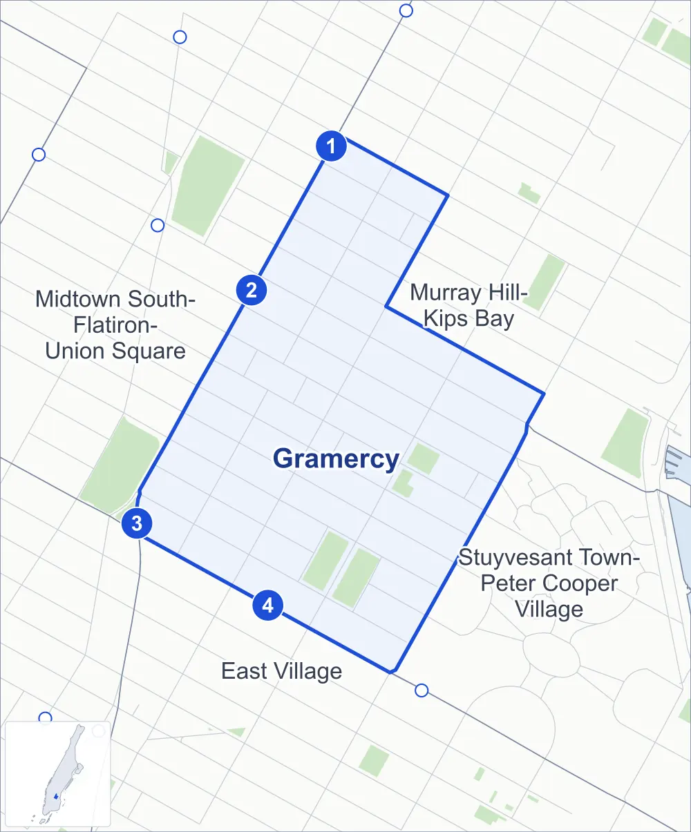
- Gramercy
- A neighboring area
- Park
- A station in the list
- Another station
Neighborhood areas and streets: NYC Department of City Planning. Parks: NYC Parks. Stations: MTA.
Neighboring areas
- Murray Hill-Kips Bay northeast
- Stuyvesant Town-Peter Cooper Village southeast
- East Village southwest
- Midtown South-Flatiron-Union Square northwest
Subway stations
- 28 St lines 6
- 23 St-Baruch College lines 6 accessible
- 14 St-Union Sq lines 4 5 6
- 3 Av lines L
Getting around
Four subway stations and buses on 33 routes stop in or at the edge of Gramercy.
- 4 subway stations
- 1 of them listed by the MTA as fully accessible
- 15 local bus routes
- 18 express bus routes
Local bus routes
- L92
- M1
- M2
- M3
- M9
- M14A-SBS
- M14D-SBS
- M15
- M15-SBS
- M23-SBS
- M34-SBS
- M34A-SBS
- M101
- M102
- M103
Express bus routes
- BM1
- BM2
- BM3
- BM4
- QM63
- QM64
- QM68
- SIM1C
- SIM3
- SIM3C
- SIM4C
- SIM6
- SIM10
- SIM11
- SIM31
- SIM33C
- X37
- X38
Safety record
Between 2021 and 2025, its corners averaged more police-reported crashes than the average Manhattan corner.
- 900 police-reported crashes at its corners
- 14.5 a corner, on average
- 13.4 the average Manhattan corner
- 1 corner with a clean record
Signal or safety changes on City record, at 41 of its corners
- Leading pedestrian intervals
- 36
- Accessible pedestrian signals
- 20
- Turn calming
- 11
- Enhanced crossings
- 3
- Safety Improvement Projects
- 2
- Barnes Dance all-way crossings
- 1
Camera tickets
In 2025 its corners had more bus-lane camera tickets than school-zone speed or red-light tickets.
- 0 red-light camera tickets
- 5,915 school-zone speed camera tickets at eight corners
- 18,683 bus-lane camera tickets at six corners
- Most speed tickets
- 3rd Avenue & East 16th Street, 1,816
- Most bus-lane tickets
- East 14th Street & Irving Place, 8,180
People and homes
The 2020 Census counted 28,628 residents in Gramercy, about 106,000 per square mile.
- 17,885 homes, 2020 Census
- 1,194 homes added since April 2010, net, by City Planning's count
Half of its 621 residential lots hold buildings from 1910 or earlier, and 82% of them date from before 1940, by the City's tax lot records.
Parks and landmarks
- Parkland
- 5.5 acres of NYC Parks property
- The largest pieces
- Stuyvesant Square (4 acres), Peter's Field (0.9 acre) and Augustus St. Gaudens Playground (0.6 acre)
- Designated landmarks
- The Russell Sage Foundation Building and Annex, the Sixty-Ninth Regiment Armory, the (former) Stuyvesant High School and the Scheffel Hall, among others
- Historic districts
- East 17th Street / Irving Place, Gramercy Park, Gramercy Park Extension and Stuyvesant Square, wholly or partly within Gramercy
Streets and trees
- Trees
- 1,381 in NYC Parks' records, most often thornless honeylocust, maidenhair tree and London planetree
- Street with the most corners
- 3rd Avenue, with 13 of the area's 62
- Height above sea level
- From 12 feet at 1st Avenue & East 22nd Street to 44 feet at East 15th Street & Union Square East
- Honorary street names
- 6 at its corners, enacted by local law
Schools and libraries
The City lists 20 schools and one library in Gramercy.
- Public schools
- 15
- Charter and private schools
- 5
- Library
- Epiphany Library
Bike share and public art
By the station list of October 3, 2026, ten bike-share stations stand in Gramercy. The City's public art inventory lists three works in the area: Washington Irving Memorial (1885), Peter Stuyvesant (1941) and Antonin Dvorak (1997).
- 10 bike-share stations
- 3 works of public art
Public safety
How complaints are countedIn 2025 the NYPD recorded 242 major felonies at places in Gramercy.
Recorded by the NYPD at places in Gramercy
- 220 major felonies in 2024
- 707 other felonies, misdemeanors and violations in 2025
In 2025, on the streets along the edge of Gramercy, the NYPD recorded another 386 major felonies.
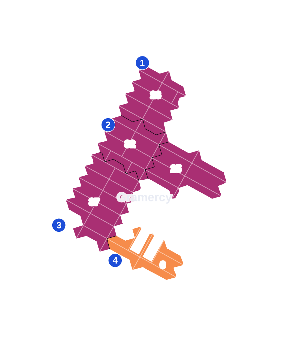
- 5 to 9
- 10 to 19
- 20 to 49
- 50 to 99
- 100 or more
- Not shaded: fewer than 5, held back under the rules in How complaints are counted, parks and public-housing grounds, and land in no patch
- Police precinct
- 13th
From January to June 2026 the NYPD recorded 124 major felonies at places in Gramercy, against 123 in the same months of 2025.
Sources: the NYPD's Complaint Data Historic, updated April 28, 2026, and Complaint Data Current (Year To Date), updated July 27, 2026, on NYC Open Data. Figures to June 30, 2026.
Street corners
- 1st Avenue & East 14th Street
- 1st Avenue & East 16th Street
- 1st Avenue & East 18th Street
- 1st Avenue & East 20th Street
- 1st Avenue & East 21st Street
- 1st Avenue & East 22nd Street
- 1st Avenue & East 24th Street
- 2nd Avenue & East 14th Street
- 2nd Avenue & East 15th Street
- 2nd Avenue & East 17th Street
- 2nd Avenue & East 18th Street
- 2nd Avenue & East 19th Street
- 2nd Avenue & East 20th Street
- 2nd Avenue & East 21st Street
- 2nd Avenue & East 22nd Street
- 2nd Avenue & East 23rd Street
- 2nd Avenue & East 24th Street
- 3rd Avenue & East 14th Street
- 3rd Avenue & East 15th Street
- 3rd Avenue & East 16th Street
- 3rd Avenue & East 17th Street
- 3rd Avenue & East 18th Street
- 3rd Avenue & East 19th Street
- 3rd Avenue & East 20th Street
- 3rd Avenue & East 21st Street
- 3rd Avenue & East 22nd Street
- 3rd Avenue & East 23rd Street
- 3rd Avenue & East 24th Street
- 3rd Avenue & East 25th Street
- 3rd Avenue & East 26th Street
- East 14th Street & Irving Place
- East 15th Street & Irving Place
- East 15th Street & Nathan D Perlman Place
- East 15th Street & Rutherford Place
- East 15th Street & Union Square East
- East 16th Street & Nathan D Perlman Place
- East 16th Street & Rutherford Place
- East 17th Street & Irving Place
- East 17th Street & Nathan D Perlman Place
- East 17th Street & Rutherford Place
- East 19th Street & Irving Place
- East 20th Street & Gramercy Park South at Gramercy Park East
- East 20th Street & Gramercy Park South at Gramercy Park West
- East 21st Street & Gramercy Park North at Gramercy Park East
- East 21st Street & Gramercy Park North at Gramercy Park West
- East 21st Street & Park Avenue South
- East 26th Street & Broadway Alley
- East 26th Street & Park Avenue South
- East 27th Street & Broadway Alley
- East 27th Street & Park Avenue South
- East 28th Street & Park Avenue South
- Irving Place & East 16th Street
- Irving Place & East 18th Street
- Irving Place & Gramercy Park South
- Lexington Avenue & East 22nd Street
- Lexington Avenue & East 23rd Street
- Lexington Avenue & East 24th Street
- Lexington Avenue & East 25th Street
- Lexington Avenue & East 26th Street
- Lexington Avenue & East 27th Street
- Lexington Avenue & East 28th Street
- Lexington Avenue & Gramercy Park North
How the figures above are measured: Methodology.