Freshkills Park (North)
Park · Staten Island
The northern section of Freshkills Park lies on Staten Island's western edge beside the Travis neighborhood, part of the 2,200-acre park rising on the former Fresh Kills Landfill.
- 2.45 square miles
- 3 street corners
- 25 bus routes
The landfill operated from 1948 until 2001, and its name comes from the Middle Dutch word kille, for a riverbed or water channel. Here the first phase of North Park, 21 acres overlooking Main Creek and its wetlands, opened in October 2023 with a half-mile path, a 20-foot bird tower and a wetland deck. NYC Parks is building the park in phases, aiming to open it fully by 2036, with the nonprofit Freshkills Park Alliance as its partner.
Sources: FAQs (Freshkills Park Alliance); North Park – Completed in 2023 and Now Open (Freshkills Park Alliance); Fresh Kills Park Transformation Takes Major Step Forward with Release of Draft Master Plan Illustrating Planned Features of the Park (April 6, 2006) (NYC Department of City Planning); Fresh Kills Landfill (Wikipedia).
Freshkills Park (North) borders five areas.
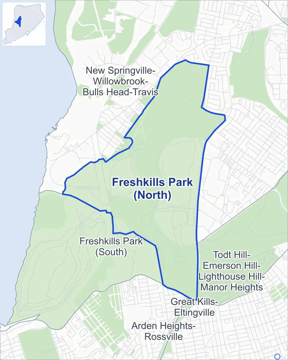
- Freshkills Park (North)
- A neighboring area
- Park
- Another station
Neighborhood areas and streets: NYC Department of City Planning. Parks: NYC Parks. Stations: MTA.
Neighboring areas
Getting around
Buses on 25 routes stop in or at the edge of Freshkills Park (North).
- 13 local bus routes
- 12 express bus routes
Local bus routes
- S44
- S55
- S56
- S59
- S61
- S62
- S74
- S79-SBS
- S84
- S89
- S91
- S92
- S94
Express bus routes
- SIM1
- SIM1C
- SIM4
- SIM4C
- SIM5
- SIM6
- SIM7
- SIM8
- SIM10
- SIM15
- SIM31
- SIM32
Safety record
Between 2021 and 2025, police reported zero crashes at all 3 of its corners.
Camera tickets
In 2025 the Department of Finance recorded no red-light, school-zone speed or bus-lane camera ticket at its corners.
Parks
- Parkland
- 868 acres of Freshkills Park, as NYC Parks maps it within the area's boundary
Streets and trees
- Trees
- 980 in NYC Parks' records, most often sweetgum, maple and American elm
- Height above sea level
- From 14 feet at West Service Road & DSNY Transfer Station Driveway to 43 feet at Nursery Path & Picnic Path
Street corners
How the figures above are measured: Methodology.