Bushwick (East)
Neighborhood · Brooklyn
Running from Bedford-Stuyvesant toward Ridgewood, Queens, the eastern part of Bushwick reaches southeast to the edge of the cemeteries around Highland Park.
- 1.00 square mile
- 62,049 residents, 2020 Census
- 178 street corners
- 8 subway stations
- 17 bus routes
Chartered by the Dutch in 1661 as Boswijck, Bushwick drew large numbers of German immigrants in the 1840s and 1850s, and around 1900 brewery owners and doctors built mansions along Bushwick and Irving Avenues. Puerto Rican and Dominican families were among those who settled here in the 20th century, and Bushwick is now the most populous Hispanic community in Brooklyn. Irving Square Park, bought by Kings County in 1895 and landscaped the following year, lies within the area.
Sources: Bushwick, Brooklyn (Wikipedia); Irving Square Park (NYC Parks); Maria Hernandez Park (NYC Parks).
Bushwick (East) borders six areas, and Bushwick Avenue holds more of its corners than any other street, 37 of 182.
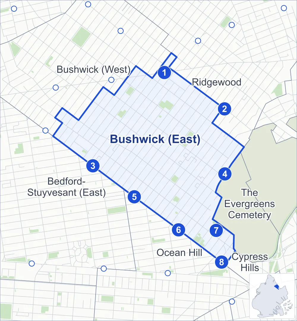
- Bushwick (East)
- A neighboring area
- Park
- A station in the list
- Another station
Neighborhood areas and streets: NYC Department of City Planning. Parks: NYC Parks. Stations: MTA.
Neighboring areas
- Ridgewood northeast
- The Evergreens Cemetery southeast
- Cypress Hills southeast
- Ocean Hill south
- Bedford-Stuyvesant (East) west
- Bushwick (West) northwest
Subway stations
- Myrtle-Wyckoff Avs lines L M accessible
- Halsey St lines L
- Gates Av lines J Z
- Wilson Av lines L
- Halsey St lines J
- Chauncey St lines J Z
- Bushwick Av-Aberdeen St lines L
- Broadway Junction lines J Z
Getting around
Eight subway stations and buses on 17 routes stop in or at the edge of Bushwick (East).
- 8 subway stations
- 1 of them listed by the MTA as fully accessible
- 17 local bus routes
Local bus routes
- B7
- B13
- B20
- B26
- B38
- B47
- B52
- B54
- B60
- B111
- L90
- M90
- Q24
- Q55
- T410
- T430
- T433
Safety record
Between 2021 and 2025, its corners averaged more police-reported crashes than the average Brooklyn corner.
- 3,344 police-reported crashes at its corners
- 18.4 a corner, on average
- 10.5 the average Brooklyn corner
Signal or safety changes on City record, at 49 of its corners
- Leading pedestrian intervals
- 37
- Accessible pedestrian signals
- 15
- Turn calming
- 6
- Safety Improvement Projects
- 2
Camera tickets
In 2025 its corners had more school-zone speed camera tickets than red-light or bus-lane tickets.
- 0 red-light camera tickets
- 1,037 school-zone speed camera tickets at four corners
- 0 bus-lane camera tickets
- Most speed tickets
- Bushwick Avenue & Jefferson Avenue, 435
People and homes
The 2020 Census counted 62,049 residents in Bushwick (East), about 62,000 per square mile.
- 23,784 homes, 2020 Census
- 3,947 homes added since April 2010, net, by City Planning's count
Half of its 5,949 residential lots hold buildings from 1915 or earlier, and 79% of them date from before 1940, by the City's tax lot records.
Parks and landmarks
- Parkland
- 14.3 acres of NYC Parks property
- The largest pieces
- Irving Square Park (2.9 acres), Bushwick Playground (2.8 acres) and Thomas Boyland Park (1.8 acres)
- Designated landmarks
- The Ridgewood Masonic Temple, the Engine Company No. 252, Public School 116 (The Elizabeth Farrell School) and the Reformed Church of South Bushwick, among others
- Historic district
- Linden Street Historic District, wholly or partly within Bushwick (East)
Streets and trees
- Trees
- 4,343 in NYC Parks' records, most often thornless honeylocust, London planetree and pin oak
- Street with the most corners
- Bushwick Avenue, with 37 of the area's 182
- Height above sea level
- From 28 feet at Wilson Avenue & Linden Street to 118 feet at Bushwick Avenue & Eastern Parkway at Vanderveer Street
- Honorary street names
- 7 at its corners, enacted by local law
Schools and libraries
The City lists 26 schools and one library in Bushwick (East).
- Public schools
- 18
- Charter and private schools
- 8
- Library
- Washington Irving Library
Bike share and public art
By the station list of October 3, 2026, 30 bike-share stations stand in Bushwick (East). The City's public art inventory lists two works in the area: Untitled Stainless Steel Sculpture (1983) and Sentinel Lanterns (2007).
- 30 bike-share stations
- 2 works of public art
Public safety
How complaints are countedIn 2025 the NYPD recorded 581 major felonies at places in Bushwick (East).
Recorded by the NYPD at places in Bushwick (East)
- 723 major felonies in 2024 142 fewer in 2025
- 2,240 other felonies, misdemeanors and violations in 2025
In 2025, on the streets along the edge of Bushwick (East), the NYPD recorded another 208 major felonies. Counting the streets along its edge, in 2025 the NYPD recorded 12.7 major felonies for every thousand residents the 2020 Census counted in Bushwick (East).
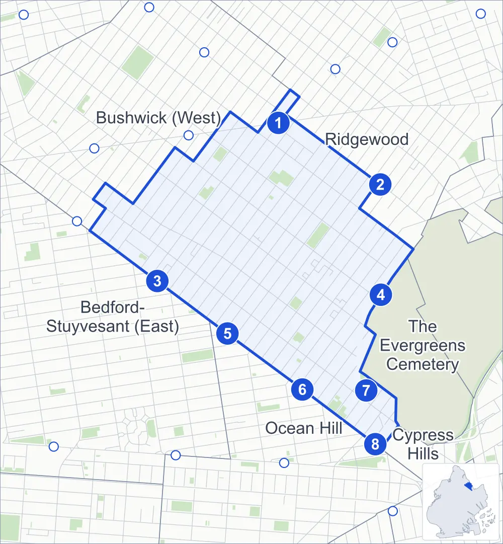
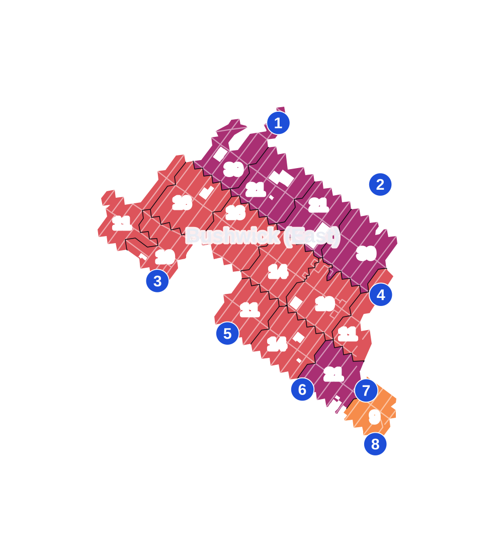
- 5 to 9
- 10 to 19
- 20 to 49
- 50 to 99
- 100 or more
- Not shaded: fewer than 5, held back under the rules in How complaints are counted, parks and public-housing grounds, and land in no patch
- Police precinct
- 83rd
From January to June 2026 the NYPD recorded 323 major felonies at places in Bushwick (East), against 261 in the same months of 2025.
Sources: the NYPD's Complaint Data Historic, updated April 28, 2026, and Complaint Data Current (Year To Date), updated July 27, 2026, on NYC Open Data. Figures to June 30, 2026.
Street corners
- Broadway & Chauncey Street
- Broadway & Cornelia Street
- Broadway & De Sales Place
- Broadway & Decatur Street
- Broadway & Eldert Street
- Broadway & Gates Avenue
- Broadway & Grove Street
- Broadway & Halsey Street
- Broadway & Hancock Street
- Broadway & Howard Avenue
- Broadway & Hull Street
- Broadway & Lexington Avenue
- Broadway & Linden Street
- Broadway & MacDonough Street
- Broadway & Madison Street
- Broadway & Marion Street
- Broadway & Monroe Street
- Broadway & Palmetto Street
- Broadway & Pilling Street
- Broadway & Putnam Avenue
- Broadway & Schaefer Street
- Broadway & Stewart Street
- Broadway & Van Buren Street
- Broadway & Weirfield Street
- Broadway & Woodbine Street
- Bushwick Avenue & Aberdeen Street
- Bushwick Avenue & Bleecker Street
- Bushwick Avenue & Chauncey Street
- Bushwick Avenue & Conway Street
- Bushwick Avenue & Cooper Street
- Bushwick Avenue & Cornelia Street
- Bushwick Avenue & Covert Street
- Bushwick Avenue & De Sales Place
- Bushwick Avenue & Decatur Street
- Bushwick Avenue & Eastern Parkway
- Bushwick Avenue & Eastern Parkway at Vanderveer Street
- Bushwick Avenue & Eldert Street
- Bushwick Avenue & Furman Avenue
- Bushwick Avenue & Granite Street
- Bushwick Avenue & Grove Street
- Bushwick Avenue & Halsey Street
- Bushwick Avenue & Hancock Street
- Bushwick Avenue & Harman Street
- Bushwick Avenue & Himrod Street
- Bushwick Avenue & Jefferson Avenue
- Bushwick Avenue & Kossuth Place
- Bushwick Avenue & Linden Street
- Bushwick Avenue & Menahan Street
- Bushwick Avenue & Moffat Street
- Bushwick Avenue & Palmetto Street
- Bushwick Avenue & Pilling Street
- Bushwick Avenue & Putnam Avenue
- Bushwick Avenue & Schaefer Street
- Bushwick Avenue & Stanhope Street
- Bushwick Avenue & Stewart Street
- Bushwick Avenue & Van Buren Street
- Bushwick Avenue & Weirfield Street
- Bushwick Avenue & Woodbine Street
- Central Avenue & Bleecker Street
- Central Avenue & Chauncey Street
- Central Avenue & Cooper Street
- Central Avenue & Cornelia Street
- Central Avenue & Covert Street
- Central Avenue & Eldert Street
- Central Avenue & Grove Street
- Central Avenue & Linden Street
- Central Avenue & Menahan Street
- Central Avenue & Moffat Street
- Central Avenue & Palmetto Street
- Central Avenue & Pilling Street
- Central Avenue & Schaefer Street
- Central Avenue & Weirfield Street
- Central Avenue & Woodbine Street
- Decatur Street & Central Avenue
- Decatur Street & Evergreen Avenue
- Decatur Street & Knickerbocker Avenue
- Decatur Street & Wilson Avenue
- Evergreen Avenue & Bleecker Street
- Evergreen Avenue & Chauncey Street
- Evergreen Avenue & Cooper Street
- Evergreen Avenue & Cornelia Street
- Evergreen Avenue & Covert Street
- Evergreen Avenue & Eldert Street
- Evergreen Avenue & Grove Street
- Evergreen Avenue & Linden Street
- Evergreen Avenue & Menahan Street
- Evergreen Avenue & Moffat Street
- Evergreen Avenue & Palmetto Street
- Evergreen Avenue & Pilling Street
- Evergreen Avenue & Schaefer Street
- Evergreen Avenue & Stanhope Street
- Evergreen Avenue & Weirfield Street
- Evergreen Avenue & Woodbine Street
- Gates Avenue & Bushwick Avenue
- Gates Avenue & Central Avenue
- Gates Avenue & Evergreen Avenue
- Gates Avenue & Irving Avenue
- Gates Avenue & Knickerbocker Avenue
- Gates Avenue & Wilson Avenue
- Gates Avenue & Wyckoff Avenue
- Greene Avenue & Bushwick Avenue
- Greene Avenue & Central Avenue
- Greene Avenue & Evergreen Avenue
- Greene Avenue & Goodwin Place
- Grove Street & Goodwin Place
- Halsey Street & Central Avenue
- Halsey Street & Evergreen Avenue
- Halsey Street & Irving Avenue
- Halsey Street & Knickerbocker Avenue
- Halsey Street & Wilson Avenue
- Hancock Street & Central Avenue
- Hancock Street & Evergreen Avenue
- Hancock Street & Irving Avenue
- Hancock Street & Knickerbocker Avenue
- Hancock Street & Wilson Avenue
- Hancock Street & Wyckoff Avenue
- Irving Avenue & Cooper Street
- Irving Avenue & Cornelia Street
- Irving Avenue & Eldert Street
- Irving Avenue & Grove Street
- Irving Avenue & Linden Street
- Irving Avenue & Menahan Street
- Irving Avenue & Palmetto Street
- Irving Avenue & Weirfield Street
- Irving Avenue & Woodbine Street
- Jefferson Avenue & Central Avenue
- Jefferson Avenue & Evergreen Avenue
- Jefferson Avenue & Irving Avenue
- Jefferson Avenue & Knickerbocker Avenue
- Jefferson Avenue & Wilson Avenue
- Jefferson Avenue & Wyckoff Avenue
- Knickerbocker Avenue & Cooper Street
- Knickerbocker Avenue & Cornelia Street
- Knickerbocker Avenue & Covert Street
- Knickerbocker Avenue & Eldert Street
- Knickerbocker Avenue & Grove Street
- Knickerbocker Avenue & Linden Street
- Knickerbocker Avenue & Menahan Street
- Knickerbocker Avenue & Moffat Street
- Knickerbocker Avenue & Palmetto Street
- Knickerbocker Avenue & Schaefer Street
- Knickerbocker Avenue & Weirfield Street
- Knickerbocker Avenue & Woodbine Street
- Lafayette Avenue & Bushwick Avenue
- Linden Street & Wyckoff Avenue
- Madison Street & Bushwick Avenue
- Madison Street & Central Avenue
- Madison Street & Evergreen Avenue
- Madison Street & Irving Avenue
- Madison Street & Knickerbocker Avenue
- Madison Street & Ridgewood Place
- Madison Street & Wilson Avenue
- Myrtle Avenue & Gates Avenue
- Myrtle Avenue & Grove Street
- Myrtle Avenue & Linden Street
- Myrtle Avenue & Menahan Street
- Palmetto Street & Ridgewood Place
- Putnam Avenue & Central Avenue
- Putnam Avenue & Evergreen Avenue
- Putnam Avenue & Irving Avenue
- Putnam Avenue & Knickerbocker Avenue
- Putnam Avenue & Ridgewood Place
- Putnam Avenue & Wilson Avenue
- Ralph Avenue & Broadway
- Wilson Avenue & Bleecker Street
- Wilson Avenue & Cooper Street
- Wilson Avenue & Cornelia Street
- Wilson Avenue & Covert Street
- Wilson Avenue & Eldert Street
- Wilson Avenue & Grove Street
- Wilson Avenue & Linden Street
- Wilson Avenue & Menahan Street
- Wilson Avenue & Moffat Street
- Wilson Avenue & Palmetto Street
- Wilson Avenue & Schaefer Street
- Wilson Avenue & Weirfield Street
- Wilson Avenue & Woodbine Street
- Woodbine Street & Ridgewood Place
How the figures above are measured: Methodology.