Highland Park-Cypress Hills Cemeteries (North)
Cemetery · Queens
Highland Park-Cypress Hills Cemeteries (North) takes in the Queens side of the cemetery belt on the Brooklyn border, south of Ridgewood and Glendale, including Jewish burial grounds such as Mount Carmel, where burials began in 1906, and the Queens portion of Highland Park.
- 1.12 square miles
- 9 street corners
- 5 bus routes
The cemetery belt took shape after New York's Rural Cemetery Act of 1847, and in 1852 New York City barred new burials within its limits. On the park's high ground sits the Ridgewood Reservoir, built in the late 1850s for the City of Brooklyn and drained by 1989, whose three basins have since grown into woodland and a state-designated freshwater wetland.
Sources: Highland Park History (NYC Parks); Ridgewood Reservoir (Wikipedia); Rural Cemetery Act (Wikipedia); Mount Carmel Cemetery (Mount Carmel Cemetery Association).
Highland Park-Cypress Hills Cemeteries (North) borders six areas, and Jackie Robinson Parkway and Vermont Place hold more of its corners than any other street, six each of 9.
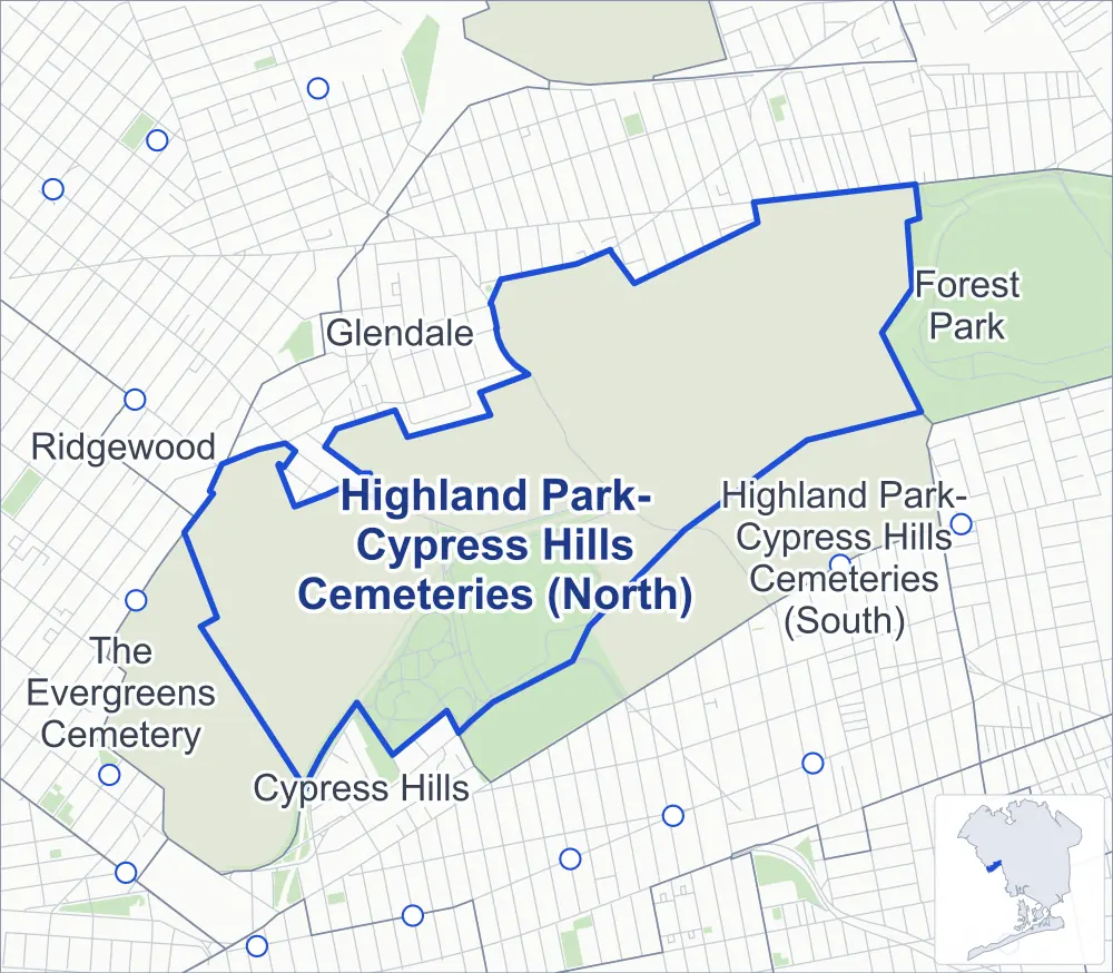
- Highland Park-Cypress Hills Cemeteries (North)
- A neighboring area
- Park
- Another station
Neighborhood areas and streets: NYC Department of City Planning. Parks: NYC Parks. Stations: MTA.
Neighboring areas
- Glendale north
- Forest Park northeast
- Highland Park-Cypress Hills Cemeteries (South) southeast
- The Evergreens Cemetery southwest
- Cypress Hills southwest
- Ridgewood west
Getting around
Buses on five routes stop in or at the edge of Highland Park-Cypress Hills Cemeteries (North).
- 2 local bus routes
- 3 express bus routes
Local bus routes
- B13
- Q55
Express bus routes
- QM24
- QM25
- QM34
Safety record
Between 2021 and 2025, its corners averaged more police-reported crashes than the average Queens corner.
- 200 police-reported crashes at its corners
- 22.2 a corner, on average
- 5.2 the average Queens corner
- 4 corners with a clean record
Signal or safety changes on City record, at one of its corners
- Leading pedestrian intervals
- 1
- Accessible pedestrian signals
- 1
Camera tickets
In 2025 the Department of Finance recorded no red-light, school-zone speed or bus-lane camera ticket at its corners.
Parks
- Parkland
- 101 acres of Highland Park, as NYC Parks maps it within Highland Park-Cypress Hills Cemeteries (North)
Streets and trees
- Trees
- 813 in NYC Parks' records, most often London planetree, pin oak and sweetgum
- Street with the most corners
- Jackie Robinson Parkway, with six of the area's 9
- Height above sea level
- From 156 feet at Cypress Avenue & Vermont Place to 169 feet at Cypress Avenue & Cypress Hills Street
Bike share
By the station list of October 3, 2026, one bike-share station stands in Highland Park-Cypress Hills Cemeteries (North).
- 1 bike-share station
Street corners
- Cypress Avenue & Cypress Hills Street
- Cypress Avenue & Vermont Place
- Cypress Hills Street & Jackie Robinson Parkway
- Jackie Robinson Parkway & Cypress Hills Street
- Jackie Robinson Parkway & Vermont Place
- Vermont Place & J Robinson Parkway (north)
- Vermont Place & J Robinson Parkway (south)
- Vermont Place & Jackie Robinson Parkway (north)
- Vermont Place & Jackie Robinson Parkway (south)
How the figures above are measured: Methodology.