Castle Hill-Unionport
Neighborhood · Bronx
Castle Hill-Unionport covers most of the Castle Hill peninsula in the southeast Bronx, between Pugsley Creek and Westchester Creek, along with Unionport, its section north of Lafayette Avenue.
- 1.18 square miles
- 41,420 residents, 2020 Census
- 165 street corners
- 2 subway stations
- 12 bus routes
The name goes back to a fortified Siwanoy village that Adriaen Block, a 17th-century explorer for the New Netherland Company, thought looked like a castle, and the Cromwell family held the land, then called Cromwell's Neck, until the late 1700s. Small houses and truck farms followed, early two- and three-story homes clustered near the Pelham Line on Westchester Avenue, and large apartment complexes rose across the neck from the 1950s through the 1970s.
Sources: Castle Hill Playground (NYC Parks); Pugsley Creek Park (NYC Parks); Castle Hill, Bronx (Wikipedia).
Castle Hill-Unionport borders six areas, and Castle Hill Avenue and East 177th Street hold more of its corners than any other street, 23 each of 165.
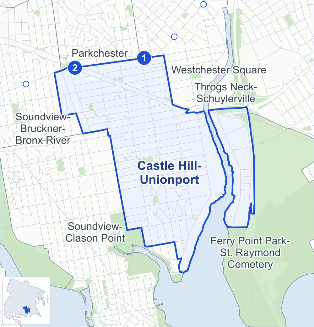
- Castle Hill-Unionport
- A neighboring area
- Park
- A station in the list
- Another station
Neighborhood areas and streets: NYC Department of City Planning. Parks: NYC Parks. Stations: MTA.
Neighboring areas
- Westchester Square north
- Throgs Neck-Schuylerville northeast
- Ferry Point Park-St. Raymond Cemetery east
- Soundview-Clason Point southwest
- Soundview-Bruckner-Bronx River northwest
- Parkchester northwest
Subway stations
- Castle Hill Av lines 6
- Parkchester lines 6 accessible
Getting around
Two subway stations and buses on 12 routes stop in or at the edge of Castle Hill-Unionport.
- 2 subway stations
- 1 of them listed by the MTA as fully accessible
- 10 local bus routes
- 2 express bus routes
Local bus routes
- Bx4
- Bx4A
- Bx5
- Bx11
- Bx22
- Bx36
- Bx39
- Q44-SBS
- Q50
- T103
Express bus routes
- BxM6
- BxM8
Safety record
Between 2021 and 2025, its corners averaged fewer police-reported crashes than the average Bronx corner.
- 1,163 police-reported crashes at its corners
- 7.0 a corner, on average
- 8.0 the average Bronx corner
- 24 corners with a clean record
Signal or safety changes on City record, at 24 of its corners
- Accessible pedestrian signals
- 17
- Leading pedestrian intervals
- 14
- Turn calming
- 4
- Barnes Dance all-way crossings
- 2
- Safety Improvement Projects
- 1
Camera tickets
In 2025 its corners had more school-zone speed camera tickets than red-light or bus-lane tickets.
- 0 red-light camera tickets
- 5,621 school-zone speed camera tickets at eight corners
- 0 bus-lane camera tickets
- Most speed tickets
- Lafayette Avenue & Brush Avenue, 3,364
People and homes
The 2020 Census counted 41,420 residents in Castle Hill-Unionport, about 35,100 per square mile.
- 14,321 homes, 2020 Census
- 999 homes added since April 2010, net, by City Planning's count
Half of its 3,379 residential lots hold buildings from 1940 or earlier, and 45% of them date from before 1940, by the City's tax lot records.
NYCHA development
NYCHA's Castle Hill development lies wholly or partly within Castle Hill-Unionport.
Parks
- Parkland
- 7.6 acres of NYC Parks property
- The largest pieces
- P.O. Serrano Playground (2.7 acres), Hugh J. Grant Circle (1.3 acres) and Randall Playground (1 acre)
Streets and trees
- Trees
- 3,687 in NYC Parks' records, most often London planetree, thornless honeylocust and Japanese flowering cherry
- Street with the most corners
- Castle Hill Avenue, with 23 of the area's 165
- Height above sea level
- From 8 feet at Hutchinson River Parkway & Schley Avenue to 55 feet at Castle Hill Avenue & Virgil Place
- Honorary street names
- 10 at its corners, enacted by local law
Schools and libraries
The City lists nine schools and one library in Castle Hill-Unionport.
- Public schools
- 5
- Charter and private schools
- 4
- Library
- Castle Hill Library
Public art
The City's public art inventory lists one work in Castle Hill-Unionport: Unionport Memorial (1924).
- 1 work of public art
Public safety
How complaints are countedIn 2025 the NYPD recorded 628 major felonies at places in Castle Hill-Unionport.
Recorded by the NYPD at places in Castle Hill-Unionport
- 644 major felonies in 2024
- 1,977 other felonies, misdemeanors and violations in 2025
In 2025, on the streets along the edge of Castle Hill-Unionport, the NYPD recorded another 167 major felonies. Counting the streets along its edge, in 2025 the NYPD recorded 19.2 major felonies for every thousand residents the 2020 Census counted in Castle Hill-Unionport.
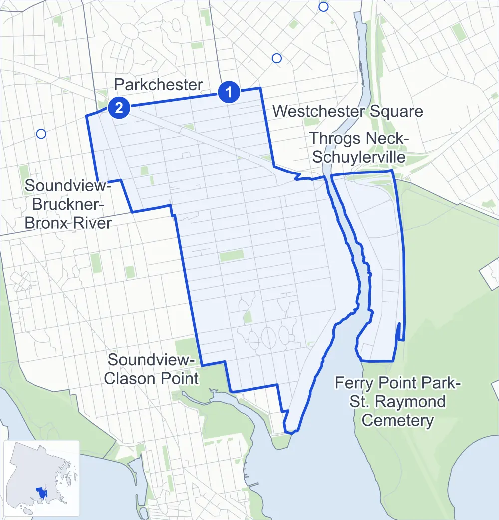
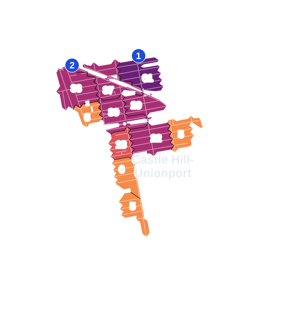
- 5 to 9
- 10 to 19
- 20 to 49
- 50 to 99
- 100 or more
- Not shaded: fewer than 5, held back under the rules in How complaints are counted, parks and public-housing grounds, and land in no patch
- Police precincts
- 43rd (most of the area), 45th
From January to June 2026 the NYPD recorded 248 major felonies at places in Castle Hill-Unionport, against 337 in the same months of 2025.
Sources: the NYPD's Complaint Data Historic, updated April 28, 2026, and Complaint Data Current (Year To Date), updated July 27, 2026, on NYC Open Data. Figures to June 30, 2026.
Street corners
- Blackrock Avenue & Virginia Avenue
- Bruckner Boulevard & Bruckner Expressway
- Bruckner Boulevard & Bruckner Expressway at Hutchinson Parkway
- Bruckner Boulevard & Brush Avenue
- Bruckner Boulevard & Castle Hill Avenue
- Bruckner Boulevard & Havemeyer Avenue
- Bruckner Boulevard & Hutchinson Parkway
- Bruckner Boulevard & Hutchinson River Parkway
- Bruckner Boulevard & Hutchinson River Parkway at Bruckner Expressway
- Bruckner Boulevard & Olmstead Avenue
- Bruckner Boulevard & Pugsley Avenue
- Bruckner Boulevard & Zerega Avenue
- Bruckner Boulevard & Zerega Avenue (Connector Road To Zerega Avenue)
- Bruckner Expressway & Bruckner Boulevard
- Bruckner Expressway & Bruckner Boulevard (Havemeyer Avenue)
- Bruckner Expressway & Bruckner Boulevard at Zerega Avenue
- Bruckner Expressway & Brush Avenue
- Bruckner Expressway & Castle Hill Avenue
- Bruckner Expressway & Cross Bronx Expressway
- Bruckner Expressway & Hutchinson Parkway
- Brush Avenue & Jay Place
- Brush Avenue & Rohr Place
- Brush Avenue & Senger Place
- Brush Avenue & Wenner Place
- Brush Avenue & Yznaga Place
- Castle Hill Avenue & Blackrock Avenue
- Castle Hill Avenue & Chatterton Avenue
- Castle Hill Avenue & Cincinnatus Avenue
- Castle Hill Avenue & Ellis Avenue
- Castle Hill Avenue & Gleason Avenue
- Castle Hill Avenue & Hermany Avenue
- Castle Hill Avenue & Homer Avenue
- Castle Hill Avenue & Lacombe Avenue
- Castle Hill Avenue & Newbold Avenue
- Castle Hill Avenue & Powell Avenue
- Castle Hill Avenue & Quimby Avenue
- Castle Hill Avenue & Seward Avenue
- Castle Hill Avenue & Story Avenue
- Castle Hill Avenue & Turnbull Avenue
- Castle Hill Avenue & Virgil Place
- Castle Hill Avenue & Watson Avenue
- Chatterton Avenue & Virginia Avenue
- Cross Bronx Expressway & Bruckner Boulevard at Bruckner Expressway
- Cross Bronx Expressway & Bruckner Expressway
- Cross Bronx Expressway & Bruckner Expressway at Hutchinson Parkway
- Cross Bronx Expressway & Castle Hill Avenue
- Cross Bronx Expressway & East 177th Street at Hugh J Grant Circle
- Cross Bronx Expressway & Ellis-Gleason Avenue Pedestrian Overpass
- Cross Bronx Expressway & Hugh J Grant Circle
- Cross Bronx Expressway & Hutchinson Parkway
- Cross Bronx Expressway & Hutchinson River Parkway at Bruckner Expressway
- Cross Bronx Expressway & Watson Avenue Pedestrian Overpass
- East 177th Street & Blackrock Avenue
- East 177th Street & Castle Hill Avenue
- East 177th Street & Cross Bronx Expressway (Exit 5A)
- East 177th Street & Cross Bronx Expressway (Exit 5B)
- East 177th Street & Ellis Avenue
- East 177th Street & Ellis Avenue at Cross Bronx Expressway
- East 177th Street & Ellis-Gleason Avenue Pedestrian Overpass
- East 177th Street & Gleason Avenue (east)
- East 177th Street & Gleason Avenue (west)
- East 177th Street & Havemeyer Avenue
- East 177th Street & Havemeyer Avenue at Chatterton Avenue
- East 177th Street & Haviland Avenue (east)
- East 177th Street & Haviland Avenue (west)
- East 177th Street & Hugh J Grant Circle
- East 177th Street & Newbold Avenue
- East 177th Street & Newbold Avenue at Cross Bronx Expressway
- East 177th Street & Olmstead Avenue
- East 177th Street & Powell Avenue (east)
- East 177th Street & Powell Avenue (west)
- East 177th Street & Pugsley Avenue
- East 177th Street & Watson Avenue
- East 177th Street & Watson Avenue Pedestrian Overpass
- Ellis Avenue & Virginia Avenue
- Gleason Avenue & Pugsley Avenue
- Gleason Avenue & Virginia Avenue
- Havemeyer Avenue & Bruckner Boulevard
- Havemeyer Avenue & Cincinnatus Avenue
- Havemeyer Avenue & Ellis Avenue
- Havemeyer Avenue & Hermany Avenue
- Havemeyer Avenue & Homer Avenue
- Havemeyer Avenue & Newbold Avenue
- Havemeyer Avenue & Powell Avenue
- Havemeyer Avenue & Quimby Avenue
- Havemeyer Avenue & Virgil Place
- Haviland Avenue & Virginia Avenue
- Howe Avenue & Norton Avenue
- Hutchinson River Parkway & Bruckner Expressway
- Hutchinson River Parkway & Cross Bronx Expressway
- Hutchinson River Parkway & Rohr Place
- Hutchinson River Parkway & Schley Avenue
- Hutchinson River Parkway & Senger Place
- Hutchinson River Parkway & Wenner Place
- Lacombe Avenue & Effingham Avenue
- Lacombe Avenue & Havemeyer Avenue
- Lacombe Avenue & Howe Avenue
- Lacombe Avenue & Screvin Avenue
- Lacombe Avenue & Torry Avenue
- Lacombe Avenue & Turneur Avenue
- Lafayette Avenue & Brush Avenue
- Lafayette Avenue & Castle Hill Avenue
- Lafayette Avenue & Havemeyer Avenue
- Lafayette Avenue & Olmstead Avenue
- Lafayette Avenue & Zerega Avenue
- Leland Avenue & Gleason Avenue
- Newbold Avenue & Virginia Avenue
- Norton Avenue & Turneur Avenue
- Olmstead Avenue & Blackrock Avenue
- Olmstead Avenue & Caesar Place
- Olmstead Avenue & Chatterton Avenue
- Olmstead Avenue & Cicero Avenue
- Olmstead Avenue & Ellis Avenue
- Olmstead Avenue & Haviland Avenue
- Olmstead Avenue & Hermany Avenue
- Olmstead Avenue & Homer Avenue
- Olmstead Avenue & Lacombe Avenue
- Olmstead Avenue & Newbold Avenue
- Olmstead Avenue & Powell Avenue
- Olmstead Avenue & Quimby Avenue
- Olmstead Avenue & Seward Avenue
- Olmstead Avenue & Turnbull Avenue
- Olmstead Avenue & Virgil Place
- Powell Avenue & Virginia Avenue
- Pugsley Avenue & Blackrock Avenue
- Pugsley Avenue & Caesar Place
- Pugsley Avenue & Chatterton Avenue
- Pugsley Avenue & Ellis Avenue
- Pugsley Avenue & Haviland Avenue
- Pugsley Avenue & Homer Avenue
- Pugsley Avenue & Powell Avenue
- Randall Avenue & Castle Hill Avenue
- Randall Avenue & Havemeyer Avenue
- Randall Avenue & Olmstead Avenue
- Randall Avenue & Pugsley Avenue
- Randall Avenue & Zerega Avenue
- Seward Avenue & Havemeyer Avenue
- Seward Avenue & Pugsley Avenue
- Story Avenue & Havemeyer Avenue
- Story Avenue & Olmstead Avenue
- Torry Avenue & Norton Avenue
- Turnbull Avenue & Havemeyer Avenue
- Underhill Avenue & Gleason Avenue
- Underhill Avenue & Watson Avenue
- Virginia Avenue & Hugh J Grant Circle
- Watson Avenue & Havemeyer Avenue
- Watson Avenue & Olmstead Avenue
- Watson Avenue & Pugsley Avenue
- Watson Avenue & Virginia Avenue
- Westchester Avenue & Castle Hill Avenue
- Westchester Avenue & Leland Avenue
- Westchester Avenue & Purdy Street
- Westchester Avenue & Unionport Road
- White Plains Road & Gleason Avenue
- White Plains Road & Westchester Avenue
- Zerega Avenue & Barrett Avenue
- Zerega Avenue & Effingham Avenue
- Zerega Avenue & Hermany Avenue
- Zerega Avenue & Homer Avenue
- Zerega Avenue & Lacombe Avenue
- Zerega Avenue & Norton Avenue
- Zerega Avenue & Quimby Avenue
- Zerega Avenue & Seward Avenue
- Zerega Avenue & Story Avenue
- Zerega Avenue & Turneur Avenue
How the figures above are measured: Methodology.