Pelham Parkway-Van Nest
Neighborhood · Bronx
Pelham Parkway-Van Nest stretches east from Bronx Park in the east Bronx, reaching from Van Nest, beside the Amtrak tracks, north to Pelham Parkway.
- 0.56 square miles
- 32,425 residents, 2020 Census
- 120 street corners
- 2 subway stations
- 14 bus routes
Van Nest takes its name from a former station on the New York, New Haven and Hartford Railroad, named for the father of one of the railroad's directors, and its building lots were carved from farmland between 1892 and 1896. Pelham Parkway, officially the Bronx and Pelham Parkway, was acquired by the City in 1884 and runs 2.5 miles from Bronx Park to Pelham Bay Park, with broad center strips, a bridle path and many American elms.
Sources: Van Nest, Bronx (Wikipedia); Pelham Parkway (NYC Parks).
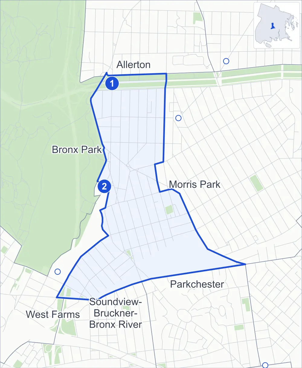
Pelham Parkway-Van Nest borders six areas, and Morris Park Avenue holds more of its corners than any other street, 18 of 120.
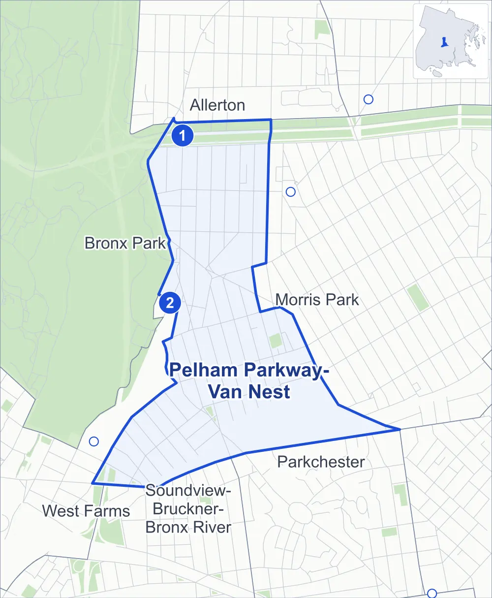
- Pelham Parkway-Van Nest
- A neighboring area
- Park
- A station in the list
- Another station
Neighborhood areas and streets: NYC Department of City Planning. Parks: NYC Parks. Stations: MTA.
Neighboring areas
- Allerton north
- Morris Park east
- Parkchester southeast
- Soundview-Bruckner-Bronx River south
- West Farms southwest
- Bronx Park northwest
Subway stations
- Pelham Pkwy lines 2 5 accessible
- Bronx Park East lines 2 5
Getting around
Two subway stations and buses on 14 routes stop in or at the edge of Pelham Parkway-Van Nest.
- 2 subway stations
- 1 of them listed by the MTA as fully accessible
- 12 local bus routes
- 2 express bus routes
Local bus routes
- Bx4A
- Bx12
- Bx12-SBS
- Bx21
- Bx22
- Bx30
- Bx36
- Bx39
- Bx40
- Bx42
- T113
- T117
Express bus routes
- BxM10
- BxM11
Safety record
Between 2021 and 2025, its corners averaged more police-reported crashes than the average Bronx corner.
- 1,081 police-reported crashes at its corners
- 9.0 a corner, on average
- 8.0 the average Bronx corner
- 4 corners with a clean record
Signal or safety changes on City record, at 36 of its corners
- Leading pedestrian intervals
- 24
- Accessible pedestrian signals
- 19
- Turn calming
- 6
- Barnes Dance all-way crossings
- 3
- Safety Improvement Projects
- 1
Camera tickets
In 2025 its corners had more red-light camera tickets than school-zone speed or bus-lane tickets.
- 8,498 red-light camera tickets at two corners
- 6,122 school-zone speed camera tickets at nine corners
- 0 bus-lane camera tickets
- Most red-light tickets
- Boston Road & Pelham Parkway South, 5,589
- Most speed tickets
- East Tremont Avenue & Elm Drive, 2,087
People and homes
The 2020 Census counted 32,425 residents in Pelham Parkway-Van Nest, about 57,900 per square mile.
- 12,032 homes, 2020 Census
- 165 homes added since April 2010, net, by City Planning's count
Half of its 1,756 residential lots hold buildings from 1920 or earlier, and 71% of them date from before 1940, by the City's tax lot records.
Parks
- Parkland
- 1.5 acres of NYC Parks property
- The largest pieces
- Matthews Muliner Playground (1 acre) and Van Nest Park (0.4 acre)
Streets and trees
- Trees
- 2,158 in NYC Parks' records, most often London planetree, thornless honeylocust and littleleaf linden
- Street with the most corners
- Morris Park Avenue, with 18 of the area's 120
- Height above sea level
- From 26 feet at East Tremont Avenue & Morris Park Avenue to 84 feet at Wallace Avenue & Brady Avenue
- Honorary street names
- 10 at its corners, enacted by local law
Schools and libraries
The City lists five schools and one library in Pelham Parkway-Van Nest.
- Public schools
- 4
- Charter or private school
- 1
- Library
- Pelham Parkway-Van Nest Library
Public art
The City's public art inventory lists one work in Pelham Parkway-Van Nest: Van Nest Memorial (1926).
- 1 work of public art
Public safety
How complaints are countedIn 2025 the NYPD recorded 511 major felonies at places in Pelham Parkway-Van Nest.
Recorded by the NYPD at places in Pelham Parkway-Van Nest
- 455 major felonies in 2024
- 1,221 other felonies, misdemeanors and violations in 2025
In 2025, on the streets along the edge of Pelham Parkway-Van Nest, the NYPD recorded another 190 major felonies. Counting the streets along its edge, in 2025 the NYPD recorded 21.6 major felonies for every thousand residents the 2020 Census counted in Pelham Parkway-Van Nest.
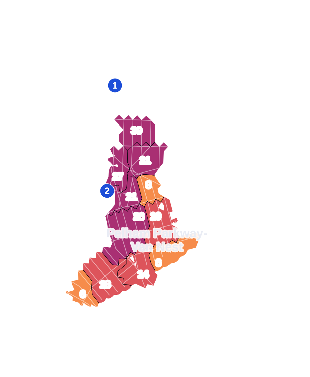
- 5 to 9
- 10 to 19
- 20 to 49
- 50 to 99
- 100 or more
- Not shaded: fewer than 5, held back under the rules in How complaints are counted, parks and public-housing grounds, and land in no patch
- Police precincts
- 49th (most of the area), 48th
From January to June 2026 the NYPD recorded 226 major felonies at places in Pelham Parkway-Van Nest, against 257 in the same months of 2025.
Sources: the NYPD's Complaint Data Historic, updated April 28, 2026, and Complaint Data Current (Year To Date), updated July 27, 2026, on NYC Open Data. Figures to June 30, 2026.
Street corners
- Amethyst Street & Sagamore Street
- Barnes Avenue & Barnett Place
- Barnes Avenue & Brady Avenue
- Barnes Avenue & Bronxdale Avenue
- Barnes Avenue & Lydig Avenue
- Barnes Avenue & Morris Park Avenue
- Barnes Avenue & Pelham Parkway South
- Barnes Avenue & Rhinelander Avenue
- Barnes Avenue & Van Nest Avenue
- Boston Road & Bronx Park East
- Boston Road & Pelham Parkway
- Boston Road & Pelham Parkway South
- Bronx Park East & Brady Avenue
- Bronx Park East & Bronxdale Avenue
- Bronx Park East & Lydig Avenue
- Bronx Park East & Maran Place
- Bronx River Parkway & East 180th Street
- Bronxdale Avenue & Antin Place
- Bronxdale Avenue & Neill Avenue
- Bronxdale Avenue & Pierce Avenue
- Cruger Avenue & Brady Avenue
- Cruger Avenue & Bronxdale Avenue
- Cruger Avenue & Lydig Avenue
- Cruger Avenue & Maran Place
- Cruger Avenue & Sagamore Street
- East 180th Street & Morris Park Avenue
- East 180th Street & Van Nest Avenue
- East Tremont Avenue & Adams Street
- East Tremont Avenue & Beach Avenue
- East Tremont Avenue & Castle Hill Avenue
- East Tremont Avenue & East 180th Street
- East Tremont Avenue & Elm Drive
- East Tremont Avenue & Leland Avenue
- East Tremont Avenue & Morris Park Avenue
- East Tremont Avenue & Purdy Street
- East Tremont Avenue & St Lawrence Avenue
- East Tremont Avenue & Taylor Avenue
- East Tremont Avenue & Unionport Road
- East Tremont Avenue & Van Nest Avenue
- Garfield Street & Baker Avenue
- Garfield Street & Mead Street
- Holland Avenue & Antin Place
- Holland Avenue & Brady Avenue
- Holland Avenue & Bronxdale Avenue
- Holland Avenue & Hunt Avenue
- Holland Avenue & Lydig Avenue
- Holland Avenue & Morris Park Avenue
- Holland Avenue & Pelham Parkway North
- Holland Avenue & Rhinelander Avenue
- Holland Avenue & Van Nest Avenue
- Hunt Avenue & Sagamore Street
- Lydig Avenue & Bolton Street
- Lydig Avenue & Muliner Avenue
- Matthews Avenue & Brady Avenue
- Matthews Avenue & Kinsella Street
- Matthews Avenue & Lydig Avenue
- Matthews Avenue & Neill Avenue
- Matthews Avenue & Van Nest Avenue
- Morris Park Avenue & Adams Street
- Morris Park Avenue & Delancey Place
- Morris Park Avenue & Garfield Street
- Morris Park Avenue & Graham Street
- Morris Park Avenue & Hunt Avenue
- Morris Park Avenue & Lebanon Street
- Morris Park Avenue & Matthews Avenue
- Morris Park Avenue & Melville Street
- Morris Park Avenue & Muliner Avenue
- Morris Park Avenue & Unionport Road
- Morris Park Avenue & Unionport Road at Amethyst Street
- Morris Park Avenue & Victor Street
- Muliner Avenue & Brady Avenue
- Muliner Avenue & Delancey Place
- Pelham Parkway North & Cruger Avenue
- Pelham Parkway South & Bolton Street
- Pelham Parkway South & Cruger Avenue
- Pelham Parkway South & Holland Avenue
- Pelham Parkway South & Matthews Avenue
- Pelham Parkway South & Muliner Avenue
- Pelham Parkway South & Wallace Avenue
- Rhinelander Avenue & Amethyst Street
- Rhinelander Avenue & Bronxdale Avenue
- Rhinelander Avenue & Hunt Avenue
- Rhinelander Avenue & Muliner Avenue
- Rhinelander Avenue & Victor Street
- Taylor Avenue & Van Nest Avenue
- Unionport Road & Mead Street
- Unionport Road & Sagamore Street
- Unionport Road & Victor Street
- Van Nest Avenue & Adams Street
- Van Nest Avenue & Fillmore Street
- Van Nest Avenue & Garfield Street
- Van Nest Avenue & Hunt Avenue
- Van Nest Avenue & Melville Street
- Van Nest Avenue & Unionport Road
- Van Nest Avenue & Van Buren Street
- Van Nest Avenue & Victor Street
- Wallace Avenue & Antin Place
- Wallace Avenue & Brady Avenue
- Wallace Avenue & Bronxdale Avenue
- Wallace Avenue & Lydig Avenue
- Wallace Avenue & Morris Park Avenue
- Wallace Avenue & Pelham Parkway North
- Wallace Avenue & Rhinelander Avenue
- Wallace Avenue & Van Nest Avenue
- White Plains Road & Brady Avenue
- White Plains Road & Bronx Park East at Birchall Avenue
- White Plains Road & Bronx Park East at Unionport Road
- White Plains Road & Bronxdale Avenue
- White Plains Road & Cruger Avenue
- White Plains Road & Lydig Avenue
- White Plains Road & Maran Place
- White Plains Road & Mead Street
- White Plains Road & Morris Park Avenue
- White Plains Road & Pelham Parkway
- White Plains Road & Pelham Parkway North
- White Plains Road & Pelham Parkway South
- White Plains Road & Rhinelander Avenue
- White Plains Road & Unionport Road
- White Plains Road & Unionport Road at Baker Avenue
- White Plains Road & Van Nest Avenue
How the figures above are measured: Methodology.